Hu:Key:natural
Jump to navigation
Jump to search
 |
| Leírás |
|---|
| A természetes földterületek megadására szolgál, beleértve az ember által módosítottakat. |
| Csoport: természetes |
| Használható elemtípusok |
| Dokumentált értékek: 3 |
| Státusz: de facto |
| Eszközök a címkéhez |
Értékei
Természet
A természetes földterületek megadására szolgál, beleértve az ember által módosítottakat. A bemutatását lásd a Natural lapon.
| Kulcs | Érték | Alapelem | Magyarázat | Megjelenítés | Fotó |
|---|---|---|---|---|---|
Vegetáció | |||||
| natural | fell | Kopár: műveletlen hegyoldal, ami gyakran fűvel borított, és legeltetésre használják. | No, see #545. |  | |
| natural | grassland | Füves puszta: ahol a fűfélék (pázsitfűfélék) és egyéb lágyszárúak dominálnak, kivéve a díszfüvet (lásd landuse=grass) és a legelőt (lásd landuse=meadow)
|
 |
 | |
| natural | heath | Törpecserjés: sík, alacsonyabban fekvő, kezeletlen, bokrokkal, esetleg fákkal ritkásan benőtt terület. |  |
 | |
| natural | moor | Hegyvidéki terület: jellemzően alacsony növésű növényzettel, savas talajjal. | currently not rendered by OSM Carto |  | |
| natural | scrub | Bozót: bokrokkal, alacsonyabb fákkal sűrűn borított, műveletlen terület. |  |
 | |
| natural | shrubbery | An area of shrubbery that is actively maintained or pruned by humans. A slightly wilder look is also possible | currently not rendered by OSM Carto |  | |
| natural | tree | Fa: magányosan álló, vagy valamiért jelentős fa. |  | ||
| natural | tree_row | Fasor: egy vonalba ültetett fák. |  |
 | |
| natural | tree_stump | Fatönk: A tree stump, the remains of a cut down or broken tree. |  | ||
| natural | tundra | Habitat above tree line in alpine and subpolar regions, principally covered with uncultivated grass, low growing shrubs and mosses and sometimes grazed. |  | ||
| natural | wood | Kezeletlen erdő: természetes, nem telepített erdő. Erdőgazdálkodás esetén a landuse=forest címkét javasolt használni. További részletek adhatóak meg a leaf_type=* és leaf_cycle=* címkékkel.
|
 |
 | |
Vizek | |||||
| natural | bay | Öböl: szárazföld által részlegesen körbezárt vízfelület, aminek kijárata van a nyílt víz felé. |  |
 | |
| natural | beach | Partszegély: lapos partszakaszokra jellemző homokos, kavicsos felszínforma. |  |
 | |
| natural | blowhole | Fúvó: egy szárazföld felé vezető barlangnyílás, amiből a tenger hullámzásának hatására vízkitörések csapnak fel. |  | ||
| natural | cape | Partfok: a part óceánba, tengerbe, tóba, folyóba nyúló, kimagasló kiszögellése. |  | ||
| natural | coastline | Partvonal: a víz és a szárazföld közötti vonal, a legmagasabb dagályok átlagos vízszintjében. A víz mindig a vonal jobb oldalára essen. | 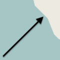 |
 | |
| natural | crevasse | Gleccserszakadék: egy nagy repedés egy gleccseren. |  | ||
| natural | geyser | Gejzír: forró, időszakosan működő szökőkútszerű vízforrás. | 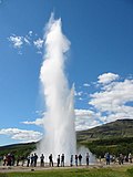 | ||
| natural | glacier | Gleccser: hóból kialakult, állandóan jéggel borított terület, ami a saját súlyánál fogva állandó mozgásban van. |  |
 | |
| natural | hot_spring | Hőforrás: meleg vizű, geotermikus forrás |  | ||
| natural | isthmus | Földszoros: kétoldalt víz által határolt keskeny földsáv, amely két nagyobb szárazföldet köt össze. |  | ||
| natural | mud | natural=wetland + wetland=* címkéket.
|
 |
 | |
| natural | peninsula | Félsziget: a szárazföld része, amely benyúlik a tengerbe, tóba, folyóba és három oldalról víz veszi körül. | 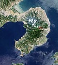 | ||
| natural | reef | A feature (rock, sandbar, coral, etc) lying beneath the surface of the water |  | ||
| natural | shingle | An accumulation of rounded rock fragments on a beach or riverbed |  |
 | |
| natural | shoal | An area of the sea floor near the sea surface (literally, becomes shallow) and exposed at low tide. See natural=sand as well.
|
 |
 | |
| natural | spring | Forrás: olyan hely, ahol a talajvíz természetes módon a felszínre tör. |  | ||
| natural | strait | A narrow area of water surrounded by land on two sides and by water on two other sides. |  |
 | |
| natural | water | Víz: Any body of water, from natural such as a lake or pond to artificial like moat or canal. Also see waterway=riverbank
|
 |
 | |
| natural | wetland | Vizenyős terület, mocsár, nádas. A natural area subject to inundation or with waterlogged ground, further specified with wetland=*
|
 |
 | |
Geológia | |||||
| natural | arch | A rock arch naturally formed by erosion, with an opening underneath. | currently not rendered by OSM Carto |  | |
| natural | arete | Kárgerinc (arête): keskeny, penge szerű sziklagerinc, általában két gleccser formálta U-völgy között. |  |
 | |
| natural | bare_rock | Csupasz szikla: gyér, vagy teljesen vegetáció mentes terület, ahol kilátszik az alapkőzet. |  |
 | |
| natural | blockfield | A surface covered with boulders or block-sized rocks, usually the result of volcanic activity or associated with alpine and subpolar climates and ice ages. | Currently not rendered by OSM Carto |  | |
| natural | cave_entrance | Barlangbejárat: a natural underground space large enough for a human to enter. |  | ||
| natural | cliff | Sziklaszirt: egy jelentős, általában csupasz sziklákból álló függőleges, vagy majdnem függőleges sziklafal, sziklapárkány teteje. (Rajzolásnál a szakadék legyen a vonal jobb oldalán.) | 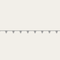 |
 | |
| natural | dune | A hill of sand formed by wind, covered with no or very little vegetation. See also natural=sand and natural=beach
|
currently not rendered by OSM Carto |  | |
| natural | earth_bank | Large erosion gully or steep earth bank |  | ||
| natural | fumarole | A fumarole is an opening in a planet's crust, which emits steam and gases |  | ||
| natural | gorge | A gorge or canyon, including variants like ravine or slot canyon, is a narrow valley with steep, typically rocky walls. | currently not rendered by OSM Carto |  | |
| natural | gully | Small scale cut in relief created by water erosion |  | ||
| natural | hill | A hill. | currently not rendered by OSM Carto |  | |
| natural | peak | Hegycsúcs: hegy vagy domb csúcsa. |  | ||
| natural | ridge | Hegygerinc: A mountain or hill linear landform with a continuous elevated crest |  |
 | |
| natural | rock | Szikla: jelentősebb szikla, vagy sziklaformáció, amely szervesen kapcsolódik az alapkőzethez. | currently not rendered by OSM Carto |  | |
| natural | saddle | Nyereg: a legalacsonyabb pont két hegycsúcs között a gerinc mentén. |  | ||
| natural | sand | Homok: főként homokkal borított terület, minimális növényzettel. Lásd még a natural=beach és natural=dune címkéket.
|
 |
 | |
| natural | scree | Törmeléklejtő: meredek sziklafal lábánál felgyűlt, szögletes kövekből álló, laza kőtörmelék, melyet a mállás és az omlás hoz létre. |  |
 | |
| natural | sinkhole | Töbör, vagy víznyelő: természetes bemélyedés, vagy lyuk a felszínen. | currently not rendered by OSM Carto |  | |
| natural | stone | Kő: magában álló, jellegzetes szikla, mely anyagában általában eltér a környezetétől, pl. vándorkövek. | currently not rendered by OSM Carto |  | |
| natural | valley | Völgy: A natural depression flanked by ridges or ranges of mountains or hills | currently not rendered by OSM Carto |  | |
| natural | volcano | Vulkán: An opening exposed on the earth's surface where volcanic material is emitted. |  | ||
| natural | user defined | Az összes gyakran használt érték a Taginfo szerint | |||
This table is a wiki template with a default description in English. Editable here. A táblázat fordítását ezen az oldalon szerkesztheted.


