FR:Android
Android est un système d'exploitation, basé sur Linux et destiné aux terminaux mobiles (téléphones, smartphones, etc ...). Les terminaux Android peuvent être utilisés pour voir et éditer des cartes basées sur OpenStreetMap, et enregistrer les traces GPS (qu'on peux envoyer vers OSM pour aider lors de l'édition).
Pour des informations générales voyez les pages de Wikipédia sur Android ou le site officiel Android.com en français (sauf section développeurs en anglais).
OpenStreetMap.org
De façon basique, ouvrir avec son navigateur le site https://www.openstreetmap.org/. Le site est optimisé pour les petits écrans, mais le Slippy Map (ou carte glissante) est très limité. OpenTouchMap (page en anglais) est un peu meilleur. Pour une lecture proche de Google Maps, voir la partie applications OSM ci-dessous. Pour contribuer à OpenStreetMap (OSM), l'iD du rédacteur (en js) permet un support basique mais il est plus pratique d'utiliser une application d'édition pour Android.
Applications OSM
Les applications suivantes sont basées sur OSM pour les fonctionnalités de base et elles sont la meilleur façon d'utiliser OSM sous Android. Elles sont mises à jour régulièrement (tous les 18 mois au minimum). Voir aussi Comparaison des applications android (en anglais).
Réalité augmentée
Ces applications utilisent un calque avec les données OSM, superposé sur une vue en temps réel de la caméra arrière du mobile.
Vers les pages en anglais : Data4All (http://data4all.github.io/) et Layar Reality Browser.
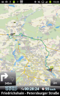
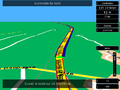
Ces applications ont une aide au déplacement étape par étape et souvent un guide vocal :
- ont une page wiki en français : FR:OsmAnd~

- pages wiki en anglais (mai 2018) :
-

-
Guru Maps
(Galileo Offline Maps) -

-

-
-

-
-

Citons aussi (page wiki en Russe seul) Navitel.
Édition de cartes
Ces applications sont des éditeurs avancés, qui permettent de contribuer directement aux cartes :
- OSM Contributor
- Osm Go!
- Vespucci (page wiki en anglais)
Ces applications ont aussi des fonctionnalités d'éditions limitées : Data4All, MAPS.ME, OsmAnd, OSMBugs, OSMapTuner, StreetComplete (page wiki en Français) et Kort.
Ces applications permettent d'envoyer des images géolocalisées : Mapillary et OpenStreetCam.
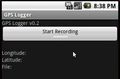
Enregistrer les mouvements GPS
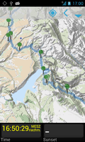
On peux envoyer à OSM ses mouvements GPS pour s'aider à enrichir ses cartes. La plupart de ces applications ont aussi des fonctionnalités d'orientation, qui sont utilise pour se déplacer mais pas aussi fine que les applications de déplacement "étape par étape".
Vers les pages du wiki en français :
Vers les autres pages du wiki (en général en anglais) :
-

-

-

-
-
Guru Maps
(Galileo Offline Maps) -
-
-

-
-
-

-

-

-

-
Prévoir un voyage
Ces applications permettent la recherche et la découverte de lieux. Beaucoup permettent l'utilisation des carte hors connexion.
Page wiki en anglais:


Jeux
Vers une autre page du wiki anglais : Games#In the game itself
Ces jeux s'appuient sur les données OSM : pages wiki en anglais BucketMan et Pokémon Go.
J'ajoute FR:StreetComplete :
- https://framalibre.org/content/street-complete
- disponible sur F-Droid https://f-droid.org/packages/de.westnordost.streetcomplete/
Divers
Pages wiki en français :

Wiki anglais :


Applications qui utilisent OSM
Ces applications utilisent aussi OpenStreetMap d'une certaine façon :
Général
| Name | A Photo Manager | AlpineQuest GPS Hiking | Baba | Bike Citizens | BRouter | CityMaps2Go | CoMaps | Cruiser GPS Navigation | CycleStreets | Every Door | Gaia GPS | GeoNotes | Geovelo | GPXSee | Jungle Bus | Karta GPS | KartaView | Kurviger | Locus Map | Maplibre Navigation Android Legacy | Maps.me | My Opening Hours | Navmii | NoniGPSPlot for Android | On Wheels | Organic Maps | OSM Contributor | OSM Dashboard for OpenTracks | OsmAnd | OSMTracker for Android | Panoramax | PeakNav | Relief Maps | Routes | StreetComplete | Trackbook | Trufi App | Vespucci | Wheelmap | СитиГИД |
|---|---|---|---|---|---|---|---|---|---|---|---|---|---|---|---|---|---|---|---|---|---|---|---|---|---|---|---|---|---|---|---|---|---|---|---|---|---|---|---|---|

|

|

|

|

|

|

|

|

|

|

|

|

|

|

|

|

|

|

|

|

|

|

|

|

|

|

|

|

|

| |||||||||||
| Site Internet, F-Droid | Site Internet, Google Play | Google Play | Site Internet, Google Play, iTunes App Store | Site Internet, F-Droid, Google Play | Site Internet, Google Play, iTunes App Store | Site Internet, F-Droid, Obtainium, Google Play, iTunes App Store | Site Internet, Google Play | Site Internet, Google Play, iTunes App Store, Mac App Store | Site Internet, F-Droid, Google Play, Huawei App Gallery, iTunes App Store | Site Internet, Google Play, iTunes App Store | Site Internet, F-Droid | Site Internet, Google Play, iTunes App Store | Site Internet, Google Play | Site Internet | Site Internet, Google Play, iTunes App Store | Site Internet, Google Play, iTunes App Store | Site Internet, Google Play, iTunes App Store | Site Internet, Google Play | Site Internet, Google Play, Huawei App Gallery, iTunes App Store | Site Internet, Google Play | Site Internet, Google Play, iTunes App Store, Mac App Store | Site Internet | Site Internet, Google Play, iTunes App Store | Site Internet, F-Droid, Obtainium, Google Play, Huawei App Gallery, iTunes App Store | Site Internet, Google Play | Site Internet, F-Droid, Google Play | Site Internet, F-Droid, Google Play, Amazon Appstore, Huawei App Gallery, iTunes App Store | Site Internet, F-Droid, Google Play | Site Internet, F-Droid, Google Play, iTunes App Store | Site Internet, Google Play | Site Internet, Google Play, iTunes App Store | Site Internet, Google Play | Site Internet, F-Droid, Google Play | Site Internet, F-Droid | Site Internet, Google Play, iTunes App Store | Site Internet, F-Droid, Google Play, Amazon Appstore | Site Internet, Google Play, iTunes App Store | Site Internet, Google Play, iTunes App Store | ||
| Genre | Photo organiser | Display, Navi, Logger | Photo | Routing, Biking, Display, Navi, Router, Travel | Routing, Router | Display, Navi, Travel | For mobile, Navi, Display, Editor, Editor tool | Display, Navi, Router, Renderer | Routing, Cyclestreets, Editor, POI, Navi, Router, Display | Display, Editor, Analyser, Editor tool | Display, Navi, Logger | Editor | ? | Display, Analyser | Display, Logger, Editor | For mobile, Display, Navi, Router | Photo, Street-level imagery | Motorcycle, Routing, Navi, Router | Display | ? | APP, Navi, Display, Editor, Editor tool | ? | Navi, Router | Display, Logger, Analyser | Display, Navi, Editor | For mobile, Navi, Display, Editor, Editor tool | Display, Logger, Editor | ? | Display, Navi, Logger, Router, Editor, Editor tool | Logger, Editor | Viewer, Street-level imagery | Display | APP, Hiking, MTB, Paragliding, Skiing, Viewer | Display, Navi, Logger, Router | Editor, Editor tool | Logger | Display, Navi, Router | Editor, Editor tool | Edit, Accessibility, Display, Navi | Display, Navi, Router, Logger |
| Description | Android gallery app that can show/edit geotags of photos through a map. | Orienteering focused. | Collect free and open street level imagery for Panoramax. | Bike Citizens is a navigation app designed for and by cyclists, offers offline routing, predefined tours and various routing profiles. | BRouter: Let's get serious about bike routing. BRouter offers routing for trekking and cycling with predefined profiles and the ability to modify and upload custom profiles. | CityMaps2Go. | Community-driven, open source and not for profit Organic Maps fork and mobile app for iOS and Android that provides worldwide maps based on OpenStreetMap data. | Cruiser is an offline route planning and navigation application. | Bicycle routing and planning and photo map based on OpenStreetMap data and the OpenCycleMap for the British Isles. API available. | Power mapper's mobile editor for maintaining amenities on OSM. | Backcountry maps, navigation, and tracking. | Create georeferences notes and photos on Android. Goal is to create notes as easy and quickly as possible with little overhead. | ? | GPS log file viewer and analyzer. | Jungle Bus Mapping Tool. Latest Material Design, add/edit/delete features for bus stops only. | Karta is a free of charge navigation app combining open map data with relevant content from Yelp and Foursquare, as well as additional non-crowdsourced information like traffic and speed camera data, without needing to be connected to the internet. | Shows geotagged street photos (formerly OpenStreetCam). | Routing and navigation specialised for motorcycles. Kurviger calculates curvy routes that are fun to ride on bike. Curves and slopes are preferred, while cities and highways are avoided. Generate loop trips with one click. Personalise the routing to your own riding style. | Online/Offline map viewer (MapsForge vector map, area downloader, tile cache), support slippy (non-free too) and vector maps (MapsForge library), guiding, routing and basic navigation (online/offline), track recording with detailed POIs (including photos/videos/audio) and elevation correction, extensive geocaching support, WMS maps and more. | Legacy MapLibre Navigation SDK for Android
|
Very popular app, now property of the Russian Mail.Ru Group. Ads can be found, but plenty of POI gathered from different sources. Even hotel bookings available through the app. | Easy to use. | Free satnav app. Maps available: Andorra, Argentina, Australia, Austria, Benelux (Belgium, Netherlands, Luxembourg), Brazil, Canada, Croatia, Czechia, Denmark, Estonia, Finland, France, Germany, Hungary, India, Ireland, Italy, Latvia, Lithuania, Mexico, Monaco, Netherlands, New Zealand, Norway, Poland, Portugal, Slovakia, Slovenia, South Africa, Spain, Sweden, Switzerland, UK. | ? | ? | Open source MAPS.ME fork and mobile app for iOS and Android that provides worldwide based on OpenStreetMap data. | OSM Contributor mapping tool. Latest material design by the jawg team, add/edit/delete features for Nodes/Ways/Comments. Can also be used with pre-entered types for mapping parties (https://www.jawg.io). | Repository moved to <a href="https://codeberg.org/OpenTracksApp/OSMDashboard" class="Link--inTextBlock" rel="nofollow">https://codeberg.org/OpenTracksApp/OSMDashboard</a>
|
Navigation (routing) offline and online, OSM and custom map display (vector data or tiles, offline, cached or online), POI and address search (offline or online Nominatim), submit OSM bugs and POI, mark favorites, public transport info. Actively being developed.
Keywords: GPS navigator, GPS navigation, navigation system, satellite navigation, sat nav, satnav, GPS tracker, GPS tracking, GPS map, OpenStreetMap, OSM viewer, map viewer, OSM mapping, offline routing, offline world map, global offline country maps, outdoor. |
Offline GPS tracker with fast POI placement shortcuts. Exports in GPX format with waypoints, suitable for editing in JOSM. | "The free alternative to photo-mapping territories"[1]. | 3D mountain viewer for offline usage.
Keywords: 3D, hiking, outdoor, map viewer, OSM viewer, OpenStreetMap. |
An Worldwide 3D GPS app (Android,IOS) for outdoor sports. | ? | Surveyor app for Android. | ? | ? | OpenStreetMap editor for Android. | Wheelchair map that let user contribute to vote for Accessibility. | CityGuide car navigator. |
| Plateformes prises en charge | Android | Android | Android, iOS | Android, iOS | Android, Web | Android, iOS | Android, Linux, MacOS, iOS, visionOS | Android, Linux, MacOS, Windows | Android, Windows, iOS | Android, iOS | Android, iOS | Android | Android, iOS | Android, Linux, MacOS, Windows | Android | Android, iOS | Android, MacOS, Web, Windows, iOS | Android, Web, iOS | Android | Android | Android, BlackBerry OS, iOS | Android | Android, BlackBerry OS, Windows, Windows Phone, iOS | Android | Android, iOS | Android, Java, Linux, MacOS, iOS, visionOS | Android | Android | Android, iOS | Android | Android, Web, iOS | Android, Desktop | Android, iOS | Android | Android | Android | Android, iOS | Android | Android, Web, Windows Phone, iOS | Android, iOS |
| Date de sortie | 2020-03-12 | 2017-06-06 | 2025-10-30 | 2024-12-11 | 2024-05-23 | 2017-08-03 | 2025-11-01 | 2025-08-13 | 2016-05-15 | 2025-10-24 | ? | 2024-11-23 | ? | 2025-11-03 | 2018-07-10 (⚠️ Non maintenu) | 2024-11-12 | 2024-05-31 | 2024-11-29 | 2022-07-26 | ????-??-?? (⚠️ Non maintenu) | 2025-10-28 | 2018-07-04 | 2021-08-16 | 2014-09-29 (⚠️ Non maintenu) | 2025-04-13 | 2025-10-23 | 2018-06-10 (⚠️ Non maintenu) | 2025-07-26 (⚠️ Non maintenu) | 2025-06-26 | 2025-09-12 | 2024-10-10 | 2025-10-17 | 2019-09-24 | ? | 2025-08-18 | 2022-05-27 | 2019-06-25 | 2025-11-04 | 2024-12-16 | 2023-11-24 |
| Langues | Deutsch, English, Français, Bahasa Indonesia, Italiano, 日本語, Nederlands, Polski, Română, Русский, Türkçe, 中文, 中文(台灣) | English, Français | Deutsch, English, Esperanto, Eesti, Français, Italiano, Nederlands, Svenska | Deutsch, English, Español, Français | Català, Česky, Deutsch, Ελληνικά, English, Español, Français, Magyar, Italiano, 한국어, Nederlands, Polski, 中文 | Deutsch, English, Español, Français, Italiano | Беларуская, Български, Česky, Dansk, Deutsch, Ελληνικά, English, Español, Eesti, Euskara, فارسی, Suomi, Français, Magyar, Bahasa Indonesia, Italiano, 日本語, 한국어, Latviešu, मराठी, Norsk (bokmål), Nederlands, Polski, Português, Română, Русский, Slovenčina, Српски / Srpski, Svenska, ไทย / Phasa Thai, Türkçe, Українська, Việtnam, 中文 (简体), 中文 (繁體) | العربية, Català, Česky, Deutsch, Ελληνικά, English, Español, Français, Italiano, 한국어, Nederlands, Polski, 中文 | Català, Česky, Dansk, Deutsch, English, Español, Français, Magyar, Italiano, 日本語, 한국어, Norsk (bokmål), Nederlands, Polski, Українська, 中文 (繁體) | Česky, Dansk, Deutsch, English, Español, Eesti, Suomi, Français, Hrvatski, Magyar, Bahasa Indonesia, Italiano, Nederlands, Polski, Português, Русский, Svenska, Українська, 中文 (简体), 中文 (繁體) | العربية, Česky, Deutsch, English, Español, Français, Italiano, 日本語, 한국어, नेपाली, Português, Русский, Svenska, 中文 | Deutsch, English, Français, Magyar, Italiano, Nederlands, Svenska | Deutsch, English, Español, Français | Česky, Dansk, Deutsch, English, Esperanto, Español, Suomi, Français, Magyar, Italiano, 한국어, Norsk (bokmål / riksmål), Polski, Português, Русский, Svenska, Türkçe, Українська, 中文 | English, Français | العربية, Česky, Dansk, Deutsch, Ελληνικά, English, Español, Suomi, Français, Bahasa Indonesia, Italiano, 日本語, 한국어, Bahasa Melayu, Norsk (bokmål), Nederlands, Polski, Português, Русский, Slovenčina, Svenska, ไทย / Phasa Thai, Türkçe, Việtnam, 中文 | Català, Deutsch, English, Español, Français, Magyar | Deutsch, English, Español, Français, Italiano, Nederlands | العربية, Česky, Dansk, Deutsch, Ελληνικά, English, Español, Suomi, Français, Magyar, Italiano, 日本語, 한국어, Nederlands, Polski, Português, Русский, Slovenčina | Français | العربية, Česky, Dansk, Deutsch, Ελληνικά, English, Español, Suomi, Français, हिन्दी, Magyar, Bahasa Indonesia, Italiano, 日本語, 한국어, Nederlands, Norsk (bokmål / riksmål), Polski, Português, Română, Русский, Slovenčina, Svenska, ไทย / Phasa Thai, Türkçe, Українська, Việtnam, 中文 (简体), 中文 (繁體) | Česky, Deutsch, English, Français, Nederlands | Dansk, Deutsch, English, Español, Français, Italiano, Multilingue, Kiswahili | Deutsch, English, Français, Polski | Deutsch, English, Español, Français, Nederlands, Português | Беларуская, Български, Česky, Dansk, Deutsch, Ελληνικά, English, Español, Eesti, Euskara, فارسی, Suomi, Français, Magyar, Bahasa Indonesia, Italiano, 日本語, 한국어, Latviešu, मराठी, Norsk (bokmål), Nederlands, Polski, Português, Română, Русский, Slovenčina, Српски / Srpski, Svenska, ไทย / Phasa Thai, Türkçe, Українська, Việtnam, 中文 (简体), 中文 (繁體) | English, Español, Français, Português | English, Français | Беларуская, Български, Bosanski, Català, Česky, Dansk, Deutsch, English, Esperanto, Español, Euskara, فارسی, Suomi, Français, Galego, עברית, हिन्दी, Magyar, Հայերեն, Bahasa Indonesia, Íslenska, Italiano, 日本語, ქართული, 한국어, Latviešu, मराठी, Nederlands, Norsk (bokmål / riksmål), Polski, Português, Română, Русский, Sardu, Slovenčina, Српски / Srpski, Svenska, Türkçe, Українська, Việtnam, 中文 | Dansk, Deutsch, Ελληνικά, English, Español, Euskara, Suomi, Français, Galego, Հայերեն, Italiano, עברית, 日本語, Myanmasa / မြန်မာဘာသာ, Norsk (bokmål), Nederlands, Norsk (nynorsk), Polski, Português, Русский, Slovenčina, Svenska, ไทย / Phasa Thai, Українська, 中文 | Deutsch, English, Esperanto, Español, Français, Magyar, Italiano, 日本語, Nederlands, Português, Svenska, 中文 (繁體) | Deutsch, English, Español, Français, Italiano, Norsk (bokmål / riksmål), Polski, Português | English, Français | Català, Deutsch, English, Español, Français | العربية, Asturianu, Български, Bosanski, Català, Česky, Dansk, Deutsch, Ελληνικά, English, Esperanto, Español, Euskara, فارسی, Suomi, Français, Galego, Hrvatski, Magyar, Հայերեն, Bahasa Indonesia, Italiano, 日本語, 한국어, Lietuvių, Latviešu, മലയാളം, Norsk (bokmål), Nederlands, Norsk (nynorsk), Polski, Português, Română, Русский, Slovenčina, Српски / Srpski, Svenska, Kiswahili, ไทย / Phasa Thai, Türkçe, Українська, 中文, 中文(台灣) | Dansk, Deutsch, English, Español, Français, Hrvatski, Bahasa Indonesia, Italiano, Nederlands, Norsk (bokmål / riksmål), Polski, Português, Русский, Svenska, Türkçe, 中文 | Deutsch, English, Español, Français, Italiano, Runa Simi | Беларуская, Català, Česky, Dansk, Deutsch, Ελληνικά, English, Español, Euskara, فارسی, Suomi, Français, Galego, Hrvatski, Magyar, Íslenska, Italiano, 日本語, ಕನ್ನಡ, 한국어, Norsk (bokmål), Norsk (nynorsk), Polski, Português, Română, Русский, Slovenčina, Svenska, Türkçe, Українська, Việtnam, 中文 (简体), 中文 (繁體) | Ελληνικά, English, Español, Français, Íslenska, Italiano, 日本語, klingon, Svenska, Туркмен / تركمن | Deutsch, English, Español, Français, Italiano, Polski, Русский, Українська |
| Couverture | ? | ? | ? | Worldwide | ? | ? | Worldwide | ? | Worldwide | ? | ? | ? | ? | ? | ? | ? | ? | ? | ? | ? | ? | ? | ? | ? | ? | Worldwide | ? | ? | ? | ? | ? | ? | Worldwide | ? | ? | ? | ? | ? | ? | ? |
| Communauté | Discussions GitHub, Problèmes | Problèmes | Forum, Salon Matrix | Salon Matrix, Mastodon, Bluesky, Reddit, Groupe Telegram, Problèmes | Mastodon, Groupe Telegram, Discussions GitHub, Problèmes | Problèmes | Problèmes | Problèmes | Problèmes | Salon Matrix, Mastodon, Bluesky, Reddit, Groupe Telegram, Discussions GitHub, Problèmes | Problèmes | Étiquette du forum, Salon Matrix, Reddit, Groupe Telegram, Discussions GitHub, Problèmes | Étiquette du forum, Groupe Telegram, Discussions GitHub, Problèmes | Forum, Salon Matrix, Mastodon, Groupe Telegram, Problèmes | Mastodon, Slack, Discussions GitHub, Problèmes | Mastodon, Bluesky, Problèmes | Problèmes | |||||||||||||||||||||||
| Auteur | klaus3b (k3b) | AlpineQuest | Alexis Lecanu | BikeCityGuide Apps GmbH | Dr. Arndt Brenschede | Ulmon GmbH | contributors list | devemux86 | CycleStreets | Ilya Zverev | Trailbehind Inc | hauke-stieler | La compagnie des mobilités | Martin Tůma | Jungle Bus association | Karta Software Technologies | Grab | Kurviger | menion.asamm | <a href='https://github.com/maplibre' target='_blank' rel='noreferrer'>maplibre</a> and other <a href='https://github.com/maplibre/maplibre-navigation-android-legacy/graphs/contributors' target='_blank' rel='noreferrer'>contributors</a> | MapsWithMe GmbH | ? | Navmii | Anthony Eguerre | On Wheels and Icapps | contributors list | jawg maps | <a href='https://github.com/OpenTracksApp' target='_blank' rel='noreferrer'>OpenTracksApp</a> and other <a href='https://github.com/OpenTracksApp/OSMDashboard/graphs/contributors' target='_blank' rel='noreferrer'>contributors</a> | Victor Shcherb and contributors | nguillaumin, elotrojames | Panoramax Team | Francesco Bonazzi | Relief Maps | Andreas Flosdorf | Tobias Zwick and contributors - app has more detailed list of credits, lists also translators | y20k | Trufi Association | MarcusWolschon/osmeditor4android/graphs/contributors | Sozialhelden e.V | ООО "МИТ" |
| Prix | gratuit | 3€ | gratuit | ? | gratuit | iPhone: Free | gratuit | gratuit | gratuit | gratuit | Freemium iOS / $19.99 Android | gratuit | ? | gratuit | gratuit | gratuit | gratuit | ? | free, paid | ? | in-app purchases | gratuit | For Android is free. For iOS the first country is free, then €2.69. | Donate 10€ to Pro | gratuit | gratuit | gratuit | ? | free or 24.99 € | gratuit | ? | gratuit | free (purchases available) | gratuit | gratuit | ? | gratuit | gratuit | gratuit | 15 days trial |
| Licence | GPL, GPL-3.0 | proprietary | AGPL v3 | proprietary | MIT | proprietary | Apache-2.0 License, Apache-2.0 | proprietary | GPL, proprietary | ISC | proprietary | GPLv3, GPL-3.0 | proprietary | GPL, GNU GPL v3 | GPLv3 | proprietary | proprietary (server backend, recent version of apps), CC-BY-SA (images), MIT (obsolete part of apps/web from 2017, commandline tools), MIT | ? | proprietary | MIT | closed source, older versions available at Apache v2.0 on GitHub , Apache-2.0 |
proprietary | proprietary | ? | proprietary | Apache-2.0 License (for app), custom non-free/open license for map data, Apache-2.0, проприетарная | GPLv3 | Apache-2.0 | GPL v3, artwork and design elements CC-BY-NC-ND, CC BY-NC-ND 2.5, GPL 3.0+ | GPLv3, GNU GPL v3, GPL-3.0 | MIT, CC BY-SA, LO | GPL | proprietary | ? | GPLv3, GNU GPL v3, GPL-3.0 | MIT | ? | Apache license 2.0, Apache-2.0 | Apache 2.0, GPLv3, CC BY-SA, AGPL, CC BY | proprietary |
| Code source | </> | ? | </> | ? | </> | ? | </> | ? | </> | </> | ? | </> | ? | </> | </> | ? | </> | ? | ? | </> | </> | ? | ? | ? | ? | </> | </> | </> | </> | </> | </> | </> | ? | ? | </> | ? | </> | </> | </> | ? |
Ce tableau a été généré par le Catalogue des applications OSM le 2025-11-07.
Affichage de carte
| Name | A Photo Manager | AlpineQuest GPS Hiking | Bike Citizens | CityMaps2Go | CoMaps | Cruiser GPS Navigation | CycleStreets | Every Door | Gaia GPS | GeoNotes | GPXSee | Jungle Bus | Karta GPS | Kurviger | Locus Map | Maps.me | Navmii | NoniGPSPlot for Android | On Wheels | Organic Maps | OSM Contributor | OsmAnd | OSMTracker for Android | Panoramax | PeakNav | Relief Maps | Routes | StreetComplete | Trackbook | Trufi App | Vespucci | Wheelmap | СитиГИД |
|---|---|---|---|---|---|---|---|---|---|---|---|---|---|---|---|---|---|---|---|---|---|---|---|---|---|---|---|---|---|---|---|---|---|
| Affichage de carte | oui | oui | oui | oui | oui | oui | oui | oui | oui | oui | oui | oui | oui | oui | oui | oui | oui | oui | oui | oui | oui | oui | oui | oui | oui | oui | oui | oui | oui | oui | oui | oui | oui |
| Données de carte | Raster | Raster | Vector | Vector, Raster | Vector | Raster, Vector | Raster, Vector | Raster | Raster | Raster | Raster, Vector | Raster, Vector | Vector | Raster, Vector | Raster, Vector | Vector | Vector | Raster | ? | Vector | Raster, Vector | Raster, Vector | Raster | ? | Raster, Vector | ? | Vector | Vector | Raster | Raster | Raster, Vector | Raster | Vector |
| Source | Online, Cache, Offline | Online, Cache, Offline | Offline | Offline | Offline | Online, Cache, Offline | Online, Cache, Offline | Online, Cache | Online, Cache | Online, Cache | Online, Cache, Offline | Online, Cache, Offline | Online, Cache, Offline | Online, Cache, Offline | Online, Offline | Offline | Cache, Offline | Online, Cache, Offline | ? | Offline | Online, Cache, Offline | Online, Cache, Offline | Online, Cache | ? | Cache, Offline | ? | Online, Offline | Online, Cache | Online, Cache | Online, Cache | Online, Cache, Offline, File | Online | Offline |
| Rotation de la carte | non | oui | oui | non | oui | oui | non | non | oui | oui | non | ? | oui | oui | oui | oui | oui | oui | ? | oui | ? | oui | non | non | oui | oui | oui | oui | non | non | non | oui | oui |
| Vue 3D | non | non | non | non | oui | oui | non | non | non | non | non | ? | oui | oui | non | oui | oui | non | ? | oui | ? | non | non | non | oui | oui | non | oui | non | non | non | non | oui |
| Affiche le site Web | ? | ? | ? | ? | oui | ? | ? | ? | ? | ? | ? | ? | ? | ? | ? | ? | ? | ? | oui | ? | ? | ? | ? | ? | ? | ? | ? | ? | ? | ? | ? | ? | ? |
| Affiche le numéro de téléphone | ? | ? | ? | ? | oui | ? | ? | ? | ? | ? | ? | ? | ? | ? | ? | ? | ? | ? | oui | ? | ? | ? | ? | ? | ? | ? | ? | ? | ? | ? | ? | ? | ? |
| Affiche les horaires | ? | ? | ? | ? | oui | ? | ? | ? | ? | ? | ? | ? | ? | ? | ? | oui | ? | ? | oui | oui | ? | oui | ? | ? | ? | ? | ? | ? | ? | ? | ? | ? | ? |
Ce tableau a été généré par le Catalogue des applications OSM le 2025-11-07.
Guidage
| Name | Bike Citizens | BRouter | CoMaps | Cruiser GPS Navigation | CycleStreets | Jungle Bus | Karta GPS | Kurviger | Locus Map | Maps.me | Navmii | On Wheels | Organic Maps | OSM Contributor | OsmAnd | Relief Maps | Routes | Trufi App | Vespucci | Wheelmap | СитиГИД |
|---|---|---|---|---|---|---|---|---|---|---|---|---|---|---|---|---|---|---|---|---|---|
| Guidage | oui | ? | oui | oui | oui | non | oui | oui | oui | oui | oui | oui | oui | non | oui | oui | ? | oui | non | non | oui |
| Créer un itinéraire manuellement | ? | ? | ? | ? | ? | ? | ? | ? | oui | ? | ? | ? | ? | ? | ? | ? | ? | ? | ? | ? | ? |
| Calculer un itinéraire | oui | oui | oui | oui | oui | non | ? | oui | oui | ? | ? | ? | ? | non | oui | ? | ? | oui | ? | ? | oui |
| Créer un itinéraire à partir de points | ? | ? | oui | oui | ? | ? | ? | oui | ? | oui | oui | ? | oui | ? | oui | ? | ? | non | ? | ? | oui |
| Profils de guidage | Bike | Bike | Car, Foot, Bike | Car, Motorcycle, Bike, Mtb, Foot, Run, Hike | Bike | Bus | Car, Foot | Motorbike | Car, Bike, Foot | Car, Foot, Bike | Car | ? | Car, Foot, Bike | Car, Bike, Foot, Wheelchair | Car, Bike, Foot | oui | Walk, Bike, Plane | Public_transport | aucun | Wheelchair | Car, Foot, Motorbike |
| Restrictions de direction | ? | ? | oui | oui | non | oui | ? | oui | oui | oui | ? | ? | oui | oui | oui | ? | ? | ? | oui | non | ? |
| Calcul d'itinéraire sans Internet (Guidage hors-ligne) | oui | oui | oui | oui | non | non | oui | ? | With co-app | oui | oui | ? | oui | non | oui | ? | ? | non | ? | ? | oui |
| Fournisseurs de guidage | Offline | ? | ? | BRouter, CycleStreets, GraphHopper, OpenRouteService, OSRM, Valhalla | CycleStreets API | aucun | ? | ? | GraphHopper, BRouter | OSRM | ? | ? | ? | aucun | CloudMade, Yours, OpenRouteService, Offline | ? | ? | ? | ? | ? | ? |
Ce tableau a été généré par le Catalogue des applications OSM le 2025-11-07.
| Name | A Photo Manager | Bike Citizens | CityMaps2Go | CoMaps | Cruiser GPS Navigation | CycleStreets | Every Door | Gaia GPS | GPXSee | Jungle Bus | Karta GPS | Kurviger | Locus Map | Maps.me | Navmii | NoniGPSPlot for Android | Organic Maps | OSM Contributor | OsmAnd | PeakNav | Relief Maps | Routes | Trufi App | Vespucci | Wheelmap | СитиГИД |
|---|---|---|---|---|---|---|---|---|---|---|---|---|---|---|---|---|---|---|---|---|---|---|---|---|---|---|
| Naviguer | non | oui | non | non | oui | oui | oui | oui | non | oui | oui | oui | oui | non | oui | non | non | oui | oui | ? | ? | oui | non | non | oui | oui |
| Rechercher un lieu | non | oui | oui | oui | oui | oui | ? | oui | non | non | ? | ? | oui | oui | ? | non | oui | oui | oui | oui | oui | non | oui | oui | ? | oui |
| Rechercher des points d'intérêts proches | non | oui | oui | oui | oui | oui | ? | ? | non | oui | oui | ? | oui | oui | ? | ? | oui | oui | oui | oui | ? | ? | non | non | oui | oui |
| Naviguer vers un point | non | oui | non | oui | oui | oui | ? | oui | non | non | oui | oui | oui | oui | ? | ? | oui | non | oui | oui | oui | oui | oui | non | oui | oui |
| Navigation vocale / Guidage vocal | non | oui | ? | oui | oui | non | ? | ? | non | non | oui | oui | oui | oui | ? | non | oui | non | oui | ? | non | oui | non | non | non | oui |
| Rester sur la route | non | ? | ? | non | oui | non | ? | ? | non | non | ? | ? | oui | non | ? | non | non | non | oui | ? | non | oui | ? | non | non | ? |
| Fonctionne sans GPS | oui | ? | ? | oui | oui | oui | ? | ? | oui | oui | oui | oui | oui | oui | ? | oui | oui | non | oui | oui | oui | oui | oui | oui | non | oui |
| Naviguer le long d'un itinéraire prédéfini | non | ? | ? | ? | oui | non | ? | non | non | non | ? | ? | oui | ? | ? | non | ? | non | oui | ? | ? | ? | non | ? | ? | ? |
Ce tableau a été généré par le Catalogue des applications OSM le 2025-11-07.
Traçage
| Name | A Photo Manager | AlpineQuest GPS Hiking | Bike Citizens | CoMaps | Cruiser GPS Navigation | CycleStreets | Gaia GPS | GPXSee | Jungle Bus | Locus Map | Maps.me | NoniGPSPlot for Android | Organic Maps | OSM Contributor | OsmAnd | OSMTracker for Android | Panoramax | PeakNav | Relief Maps | Routes | StreetComplete | Trackbook | Vespucci | СитиГИД |
|---|---|---|---|---|---|---|---|---|---|---|---|---|---|---|---|---|---|---|---|---|---|---|---|---|
| Créer une trace | non | oui | oui | oui | oui | non | oui | non | non | oui | non | oui | non | non | oui | oui | ? | ? | oui | oui | oui | oui | oui | non |
| Intervalle d'enregistrement personnalisable | ? | ? | ? | non | ? | ? | ? | oui | non | oui | non | ? | non | non | oui | oui | ? | ? | non | oui | ? | oui | oui | ? |
| Format des traces | ? | Gpx | ? | Png | ? | ? | ? | Pdf, Png | Png | Gpx, Kml/kmz, Csv, Tcx, Dxf, Ov2, Nmea | Png | Gpx, Kml, Csv, Ngt, Png, Bmp, Jpg | Png | Png | Gpx | Gpx | ? | Pbf | ? | Gpx, Kml | ? | Gpx | Gpx | CGNET, CGMAP |
| Géocodage | Photo | ? | ? | Note | ? | Note, Photo | ? | ? | Note | Photo, Video, Audio | ? | Note | Note | Note | oui | Note, Photo, Audio | Photo | ? | Note, Photo | Note | ? | ? | aucun | ? |
| Bouton d'ajout rapide | non | ? | ? | ? | ? | ? | oui | non | oui | oui | non | oui | ? | oui | oui | oui | ? | ? | ? | ? | ? | non | non | ? |
| Importer des GPX dans OSM | non | non | ? | non | ? | non | oui | non | non | oui | non | oui | non | non | oui | oui | ? | ? | oui | ? | ? | non | oui | ? |
Ce tableau a été généré par le Catalogue des applications OSM le 2025-11-07.
Suivi
| Name | AlpineQuest GPS Hiking | Bike Citizens | CoMaps | Cruiser GPS Navigation | CycleStreets | Gaia GPS | GPXSee | Jungle Bus | Locus Map | Maps.me | NoniGPSPlot for Android | Organic Maps | OSM Contributor | OsmAnd | OSMTracker for Android | Relief Maps | Routes | Trackbook | Vespucci | СитиГИД |
|---|---|---|---|---|---|---|---|---|---|---|---|---|---|---|---|---|---|---|---|---|
| Suivi | oui | non | non | oui | non | oui | non | non | oui | non | oui | non | non | oui | oui | ? | ? | oui | oui | non |
| Afficher la trace actuelle | oui | ? | oui | ? | oui | ? | oui | non | oui | oui | oui | oui | non | oui | oui | oui | oui | oui | oui | ? |
| Ouvrir une trace existante | ? | ? | oui | ? | ? | ? | oui | non | oui | oui | oui | oui | non | oui | oui | oui | oui | oui | oui | ? |
| Diagramme d'altitude | oui | ? | ? | ? | oui | ? | oui | non | oui | ? | oui | ? | non | non | non | oui | oui | non | non | ? |
| Afficher la valeur POD | ? | ? | ? | ? | ? | ? | ? | non | oui | ? | non | ? | non | non | oui | oui | ? | non | oui | ? |
| Vue satellite | non | ? | ? | ? | Y | ? | ? | non | oui | ? | oui | ? | non | Yes (via additional app) | non | non | ? | non | non | ? |
| Afficher les données NMEA en direct | non | ? | ? | ? | non | ? | ? | non | Record | ? | oui | ? | non | non | non | ? | ? | non | non | ? |
| Afficher la vitesse | ? | oui | ? | ? | non | ? | oui | non | ? | ? | oui | ? | non | oui | non | oui | oui | ? | ? | ? |
| Envoyer la position actuelle | non | ? | oui | ? | non | ? | non | oui | Sms, Www | non | non | oui | oui | Www | non | ? | ? | non | non | ? |
Ce tableau a été généré par le Catalogue des applications OSM le 2025-11-07.
Édition
| Name | A Photo Manager | CoMaps | Every Door | Jungle Bus | Locus Map | Maps.me | NoniGPSPlot for Android | On Wheels | Organic Maps | OSM Contributor | OsmAnd | StreetComplete | Vespucci | Wheelmap |
|---|---|---|---|---|---|---|---|---|---|---|---|---|---|---|
| Ajouter des points | non | oui | oui | oui | ? | oui | ? | oui | oui | oui | oui | oui | oui | ? |
| Modifier/Supprimer des points | non | oui | oui | oui | ? | oui | ? | oui | oui | oui | oui | non | oui | oui |
| Ajouter un chemin | non | non | non | non | ? | ? | ? | ? | ? | oui | ? | non | oui | ? |
| Modifier des formes | non | non | non | non | ? | ? | ? | oui | ? | oui | ? | non | oui | ? |
| Modifier les propriétés des objets OSM existants | non | oui | oui | oui | ? | oui | ? | oui | oui | oui | Yes for nodes | oui | oui | ? |
| Modifier les relations | non | ? | non | non | ? | ? | non | ? | ? | oui | ? | non | oui | ? |
| Voir les notes | non | non | non | oui | oui | ? | non | ? | ? | oui | oui | oui | oui | ? |
| Créer des notes | ? | oui | ? | ? | oui | ? | ? | ? | oui | ? | oui | oui | oui | ? |
| Modifier les notes | non | non | non | oui | ? | ? | non | ? | ? | oui | oui | oui | oui | ? |
| Travailler hors-ligne | Offline | Offline | Online, Cache, Offline | Online, Cache, Offline | ? | Offline | Online, Cache, Offline | ? | Offline | Online, Cache, Offline | ? | Online, Offline | Cache, Offline | ? |
| Prendre en charge le décalage d'image | non | non | non | non | ? | ? | non | ? | ? | non | ? | non | oui | ? |
| Envoyer vers OSM | non | oui | oui | oui | ? | oui | non | oui | oui | oui | oui | oui | oui | ? |
Ce tableau a été généré par le Catalogue des applications OSM le 2025-11-07.
Accessibilité
| Name | Jungle Bus | NoniGPSPlot for Android | On Wheels | OSM Contributor | OsmAnd | Routes | Trufi App | Wheelmap | СитиГИД |
|---|---|---|---|---|---|---|---|---|---|
| Prise en charge de l'accessibilité | aucun | ? | Blind, Wheelchair | aucun | Blind | ? | ? | Wheelchair | ? |
| Sortie de texte non graphique complète | oui | non | ? | oui | ? | ? | ? | non | ? |
| Mode exploration | ? | oui | ? | ? | ? | oui | ? | non | ? |
| Mode transport en commun | non | non | ? | non | oui | ? | oui | non | ? |
| Avertissement des dangers | non | non | ? | non | ? | ? | ? | non | oui |
| Lecteur d'écran | aucun | NVDA | All supported | aucun | Talkback, TomTom voices | ? | ? | ? | ? |
| Langue des lecteurs d'écran | aucun | English, Deutsch, Polski, Français | ? | aucun | ? | ? | ? | ? | ? |
Ce tableau a été généré par le Catalogue des applications OSM le 2025-11-07.