Zh-hans:Key:access
 |
| 说明 |
|---|
| 此标签描述法律层面上的通行限制。 |
| 组: Restrictions |
| 用于这些元素 |
| 已记载的值: 24 |
| 常用组合 |
| 状态:实际使用 |
| 此标签的工具 |
access=*描述了道路,铁路或水路的通行限制,同时也可描述设施的使用限制,如建筑物,建筑物入口,便利设施以及娱乐场所。
access=*标记了法律层面上的通行限制,并且应与基本事实相符,例如道路上的标志或相关法律。这个标签不描述人们通常的通行方法,即使当地的交通标志经常被忽略。
通行限制可能非常复杂。它可能包括车辆种类,行驶方向,车辆大小和不同时段的通行限制。大多数限制都可以被标记在OSM上。好消息是,不复杂的通行限制在标记上通常也很简单。
在复杂的情况下,可能更取巧的做法是添加一条描述此处交通标志的笔记,特别是当此处与法律中的规则冲突或者有一些少见的标记组合。
入门示例
非公共的停车场
停车场都被标记为amenity=parking,但有些停车场只有一部分人可以使用。
标记非公共停车场是个好主意。添加access=private来标记一个停车场有严格的进入限制,并非公共停车场。有时候情况会更复杂,比如access=customers意味着只有顾客才可以使用停车场。一些停车场的情况则更加复杂,如限制了停留时间。
有通行限制的公路

access=private。有一些道路受到通行限制,如在工业园内的道路,军事区的道路或者是私人车道。添加access=private以表明此段道路仅允许拥有者通行。
注意,这个标签标注的是通行限制而不是所有权,有许多私人道路可以自由通行而不需要得到拥有者允许。如果拥有者可以自由撤销道路使用权,则需要标记为access=permissive。如果拥有者有义务开放私人道路,并且无法撤销他人对道路的使用权,这可以被标记为access=yes。
access=private的用处并不仅局限于道路。它可能在其他的地方出现,如leisure=playground。
居民,行人,骑行者可通行的道路
你可以标记只对某些交通方式开放的道路,比如只有当地居民可以驾车进入但骑行者仍可通行的道路。
可以使用如下标签组合来标记上述情况:
更加复杂的示例

一条带有access=customers的辅助道路(highway=service)表示了这条路只能被顾客使用,除此之外没有其他的限制,顾客可以搭乘任何交通工具,在任何时间使用道路。
但如果加上motor_vehicle=no,那地图使用者就知道了只有顾客能使用这条路并且他们不能搭乘机动车使用道路。
也许这条路还是是一条单行线,那么请加上oneway=yes。
也许它只能在某些时间段被使用,那么请加上使用条件以及时间:access:conditional=customers @ (Mo-Fr 08:00-17:00)
交通方式限制
使用access=*来描述一般的,适用于所有的交通方式的通行限制。
理论上来说,在highway=footway中添加access=yes可以被解读为改变默认限制(通常highway=footway默认为foot=yes和vehicle=no)为“是”。highway=footway+access=yes意味着“这条步行道路对所有行人和车辆开放”。
在实际应用中,这个组合常被编辑者用于更改而不是扩大默认值。比如access=permissive加上highway=steps,不管标签是什么,卡车都不太可能在这种“道路”上面行驶。
为了避免歧义,你可能因此想要避开一般的标签(access=yes和access=permissive),使用更加适当的特定交通方式标签标记。比如,区分一条步行道路是否开放,可用foot=yes代替access=yes。
如果不同的限制适用于不同的交通方式,那么可以使用特定交通方式标签。这些标签从大标签分支出来,每个都有一个类别,使标签的范围缩小。
比如,
access=no,bus=yes意味着只有公共汽车能使用道路(比如一条公共汽车专用道路)。access=yes,motor_vehicle=no意味着除了机动车以外所有交通方式都可通行。access=forestry,foot=permissive表示林业车辆可以合法的使用道路。行人也可以使用道路,但允许可能在之后被撤销。注意,这个标签同时禁止了所有的交通方式,除了被标记的交通方式。比如,自行车和马通常在这个组合中被搞错。因此,在限制中最好使用特定交通方式标签,而不是通常的access=*。
陆上交通
每个国家的车辆类别都不一样,所以可能你的国家的有些车辆类别未在表中列出。有些车辆类别可能会在表中有一个不同的定义。
access=*(类别:任何陆上交通工具)- 不使用车辆的交通方式

foot=*(行人)
dog=*(行人可以在此遛狗。在大多数国家,特殊的狗如导盲犬可以不受这个标签控制。)ski=*ski:nordic=*(![[W]](https://upload.wikimedia.org/wikipedia/commons/thumb/0/00/Tango_style_Wikipedia_Icon_no_shadow.svg/20px-Tango_style_Wikipedia_Icon_no_shadow.svg.png) 越野滑雪)
越野滑雪)ski:alpine=*(滑雪下山)ski:telemark=*(![[W]](https://upload.wikimedia.org/wikipedia/commons/thumb/0/00/Tango_style_Wikipedia_Icon_no_shadow.svg/20px-Tango_style_Wikipedia_Icon_no_shadow.svg.png) 只固定脚趾的滑雪)
只固定脚趾的滑雪)
inline_skates=*ice_skates=*
horse=*(骑马)
- 使用车辆的交通方式
vehicle=*(类别:任何车辆)- 非机动车
- 机动车
motor_vehicle=*(类别:任何机动车)- 单条轨迹的

motorcycle=*(两轮摩托车)
moped=*(轻便摩托车;电动轻便摩托)
mofa=*(电动自行车)
 两条轨迹的(类别:有两轮以上或轨迹多于一条的机动车)

motorcar=*汽车(它可以在限制中表示通常的两条轨迹的机动车类别)
motorhome=*(![[W]](https://upload.wikimedia.org/wikipedia/commons/thumb/0/00/Tango_style_Wikipedia_Icon_no_shadow.svg/20px-Tango_style_Wikipedia_Icon_no_shadow.svg.png) 房车)
房车)
tourist_bus=*描述了一种不像普通的公交服务的公共交通服务,通常是长途(但不是全部)。
coach=*描述了不属于公共交通服务的长途大巴。goods=*(轻型商业货运车辆,如最大重量小于等于3.5t的货运车辆)
hgv=*(重型货运车辆,如最大重量大于于3.5t的货运车辆)
hgv_articulated=*(挂车)

agricultural=*(农业机动车辆,如拖拉机。有额外限制,如限速25km/h)golf_cart=*(高尔夫车和相似的小型低速电动车)atv=*(又名四轮摩托车(Quad)(限制宽度为1.27米或更小的车辆)。这仍在提案阶段。你可以使用maxwidth=1.27以代替。snowmobile=*
- 特殊用途车辆
psv=*(公共交通服务车辆)
bus=*(公交车)taxi=*(出租车)minibus=*(微型巴士)share_taxi=*(拼车)
hov=*(高容量车辆的快速通道,限制因地区而异,如至少一位乘客)car_sharing=*(共享汽车)emergency=*(类别:紧急车辆。如救护车,消防车,警车)注意,紧急车辆通常不被法定通行限制所限制。明确指定是紧急车辆通道的地方可使用emergency=designated。hazmat=*(危险品车)hazmat:water=*(可污染水的危险品车)

disabled=*(残疾人士通行限制(不止在停车场))
- 不使用车辆的交通方式
未列出的
- 混合动力车,电动车和其他无排放车辆(如氢动力)。查看讨论页了解更多。
- 聘请司机的车辆。
4wd_only=*(仅允许四驱)
roadtrain=*(![[W]](https://upload.wikimedia.org/wikipedia/commons/thumb/0/00/Tango_style_Wikipedia_Icon_no_shadow.svg/20px-Tango_style_Wikipedia_Icon_no_shadow.svg.png) 公路火车)(公路火车)
公路火车)(公路火车)
lhv=*(长货车)![[W]](https://upload.wikimedia.org/wikipedia/commons/thumb/0/00/Tango_style_Wikipedia_Icon_no_shadow.svg/20px-Tango_style_Wikipedia_Icon_no_shadow.svg.png) 推车
推车![[W]](https://upload.wikimedia.org/wikipedia/commons/thumb/0/00/Tango_style_Wikipedia_Icon_no_shadow.svg/20px-Tango_style_Wikipedia_Icon_no_shadow.svg.png) 电动人力车
电动人力车![[W]](https://upload.wikimedia.org/wikipedia/commons/thumb/0/00/Tango_style_Wikipedia_Icon_no_shadow.svg/20px-Tango_style_Wikipedia_Icon_no_shadow.svg.png) Kei Cars(有限制尺寸,重量以及引擎动力的小车。它们的尺寸被一些国家从道路限制中区别开,比如日本。
Kei Cars(有限制尺寸,重量以及引擎动力的小车。它们的尺寸被一些国家从道路限制中区别开,比如日本。
水上交通
access=*(类别:任何水上交通)
swimming=*(游泳)boat=*(小船,包括游艇)(在CEVNI中小于20m长的船,可能在不采用CEVI的地区有其他规定)fishing_vessel=*(渔船)
ship=*(商船)passenger=*(客船)cargo=*(货船)bulk=*(干物品散货船)tanker=*(液体散货船,包括压缩气体)tanker:gas=*(压缩气体或液化气)tanker:oil=*(原油或其衍生产品)tanker:chemical=*(化学物品)tanker:singlehull=*(单壳油轮,欧美对其有更严格的限制。普通的标签都适用于双壳邮轮。)
container=*(普通货船的集体标签)imdg=*(危险品货船,查看![[W]](https://upload.wikimedia.org/wikipedia/commons/thumb/0/00/Tango_style_Wikipedia_Icon_no_shadow.svg/20px-Tango_style_Wikipedia_Icon_no_shadow.svg.png) IMDG了解更多。)
IMDG了解更多。)
isps=*(国际船舶和港口设施安全条例)
建议讨论后再做标记。
轨道交通
可能的值
| 值 | 描述 |
|---|---|
yes
|
公众具有官方的,合法的通行权;即,具有路权。 |
no
|
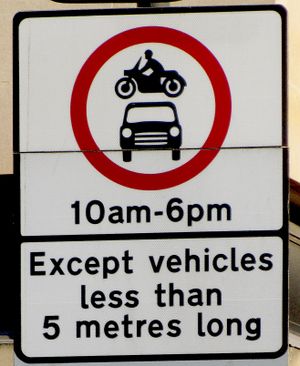
一般公众没有通行权。考虑使用其他标签(如 foot=yes 或 bicycle=permissive 等)来描述谁 可以 使用该要素。If only specific transport modes are forbidden, for example, at a vehicle no-entry sign, use a more specific restriction like vehicle=no or motor_vehicle=no over the general key access.
|
private
|
仅在个人许可的情况下 |
permissive
|
开放给一般车辆通行,直到所有者撤销许可为止,法律允许他们在未来任何时候撤销许可。 |
destination
|
仅在前往该要素/区域时使用;即仅用于当地交通。注意: 该限制通常只适用于某些交通方式(如只适用于车辆)。注意使用正确的交通方式限制;例如vehicle=destination 只限制车辆通行时。
Sign text in different languages: Note that "access only for residents" is |
delivery
|
只有在向要素交付货物时。例如在一条 highway=pedestrian 上标注 motor_vehicle=delivery。Status: "approved" |
customers
|
只针对该要素的客户。If access is not open to any person willing to pay, consider using private instead. Membership clubs are generally tagged as private.
|
designated
|
A preferred or designated route for the class of traffic specified by the tag key, such as foot=designated, in general this means that there is a (explicit) sign saying something like "pedestrians allowed", or a pedestrian icon.
将此值与 有关绘制为独立道路的强制性自行车道,请参见 |
| use_sidepath | Used to indicate that a mapped parallel way -that belongs to the same road- must be used instead (mostly acting as access=no with some exceptions). A road can legally consist of several ways, such as a single or dual carriageway with parallel tracks for cyclists, mopeds, pedestrians and/or equestrians. Used in countries where these classes must use specific parallel ways when present (following traffic rules, sometimes in conjunction with traffic signs). This tag should only be used to limit specific transport modes (e.g., bicycle=use_sidepath).
|
dismount
|
只有在下车/下马等情况下才允许某些车辆(或动物)。Mostly used for bicycle: Use bicycle=dismount when people are not permitted to cycle (e.g., through a graveyard) but are allowed to dismount and bring the bike. See Bicycle#Bicycle Restrictions. Note that bicycle=no is also commonly used where dismounting and pushing bicycle is legal.
|
agricultural
|
仅用于农业交通。请注意,农民的小道是私人的(private),而不是农业的(agricultural),除非该小道对任何用于农业的车辆开放。 Status: "approved" |
forestry
|
仅用于林业交通。 Status: "approved" |
discouraged
|
A legal right of way exists (see yes) but usage is officially discouraged (e.g., HGVs on narrow but passable lanes). Only if marked by a traffic sign (subjective otherwise).
 |
unknown
|
通行限制未知或不清晰。对于访问密钥,用户可能会根据定义或某种默认设置来假定访问权限,这就明确表明实际情况并不清楚(因为没有访问标签也可能被某些用户误认为符合假定的默认设置)。因此,如果没有更好的替代方案,就不应删除这些标记 |
点,线,区域
访问 "组标签可用于节点、道路和区域。在 OSM 社区中,有不同的优先级,可以在不同的地方放置 “进入 ”标签:区域(通常是广场,有一些特定的进入条件)、线路(通常是广场内的道路)或节点(通常是屏障中的门,环绕广场,有可能进入该区域)。需要注意的是,出入标签标志着领土的法律地位,而障碍物和警告标志只是区域限制的实际反映。因此,即使周围没有障碍物或障碍物被破坏,具有私人地位的区域也应具有适当的值。需要注意的是,不同的入口可以有不同的通道值,区域内不同的道路也可以有不同的通道值。例如,我们有一个允许进入的区域,因此我们用 access=permissive 标记它。但这里有几个入口,其中一个指定给所有人使用,另一个只给有钥匙的人使用。因此,我们在一个入口处标注 access=permissive,在另一个入口处标注 access=private。另一个例子是,我们有一个植物园,园内有两条道路,一条供公众使用,另一条仅供园内工作人员使用。在这种情况下,我们在一条道路上标注 access=permissive,在另一条道路上标注 access=private(或 access=no)。
当您在某个区域贴标签时,您可以决定在哪里贴 “进入 ”标签:区域、入口或区域内的道路(因为没有人可以让您在某个地方添加标签),但删除别人贴的正确标签则是错误的(近乎破坏)。如果您喜欢给区域贴标签,那就贴吧,如果您喜欢给区域内的道路贴标签,那就贴吧,如果您喜欢给入口贴标签,那就贴吧。但不要删除您不喜欢的元素类型的标签。
Facility restrictions
Access can be tagged on facilities, typically including
- building entrances, which can be used to model that different entrances are for different groups of users,
- buildings themselves,
- amenities, often used on
amenity=parkingwith restrictions to private (e.g. company employees only) or customers (people visiting a shop), - leisure entities, such as
leisure=sports_centreorleisure=playgroundwhere private describes a closed user group, e.g. members only or children of a particular school.
Access time and other conditional restrictions
- For a full description and more examples, please see the conditional restrictions page.
Restrictions may be limited to a particular time or day. Or they may limit the access for vehicles over a certain weight. Such conditions can be tagged as shown in these tagging examples:
- Only destination access is permitted during 8am and 5pm on Mondays to Fridays:
access:conditional=destination @ (Mo-Fr 08:00-17:00) - Motor vehicles heavier than 5 tonnes may only access this street for the purpose of delivering goods:
motor_vehicle:conditional=delivery @ (weight>5)
Please note that the above tagging style can be used to replace the following time dependent restrictions. It has been suggested that they be deprecated and should therefore no longer be used. date_on=*, date_off=*, day_on=*, day_off=*, hour_on=*, hour_off=*. Also note, that using of conditional tag assumes overt indication of value, which mostly suites as a default value. For example, if access is open on one part of day (on this part of day access=permissive) and is closed on other part of day (on this part of day access=private), we have a situation, when we should mark the object with a tag access=permissive or access=private. There is no concrete, precise and universal algorithm to define, if we should use permissive or private in concrete situation, but we can definitely say, that in such case we can't use access=yes (or not use tag access at all), because access=yes (or absence of tag access) means round-the-clock open access for general public.
Size and statutory restrictions
A number of statutory restrictions based on height, width, weight, etc. can also be defined. A assumed units are the appropriate SI unit and should be specified without any suffix. For lengths use metres, for weights use metric tonnes and for times use hours. Decimal numbers should include a decimal point. Exceptions include speeds which should be in mph in places where speed limits are defined in these units and times which can include a suffix of 'days' if appropriate.
maxaxleload=*- The legal maximum axleload in metric tonnes.maxheight=*- The legal maximum height in metresmaxheight:physical=*- The maximum height in metresmaxlength=*- The legal maximum length in metresmaxspeed=*- Specifies the maximum legal speed limit on a road, railway or waterway (km/h by default, mph where specified)maxstay=*- Maximum time you are allowed to stay somewhere. (maximum parking time)maxweight=*- permissible maximum actual weightmaxweightrating=*- Legal access restriction for vehicles with a max allowed weight above the specified weight in metric tonnes.maxwidth=*- The legally restricted maximum width of a vehicle (also notewidth=*for the physical width of the entire road.)mindistance=*- minimum trailing distance, often asmindistance:hgv=*on old bridges or in tunnelsminspeed=*- Specifies the minimum speed limit on a road, railway or waterway.maxdraught=*-
导航限制
单行限制
Ways may have different access restrictions for each direction. The most simple case is a way designated as a oneway road:
oneway=yes- Driving is only allowed in the direction of the way.
oneway=-1- Driving is only allowed against the direction of the way. If possible reverse the direction of the way and tag with oneway=yes.
oneway=no- Not normally used, as two-way traffic is the default. Use only where another tag (such as
highway=motorway) implies oneway=yes.
For more complex direction dependent restrictions, the postfixes :backward and :forward can be used on the keys, for example:
bicycle:backward=yes- When cyclists are allowed to travel in both directions on a oneway street (but no lane is present).
bicycle:backward=no- When a road has a oneway cycleway next to it that must be used, and a cyclelane in the other direction.
Also in use when cyclists are allowed to travel in the opposite direction:
cycleway=oppositecycleway=opposite_lane- Only if a separate lane exists.
cycleway=opposite_track- Only if a separate track exists.
oneway:bicycle=no- Consistent with tags based on conditions. Note: This was previously tagged as "bicycle:oneway=no", but this is deprecated.
The oneway tag can be translated (for routing purposes) to this generic system as follows (oneway restrictions presumably do not apply to pedestrians):
不同车道的限制
- 主条目:Lanes
通行限制可能在不同的车道上不同。
hgv:lanes=no|yes|yes- 重型车辆不得在三车道道路的最左侧车道行驶。
bus:lanes:forward=no|yes|designated- 在前进方向有三条车道的道路上,最左侧车道不允许行驶公交车。最右侧车道为指定的公交车道。
转向限制
- 主条目:Turn restriction
其他示例
bicycle=yesThe public has a right of way when travelling on a bicycle.horse=designatedThe route is designated for use by equestrians.motorcycle=unknownIt is unclear whether motorcycles can use this section.motorcar=privateThe owner must give access to cars on an individual basis. Access by car is private; e.g., on a private road.goods=noGeneral goods vehicle traffic is not allowed.hgv=noHeavy goods vehicle traffic is not allowed.boat=noWaterway is not available for boat traffic.oneway=yes+psv=opposite_laneThe street is one way for cars but there is one opposite lane for buses and taxis.maxweight=7限重7t。maxaxleload=3.5限轴重3.5t。maxheight=2.5限高2.5m。maxdraught=1船最大吃水深度为1m。maxspeed=110限速110km/hmaxspeed=55 mph限速55mph。maxstay=14 days最长的停留时间,单位可以是hour/hours或day/days。

标记方法:
现实情况与法律不符
在一些地区,至少有一些交通运输方式,法律的规定和通常通行方式完全不符合[1]。目前OSM还没有好方法来标记这些。
bicycle=no bicycle:de_facto=yes(存疑)
目前,一些编辑者将当地常态放入access标签,而不是法律规定[2]。
可能产生的错误标记
查看更多
- 默认标签
- Conditional restrictions
access=designated标记了不同的显性进入限制,如步行道路,自行车道,马道。highway=cyclewayhighway=footwayhighway=bridleway- Approved features/More access keys and values
male=*,female=*,unisex=*标记只有特定性别才可进入的场所,比如洗手间。min_age=*,max_age=*dog=*标记了某处能否带狗进入。