Indonesian Tagging Guidelines
OpenStreetMap is a digital map that displays various objects on earth. OpenStreetMap is Free and Opensource, hence OpenStreetMap enables its user to give any tag/information for the mapped objects. Therefore, to avoid wrong tagging and to avoid dissimilarity tag/information for the objects, OpenStreetMap has provided general references that can be used by users on the page Map Features in giving information for the mapped objects.
But, along with the increase of OpenStreetMap users around the world, the amount and the type of information submitted to OpenStreetMap has also increased. The page of Map Feature, which contains information for the objects in OpenStreetMap, does not seem to help users especially for specific objects which only exist in particular country including Indonesia. Frequently, users do not get information for the intended tag on Map Feature page or simply miss the objects because the name is different. Usually, the objects have their own local name such as posyandu, pesantren et cetera.
For those reasons, this page is intentionally made to provide attribute references for particular OpenStreetMap objects in Indonesia. On this page, the objects divided into several categories match with Indonesian Objects presets. Hopefully this page can help users and the OpenStreetMap community in Indonesia in mapping their region. Keep in mind, the object list on this page is not fully completed yet. Information showed below could change at any moment according to terms and conditions from OpenStreetMap.
For additional information, you can use Badan Informasi Geospasial (BIG) data (National Geospatial Information Agency for Indonesia) to complete name=* tags. For this, BIG has provide a valid and standardized name for some public facilities, government offices and many more in their SINAR Gazeter platform. BIG encourages OSM Community to adapt the standardized toponym into OSM.
POINT AND POLYGON (BUILDING) OBJECTS
Object list shown below contains the type of objects that can be drawn either as a point or a polygon (building). The object that can only be drawn as polygon (building) is denoted by the symbol ![]() and the object that can only be drawn as point is denoted by the symbol
and the object that can only be drawn as point is denoted by the symbol ![]() . The object that can be drawn either as polygon or point is denoted by both
. The object that can be drawn either as polygon or point is denoted by both ![]() and
and ![]() . It is better to draw the object as a polygon if the building footprint of the object is clearly seen on the satellite imagery, but if it is not, draw the object as a point.
. It is better to draw the object as a polygon if the building footprint of the object is clearly seen on the satellite imagery, but if it is not, draw the object as a point.
Places and Settlements
- Hierarchically, administrative levels in Indonesia are divided into several parts, here are further explanations:
- admin_level=4 - Province (Provinsi)
- admin_level=5 - City / Regency (Kotamadya/Kabupaten)
- admin_level=6 - District (Kecamatan)
- admin_level=7 - Village (Kelurahan/Desa/Kampung)
- admin_level=8 - Community Group (Rukun Warga/Dusun)
- admin_level=9 - Neighborhood Unit (Rukun Tetangga)
Places
This is used mainly to give details about settlements. See the page titled Places for an introduction on its usage.
| Key | Value | Element | Comment | Rendering | Photo | |
|---|---|---|---|---|---|---|
Administratively declared places | ||||||
| place | country | Negara: A nation state or other high-level national political/administrative area. Also see boundary=administrative, admin_level=2 for mapping national borders | ||||
| place | province | Provinsi: A large sub-national political/administrative area, mapped as a node. Also see boundary=administrative, admin_level=4 for mapping provincial borders | ||||
| place | city | Kotamadya/Kabupaten: The largest urban settlements in the territory. These are usually defined by charter or governmental designation in Indonesia. Most have a population of >100,000 people, larger than nearby towns. See place=suburb and place=neighbourhood on how to tag divisions within a city. The outskirts of urban settlements may or may not match the administratively declared boundary of the city. | ||||
| place | district | Kecamatan/Distrik: A district - a type of administrative division, used when the borders are not known well enough to map as an administrative area. See boundary=administrative, admin_level=6 for mapping the borders. | ||||
| place | suburb | Kelurahan: A distinct, large section of a city or town with its own name and identity. May also be a kelurahan in a small city or large town | ||||
Populated settlements, urban / suburban | ||||||
| place | neighbourhood | Kampung / Lingkungan: A named part of a place=village, a place=town or a place=city. Smaller than place=suburb or place=quarter. | ||||
Populated settlements, towns and rural | ||||||
| place | town | Kota (town): A second tier urban settlement of local importance, smaller than a city and larger than a village, often with a population of 10,000 people and good range of local facilities including schools, medical facilities etc and traditionally a market. In areas of low population, towns may have significantly lower populations. See place=neighbourhood and possibly also place=suburb on how to tag divisions within a town. | ||||
| place | village | Desa: A smaller distinct settlement, smaller than a town with just a few facilities available, such as a school and mosqu, temple or church and a few shops. Populations of villages vary widely in different provinces but will nearly always be less than 10,000 people, but over 100 people. See place=neighbourhood on how to tag divisions within a larger village. | ||||
| place | hamlet | Dusun: A smaller rural community typically with fewer than 100-200 inhabitants, little to no services or facilities, often too small for a mosque or church | ||||
| place | isolated_dwelling | Rumah terisolasis: Smallest kind of human settlement. No more than 1 or 2 households. | ||||
Other places | ||||||
| place | archipelago kepulauan | Kepulauan: a named group or chain of related islands and islets | ||||
| place | island | Pulau: Identifies the coastline of a piece of land completely surrounded by water. Also consider place=islet for very small islands | ||||
| place | islet | Pulau kecil: Identifies an islet (< 1 km2). | ||||
| place | square | Alun-alun: a named square in a town or village | ||||
| place | locality | Lokasi tidak berpenguni For an unpopulated named place. | ||||
| place | sea | Laut: A named division of the ocean. | ||||
Education
The list below shows objects providing education service especially formal education, such as school. Here are Indonesian objects that provides education services:
| No. | Object Name | Object Type | Description | Key | Value | Rendering | Photo |
|---|---|---|---|---|---|---|---|
| 1. | Playgroup (PAUD) | A school or a place where toddlers (children under 5 years old) learn by playing | amenity | kindergarten | |||
| 2. | Kindergarten (Taman Kanak-Kanak) | A school for children aged 5-6 | amenity | kindergarten | |||
| 3. | Elementary School (Sekolah Dasar or SD) / Madrasah Ibtidaiyah (MI) | A school for elementary education. Usually takes 6 years. |
|
|
|||
| 4. | Junior High School (Sekolah Menengah Pertama or SMP) / Madrasah Tsanawiyah (MTs) | A school attended after elementary school. Usually takes 3 years. |
|
|
|||
| 5. | Senior High School (Sekolah Menengah Atas or SMA) / Madrasah Aliyah (MA) | A school attended after junior high school. Usually takes 3 years. |
|
|
|||
| 6. | College (Sekolah Tinggi) | An educational institution or establishment, providing higher education or specialized professional | amenity | college | |||
| 7. | University (Universitas) | An institution of higher learning, consisting of several faculties, performing scientific education and/or professional in various academic disciplines | amenity | university |
Healthcare
Objects providing facilities and services in healthcare, like medication and treatment. Here are healthcare objects in Indonesia:
| No. | Object Name | Object Type | Description | Key | Value | Rendering | Photo |
|---|---|---|---|---|---|---|---|
| 1. | Village Clinic (Puskesmas) | Functional facility providing healthcare services for the people. Usually the service coverage covers only village/kelurahan. | amenity | clinic | |||
| 2. | Maternal and Child Health Center (Posyandu) | Healthcare facility focusing on maternal and child health. Usually it is not open daily and only open once a month. | amenity | clinic | |||
| 3. | Hospital (Rumah Sakit) | An institution providing medical and/or surgical treatment for sick or injured people | amenity | hospital | |||
| 4. | Private Practice/Midwife (Rumah Praktik Dokter/Bidan) | Building/residence providing private practice from general practitioner/doctor for medical treatment or from midwife for midwifery treatment | amenity | doctors | |||
| 5. | Dentist (Dokter Gigi) | Building/residence providing dental practice from dentist | amenity | dentist | |||
| 6. | Pharmacy/Drug Store (Apotek/Toko Obat) | A store where medicinal drugs are compounded and sold based on doctor's prescription | amenity | pharmacy |
Transportation
Objects providing transportation services and facilities, such as public transport: bus, train, airplane et cetera. Here are transportation objects in Indonesia:
| No. | Object Name | Object Type | Description | Key | Value | Rendering | Photo |
|---|---|---|---|---|---|---|---|
| 1. | Bus Stop (Halte Bus) | A place to wait for the bus | highway | bus_stop | |||
| 2. | Bus Station (Terminal Bus) | A place where buses stop for a while and pick up the passengers and also a place for bus depot | amenity | bus_station | |||
| 3. | Train Station (Stasiun Kereta) | A place for train to pick up and drop off passengers | public_transport | station | |||
| 4. | Harbour (Pelabuhan) | A place where people, cars et cetera can board and leave a ferry | amenity | ferry_terminal | |||
| 5. | Airport (Bandar Udara) | A place where aircraft land and take off | aeroway | aerodrome | |||
| 6. | Traffic Lights (Lampu Lalu Lintas) | Lights that control the traffic | highway | traffic_signals | |||
| 7. | Motor Taxi/Tricycle Station (Pangkalan Ojek/Becak) | A place or an area where motor taxi or tricycle wait for passengers |
|
||||
| 8. | Parking Area (Tempat Parkir) | An area for parking |
|
||||
| 9. | Car Repair/Tire Repair (Bengkel/Tambal Ban) | A place to get your vehicle repaired | shop | car_repair | [[|100px|center]] | ||
| 10. | Car Wash (Tempat Cuci Kendaraan) | A place to get your vehicle washed | amenity | car_wash | |||
| 11. | Fuel (Tempat pengisian bahan bakar Umum/SPBU) | Gas station | amenity | fuel | |||
| 12. | Car Store (Toko Mobil) | A place to buy cars | shop | car | |||
| 13. | Motorcycle Store (Toko Motor) | A place to buy motorcycle and its accessories | shop | motorcycle | [[|100px|center]] | ||
| 14. | Bicycle Store (Toko Sepeda) | A place to buy bicycle and its accessories | shop | bicycle | [[|100px|center]] |
Place of Worship
Objects used for worship or religious activities. Here are objects used for worships in Indonesia:
Government Office
Buildings used for government activities, such as community services or other kind of government activities. Here are government offices in Indonesia:
| No. | Object Name | Object Type | Description | Key | Value | Rendering | Photo |
|---|---|---|---|---|---|---|---|
| 1. | Sub-sub-village Office (Kantor RT) | The smallest administrative level of government office. RT (Sub-sub-village) itself is an abbreviation for Rukun Tetangga. | |||||
| 2. | Sub-village Office (Kantor RW) | The second smallest administrative level of government office right above RT. RW (Sub-village) itself is an abbreviation for Rukun Warga. | |||||
| 3. | Neighborhood / Hamlet Office (Kantor Kampung/Dusun) | Government office with administrative level above RW, below Desa/Kelurahan | |||||
| 4. | Village Office (Kantor Desa/Kelurahan) | Government office with administrative level above Kampung/Dusun, below Kecematan/Distrik. | |||||
| 5. | Municipality or District Office (Kantor Kecamatan / Distrik) | Government office with administrative level above Village/Kelurahan, below Regency | |||||
| 6. | Mayor / Regent Office (Kantor Bupati/Walikota) | Government office with administrative level above Municipality/District (Kecamatan/Distrik), below Province. The coverage area is Regency or Independent City (Kabupaten / Kotamadaya). | |||||
| 7. | Governor's Office (Kantor Gubernur) | Government office with administrative level above Sub-district/Regency. The coverage area is Province. | |||||
| 8. | Departement/Government Agency (Departemen/Instansi Pemerintah) | Building that provides community services facilities and is used for government activities | office | government | |||
| 9. | Embassy (Kedutaan Besar) | The official office of a country in another country | amenity | embassy |
Commercial
Buildings used for trading activities: products or services, or objects used for economic activities. Here are some examples of commercial building in Indonesia:
| No. | Object Name | Object Type | Description | Key | Value | Rendering | Photo |
|---|---|---|---|---|---|---|---|
| 1. | ATM | A place where basic banking function such as cash withdrawal can be performed through a machine | amenity | atm | |||
| 2. | Bank |
A financial institution providing banking services: accepts deposit from the public, issues cash withdrawal, makes loans and money circulation services |
amenity | bank | |||
| 3. | Money Changer (Toko Penukaran Uang Asing) | A place that provides money exchanging services | amenity | bureau_de_change |
| No. | Object Name | Object Type | Description | Key | Value | Rendering | Photo |
|---|---|---|---|---|---|---|---|
| 1. | Stall/Kiosk (Warung/Kios) | A small shop where cigarette, candies and other goods are sold | shop | kiosk | |||
| 2. | Minimarket | A place where daily needs are sold. Usually it is more complete than stall/kiosk, but it is smaller than supermarket. | shop | convenience | |||
| 3. | Supermarket | A closed room, air conditioned building where a wide variety of food and household products are sold | shop | supermarket | |||
| 4. | Mall | A shopping center building, containing various stores, usually covered and accessible by common passageways | shop | mall | |||
| 5. | Marketplace (Pasar) | A place where a public market or sale is set up. Sold products are vary. | amenity | marketplace | |||
| 6. | Fish Shop / Market (Pasar Ikan) | A shop or market where fish and seafood are sold | shop | seafood | |||
| 7. | Bakery (Toko Kue dan Roti) | A place where cake and bread are sold | shop | bakery | |||
| 8. | Greengrocer (Toko Buah / Toko Sayur) | A place where fruits or vegetables are sold | shop | greengrocer |
| No. | Object Name | Object Type | Description | Key | Value | Rendering | Photo |
|---|---|---|---|---|---|---|---|
| 1. | Hotel | A building with restaurant and numerous rooms for rent for travelers | tourism | hotel | |||
| 2. | Guest House / Motel (Wisma / Motel) | A building providing lodging for travelers. Smaller than hotel and usually cheaper than hotel. | tourism | guest_house |
| No. | Object Name | Object Type | Description | Key | Value | Rendering | Photo |
|---|---|---|---|---|---|---|---|
| 1. | Restaurant (Rumah Makan) | A building that provides foods. On daily life, this object can also appear as restaurants, padangnese restaurants, nasi rames restaurants, warteg
/* Notes: this object should be a permanent building |
amenity | restaurant | |||
| 2. | Cafe (Kafe) | A place where drinks such as coffee, tea, beer and snacks are sold | amenity | cafe | |||
| 3. | Fast food restaurant (Restaurant Cepat Saji) | A fast food restaurant | amenity | fast_food |
| No. | Object Name | Object Type | Description | Key | Value | Rendering | Photo |
|---|---|---|---|---|---|---|---|
| 1. | Hairdresser / Barber (Salon / Tukang Cukur) | A place providing hair cutting service and another service like manicure, pedicure et cetera | shop | hairdresser | |||
| 2. | Perfumery (Toko Parfum) | A building where any kinds of perfume are sold | shop | perfumery |
| No. | Object Name | Object Type | Description | Key | Value | Rendering | Photo |
|---|---|---|---|---|---|---|---|
| 1. | Optician (Optik) | A place or building where eye glasses and eye care are sold | shop | optician | |||
| 2. | Clothes Shop (Toko Pakaian) | A place or building where clothes such as tops and pants are sold | shop | clothes | |||
| 3. | Shoes (Toko Sepatu) | A place or building where shoes and footwear are sold | shop | shoes | |||
| 4. | Laundry (Toko Cuci Pakaian) | A place or building providing cloth washing service | shop | laundry | |||
| 5. | Jewelry Shop (Toko Perhiasan) | A place or building where jewelry are sold | shop | jewelry | |||
| 6. | Tailor (Tukang Jahit) | A place where clothes are made or fixed | shop | tailor |
| No. | Object Name | Object Type | Description | Key | Value | Rendering | Photo |
|---|---|---|---|---|---|---|---|
| 1. | Bookstore (Toko Buku) | A place or building where books are sold | shop | books | |||
| 2. | Stationery Shop (Toko Alat Tulis) | A place or building where stationery are sold | shop | stationery | |||
| 3. | Copy Shop (Toko Fotokopi) | A place or building where photocopy service provided. Usually stationery are also available here. | shop | copyshop |
| No. | Object Name | Object Type | Description | Key | Value | Rendering | Photo |
|---|---|---|---|---|---|---|---|
| 1. | Electronic Store (Toko Elektronik) | A place or building where electronics and accessories are sold | shop | electronics | |||
| 2. | Computer Store (Toko Komputer) | A place or building where computer and accessories are sold | shop | computer | |||
| 3. | Handphone Store (Toko Handphone) | A place or building where handphone and accessories are sold | shop | mobile_phone |
| No. | Object Name | Object Type | Description | Key | Value | Rendering | Photo |
|---|---|---|---|---|---|---|---|
| 1. | Sports Store (Toko Olahraga) | A place or building where sport equipment are sold | shop | sports | |||
| 2. | Outdoor Store (Toko Perlengkapan Outdoor) | A place or building where outdoor equipment are sold | shop | outdoor | |||
| 3. | Pet Shop (Toko Hewan Peliharaan) | A place or building where pet supplies and accessories are sold | shop | pet | |||
| 4. | Handicraft Shop (Toko Alat Jahit / Kerajinan Tangan) | A place or building where handicrafts are sold | craft | handicraft | |||
| 5. | Garden Store (Toko Tanaman) | A place or building where ornamental plants and garden tools are sold | shop | garden_centre | |||
| 6. | Florist (Toko Bunga) | A place where flowers are sold | shop | florist | |||
| 7. | Music Store (Toko Musik) | A place or building where musical instruments are sold | shop | musical_instrument | |||
| 8. | Travel Agency (Toko Perjalanan) | A place or building that provides travel and tourism related services such as transportation ticketing, travel insurance and package tours | shop | travel_agency | |||
| 9. | Photo Studio (Studio Foto) | A place or building that provides photography related services such as photo studio and photo printing | shop | photo |
| No. | Object Name | Object Name | Description | Key | Value | Rendering | Photo |
|---|---|---|---|---|---|---|---|
| 1. | Furniture Store (Toko Furnitur) | A place or building where furniture are sold | shop | furniture | |||
| 2. | Hardware Store (Toko Bahan Bangunan) | A place or building where building materials such as pipe, hammer, roof tile, brick et cetera are sold | shop | hardware |
| No. | Object Name | Object Type | Description | Key | Value | Rendering | Photo |
|---|---|---|---|---|---|---|---|
| 1. | Gift Store (Toko Oleh-Oleh) | A place or building where gifts and souvenirs are sold | shop | gift | |||
| 2. | Toy Store (Toko Mainan Anak-anak) | A place or building where toys are sold | shop | toys |
Entertainment and Sport
Objects providing recreational facility and entertainment either free of charge or priced such as cinema, zoo et cetera. Here is the list of entertainment and recreational objects in Indonesia:
| No. | Object Name | Object Type | Description | Key | Value | Rendering | Photo |
|---|---|---|---|---|---|---|---|
| 1. | Internet Cafe (Warnet) | A place providing video games, internet facility and services. Usually rented by hour and open for public. | amenity | internet_cafe | |||
| 2. | Cinema (Bioskop) | A place where people go to watch movies, usually new release movies | amenity | cinema | |||
| 3. | Zoo (Kebun Binatang) | A place where live animals are kept for study, conservation or display to the public | tourism | zoo | |||
| 4. | Museum | A building where historical, scientific, cultural and artistic objects are exhibited | tourism | museum | |||
| 5. | Arts Centre (Gedung Kesenian) | A building that holds arts practice | amenity | arts_centre | |||
| 6. | Fishing Spot (Pemancingan) | A spot or an area where the activity of catching fish takes place | leisure | fishing | |||
| 7. | Swimming Pool / Water Park (Kolam Renang / Taman Air) | A place with area of water for swimming or a park with facilities for aquatic recreation | leisure | ||||
| 8. | Park (Taman) | A place with a large public green area for recreation and planted with flowers or ornamental plants | leisure | park | |||
| 9. | Playground (Taman Bermain) | A place or an area for children to play on | leisure | playground | |||
| 10. | Theatre (Gedung Teater) | A place or building where theatrical plays are performed | amenity | theatre | |||
| 11. | Karaoke Bar/Discotheque (Tempat Karaoke/Diskotik) | A place or building that holds karaoke sessions. Usually for singing and dancing. | amenity | nightclub | |||
| 12. | Stadium (Stadion) | A building intended for sport activities surrounded with seats | leisure | stadium | |||
| 13. | Sports Centre (Pusat Kegiatan Olahraga) | A place where any kind of sport activities are done | leisure | sports_centre | |||
| 14. | Pitch (Lapangan Olahraga) | An outdoor area of ground where sport is played | leisure | pitch |
Public Facility
Objects providing services and facilities for public activities such as toilets, town hall, library et cetera. Here is the list of public facility in Indonesia:
| No. | Object Name | Object Type | Description | Key | Value | Rendering | Photo |
|---|---|---|---|---|---|---|---|
| 1. | Toilets (WC / Toilet Umum) | A building that provides toilets for public, usually located at public places | amenity | toilets | |||
| 2. | Town Hall (Balai Kota) | A building used for the administration of local government in a village, town or city. May also be used for a community meeting place. | amenity | townhall | |||
| 3. | Library (Perpustakaan) | A place containing collections of books where the books could be borrowed, rented or read | amenity | library | |||
| 4. | Courthouse (Pengadilan) | A building where courts of law are held | amenity | courthouse | |||
| 5. | Post Office (Kantor Pos) | An office responsible for mail services such as letter and packages posting | amenity | post_office | |||
| 6. | Prison (Lembaga Pemasyarakatan) | A building where criminals are held as a punishment of the crime they committed | amenity | prison | |||
| 7. | Hall (Aula / Balai Pertemuan) | A building used for holding a great event or meeting. Accessible to general public. | building | public | |||
| 8. | Social Facility (Rumah Panti/Rumah Sosial) | A facility that provides social services such as orphanage (panti asuhan = group_home) or nursing home (panti jompo = nursing_home) | |||||
| 9. | Police Station (Kantor Polisi) | A place police officers patrol from and that is a first point of contact for civilians | amenity | police | |||
| 10. | Fire Station (Kantor Pemadam Kebakaran) | A station from which a fire brigade operates | amenity | fire_station |
Industry
Objects that used for industrial matter such as warehouse. Here is the list of industrial objects in Indonesia:
| No. | Object Name | Object Type | Description | Key | Value | Rendering | Photo |
|---|---|---|---|---|---|---|---|
| 1. | Warehouse (Gudang) | A building where manufactured goods (usually in a great amount) are stored | building | warehouse | |||
| 2. | Factory (Pabrik) | A place where goods or products (usually in a great amount) are manufactured | man_made | works | |||
| 3. | Power Plant (Pembangkit Listrik) | A place or industrial facility where electrical power is generated | power | plant |
Residence
Building used for residential purpose.
| No. | Object Name | Object Type | Description | Key | Value | Rendering | Photo |
|---|---|---|---|---|---|---|---|
| 1. | House (Rumah) | Building used primarily for residential purpose. | building | residential |
Other Buildings
Other objects in Indonesia and also need to be mapped.
| No. | Object Name | Object Type | Description | Key | Value | Rendering | Photo |
|---|---|---|---|---|---|---|---|
| 1. | Unclassified Building (Bangunan Belum Terklasifikasi) | An unclassified building | building | yes | |||
| 2. | Animal Boarding (Kandang Hewan) | A place or a building for animal or pet | amenity | animal_boarding | |||
| 3. | Substation (Gardu Listrik) | An electrical installation to distribute electrical power to another area | power | substation | |||
| 4. | Tower (Tiang Listrik) | Big towers or pylons carrying electricity cables | power | tower | |||
| 5. | Communication Tower (Tower Komunikasi) | Tower used for transmitting telecommunications signals | man_made | communications_tower | |||
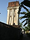
| 6. | Water Tower (Menara Air) | Tower used for water tank to deliver water at a required elevation | man_made | water_tower | |||
| 7. | Reservoir (Bak Penampung Air) | An artificial man-made tank for holding fresh water | man_made | reservoir_covered | [[|100px|center]] | ||
| 8. | Well (Sumur) | A great hole made to access ground water. Usually the hole is surrounded with a brick wall. | man_made | water_well | |||
| 9. | Lighthouse (Mercusuar) | Tower that emits lights to navigate approaching ships | man_made | lighthouse | |||
| 10. | Fountain (Air Mancur) | Recreational object that artificially created jet or stream of water | amenity | fountain | |||
| 11. | Watermill (Rumah Pompa) | A building or an installation used for streaming water down to the sea or river | man_made | watermill | |||
| 12. | Archaeological Site (Situs Bersejarah) | A historical or an archaeological site where historical event happened | historic | archaeological_site | |||
| 13. | Memorial (Tugu) | A big high pillar made of stone, brick etc as a symbol of past event or simply as a symbol of particular place | historic | memorial | |||
| 14. | Monument (Monumen) | A historical place or a historical building protected by the country. Bigger than memorial. | historic | monument | |||
| 15. | Rune Stone (Prasasti) | Piagam (written on a stone, copper etc). Stone with a runic inscription. | historic | rune_stone |
Access and Barrier Tagging in Indonesia
The use of access and barriers are usually called portals, will affect road access. If a portal is permanently closed, it will make road access around it being closed. If we want to enter a residential complex area and there is a portal guarded by security officers or security guards, then this will result in road access being private. Below we have provided a flowchart if we want to edit the OSM map, especially if we are adding access or barrier on the road. This flowchart will help beginners or experienced editors to add access tags or barriers to highway in OSM.
Additional Attribute Information about BUILDING OBJECT
If you draw an object using building attribute, then you should give information regarding the building as shown on the list below:
| No. | Information | Key | Value | Description |
|---|---|---|---|---|
| 1. | Building Type | building | User Defined: the value is defined by user based on the information of the building | Building type information for the mapped building. The suitable value can be given to the mapped object. For example, the mapped object is actually a school building, user can tag this object with building=school. For further information, see this link. |
| 2. | Building Level | building:levels | User Defined: the value is defined by user based on the information of the building | Building level information for the mapped building. The suitable value can be given to the mapped building. For example, the mapped building is a three-level building, user can give additional tag building:levels=3 for the mapped building. For further information, see this link. |
| 3. | Building Structure | building:structure |
|
Describes the type of construction for the walls of the building, when known. If the mapped walls made of reinforced concrete (for example, steel reinforcing bars are exposed at the top of the walls), user can give additional tag building:structure=reinforced_masonry for the mapped building. |
| 4. | Address | addr:full | User Defined: the value is defined by user based on the information of the building | Address information for the mapped building. For example, the mapped building's address is Jalan M.H.Thamrin, user can give additional tag addr=Jalan M.H Thamrin for the mapped building. For further information, see this link. |
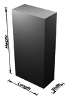
| 5. | Building Height | height | User Defined: the value is defined by user based on the information of the building | Building height information for the mapped building. For example, the mapped building is a 10-meter building, user can give additional tag height=10 for the mapped building. For further information, see this link. |
| 6. | House number | addr:housenumber | User Defined: the value is defined by user based on the information of the building | House/building number information for the mapped object. For example, the house number of the mapped object is 5, user can give additional tag addr:housenumber=5 for the mapped object. For further information, see this link. |
| 7. | Building Name | name | User Defined: the value is defined by user based on the information of the building | Building name information for the mapped object. For example, the name of the mapped building is Rumah Makan Enak, user can give additional tag name=Rumah Makan Enak for the mapped object. For further information, see this link. |
| 8. | Building Surface Material | building:material |
|
Building surface material information. Describes the cladding or facade material on the outer layer of the building walls. The suitable value can be given to the mapped object. For example, if the exposed surface of the building is plaster, use building:material=plaster for the mapped object.] |
| 9. | Roof Material | roof:material |
|
Describes the material used for the exposed outer surface of the roof. The suitable value can be given to the mapped object. For example, the roof material for the mapped object is tile, user can give additional tag roof:material=tile for the mapped object. |
| 10. | Roof Access | access:roof |
|
Roof access information. If the building has access to the roof, user can give additional tag access:roof=yes for the mapped building. |
POLYGON OBJECT (AREA)
List of object below is the kind of object that needed to draw as an area. Most of these objects are landuse. All polygon objects denoted with this symbol ![]() . Here is the list of landuse object in Indonesia:
. Here is the list of landuse object in Indonesia:
Land Use
| No. | Object Name | Object Type | Description | Key | Value | Rendering | Photo |
|---|---|---|---|---|---|---|---|
| 1. | Orchard (Perkebunan/Ladang buah-buah) | A field of land planted with tree or bushes (for fruits, palm oil, etc.) | landuse | orchard | |||
| 2. | Farmland (Sawah / ladang) | Cultivated land for planting rice, maize or other seasonal crops | landuse | farmland | |||
| 3. | Residential (Permukiman) | Specific area used for residential buildings | landuse | residential | |||
| 4. | Industrial Area (Kawasan Industri) | An area used for industrial activity such as processing material using various tools and machines | landuse | industrial | |||
| 5. | Wetland (Rawa) | Lower part from one land (commonly found on coastal area) and filled with water, usually has many water plant inside | natural | wetland | |||
| 6. | Forest (Hutan) | land covered with various trees | landuse | forest | |||
| 7. | Commercial (Perkantoran) | Area specifically used for office and economic activity | landuse | commercial | |||
| 8. | Cemetery (Pemakaman) | Land used to bury dead people. Add religion=* if specific to one religion. | landuse | cemetery | |||
| 9. | Construction Area (Konstruksi/Lahan Pembangunan) | Area that still on construction progress | landuse | construction | |||
| 10. | Brown Field (Tanah Lapang) | Unused land or land that will be use in the future. The building located in this place already destroyed. It might be a land that still has a development process/construction | landuse | brownfield | |||
| 11. | Landfill (Tempat Pembuangan Sampah) | Area used for disposing waste materials | landuse | landfill | |||
| 12. | Meadow / Pasture (Padang Rumput) | Area that covered with grass used for grazing or hay. | landuse | meadow | |||
| 13. | Grass (Daerah Rumput) | A small area of mown and managed grass, for example next to highways | landuse | grass | |||
| 14. | Retail (Pertokoan) | Specific area that has various shop/shopping center. Easy to access so all buyer can come and buy any things from it. | landuse | retail | |||
| 15. | Garden (Taman Bunga) | A park filled with various kind of flowers and ornamental plants | leisure | garden | |||
| 16. | Nature Reserve (Taman Nasional) | An area that strongly protected by the government. There are forest, animals, or plants that might be in endangered status. | leisure | nature_reserve | |||
| 17. | Recreation Ground (Taman Rekreasi) | A place that has many kinds of attraction and recreational activities | landuse | recreation_ground |
Waters
In OpenStreetMap, we can map the waters object that has polygon shape, such as:
| No. | Object Name | Object Type | Description | Key | Value | Rendering | Photo |
|---|---|---|---|---|---|---|---|
| 1. | Lake (Danau) | Area of water surrounded by land. | natural | water | |||
| 2. | Reservoir (Waduk) | An artificial lake which may be used to store water | landuse | reservoir | |||
| 3. | River Bank (Daerah air sungai) | The water-covered area of a river. | waterway | riverbank | |||
| 4. | Basin (Cekungan) | An area of land artificially graded to hold water | landuse | basin | |||
| 5. | Beach (Pantai) | Unvegetated area of sand, pebbles, or other loose minerals formed by waves at the coast of the sea or the shore of a lake | natural | beach |
Additional Attribute Information about LAND USE OBJECT
If you add an object using the attribute of landuse, you should add some additional information regarding list of buildings below:
| No. | Information | Key | Value | Description |
|---|---|---|---|---|
| 1. | Object Name | name | User Defined: the value is set by the user based on the information of the land use | Information about the name of land use object that has been mapped. For example, there are landuse object named “Taman Nasional Bukit Barisan”, then we can write the tag combination like this name=Taman Nasional Bukit Barisan. For further information, visit this link here |
LINE OBJECT
List of objects below should be drawn as line object. All line object marked with symbol ![]() . This is all line object that commonly found in Indonesia:
. This is all line object that commonly found in Indonesia:
Administrative Boundary
| No. | Object Name | Object Type | Description | Key | Value | Rendering | Photo |
|---|---|---|---|---|---|---|---|
| 1. | State Boundary (Batas Negara) | Imaginary line that separated 2 or more countries. Usually separated by natural object like river, coastline, mountains, or artificial object like stakes or gate. | admin_level | 2 | [[|100px|center]] | ||
| 2. | Province Boundary (Batas Provinsi) | An imaginary line that separated 2 or more provinces. Usually separated by a natural object like a river, coastline, mountains, or an artificial object like stakes or gate. | admin_level | 4 | [[|100px|center]] | ||
| 3. | Sub-district/Regency Boudaries (Batas Kotamadya/Kabupaten) | An imaginary line that separated 2 or more sub-districts/regencies. Usually separated by a natural object like a river, coastline, mountains, or an artificial object like stakes or gate. | admin_level | 5 | [[|100px|center]] | ||
| 4. | Municipality Boundaries (Batas Kecamatan) | An imaginary line that separated 2 or more municipalities. Usually separated by a natural object like a river, coastline, mountains, or an artificial object like stakes or gate. | admin_level | 6 | [[|100px|center]] | ||
| 5. | Village Boundaries (Batas Kelurahan/Desa) | An imaginary line that separated 2 or more villages. Usually separated by a natural object like a river, coastline, mountains, or an artificial object like stakes or gate. | admin_level | 7 | [[|100px|center]] | ||
| 6. | Hamlet Boundaries (Batas Dusun) | An imaginary line that separated 2 or more hamlets. Usually separated by a natural object like a river, coastline, mountains, or an artificial object like stakes or gate. | admin_level | 8 | [[|100px|center]] | ||
| 7. | Sub-village Boundaries (Batas RW) | An imaginary line that separated 2 or more sub-villages. Usually separated by a natural object like a river, coastline, mountains, or an artificial object like stakes or gate. | admin_level | 9 | [[|100px|center]] | ||
| 8. | Sub-sub-village Boundaries (Batas RT) | An imaginary line that separated 2 or more sub-subvillages. Usually separated by a natural object like a river, coastline, mountains, or an artificial object like stakes or gate. | admin_level | 10 | [[|100px|center]] |
Roads
Highway
This is used to describe roads and footpaths. For an introduction on its usage see the page titled Highways. See the page titled Restrictions for an introduction on access limitations by vehicles type, time, day, load and purpose, etc.
| Key | Value | Element | Comment | Rendering carto | Examples | |
|---|---|---|---|---|---|---|
Roads | ||||||
|
This group lists the 7 main tags for the road network, from most to least functionally important for motor vehicle traffic. | ||||||
| highway | motorway | A restricted access major divided highway, normally with 2 or more running lanes plus emergency hard shoulder. Equivalent to the Freeway, Autobahn, etc.. | ||||
| highway | trunk | The most important roads in a country's system that aren't motorways. (Need not necessarily be a divided highway.) | ||||
| highway | primary | The next most important roads in a country's system. (Often link larger towns.) | ||||
| highway | secondary | The next most important roads in a country's system. (Often link towns.) | ||||
| highway | tertiary | The next most important roads in a country's system. (Often link smaller towns and villages) | ||||
| highway | unclassified | The least important through roads in a country's system – i.e. minor roads of a lower classification than tertiary, but which serve a purpose other than access to properties. (Often link villages and hamlets.)
The word 'unclassified' is a historical artefact of the UK road system and does not mean that the classification is unknown; you can use highway=road for that. |
||||
| highway | residential | Roads which serve as an access to housing, without function of connecting settlements. Often lined with housing. | ||||
Link roads | ||||||
| highway | motorway_link | The link roads (sliproads/ramps) leading to/from a motorway from/to a motorway or lower class highway. Normally with the same motorway restrictions. | ||||
| highway | trunk_link | The link roads (sliproads/ramps) leading to/from a trunk road from/to a trunk road or lower class highway. | ||||
| highway | primary_link | The link roads (sliproads/ramps) leading to/from a primary road from/to a primary road or lower class highway. | ||||
| highway | secondary_link | The link roads (sliproads/ramps) leading to/from a secondary road from/to a secondary road or lower class highway. | ||||
| highway | tertiary_link | The link roads (sliproads/ramps) leading to/from a tertiary road from/to a tertiary road or lower class highway. | ||||
Special road types | ||||||
| highway | living_street | For living streets, which are residential streets where pedestrians have legal priority over cars, speeds are kept very low. | ||||
| highway | service | For access roads to, or within an industrial estate, camp site, business park, car park, alleys, etc. Can be used in conjunction with service=* to indicate the type of usage and with access=* to indicate who can use it and in what circumstances. | ||||
| highway | pedestrian | For roads used mainly/exclusively for pedestrians in shopping and some residential areas which may allow access by motorised vehicles only for very limited periods of the day. To create a 'square' or 'plaza' create a closed way and tag as pedestrian and also with area=yes. | ||||
| highway | track | Roads for mostly agricultural or forestry uses. To describe the quality of a track, see tracktype=*. Note: Although tracks are often rough with unpaved surfaces, this tag is not describing the quality of a road but its use. Consequently, if you want to tag a general use road, use one of the general highway values instead of track. | ||||
| highway | bus_guideway | A busway where the vehicle guided by the way (though not a railway) and is not suitable for other traffic. Please note: this is not a normal bus lane, use access=no, psv=yes instead! | ||||
| highway | escape | For runaway truck ramps, runaway truck lanes, emergency escape ramps, or truck arrester beds. It enables vehicles with braking failure to safely stop. | ||||
| highway | raceway | A course or track for (motor) racing | ||||
| highway | road | A road/way/street/motorway/etc. of unknown type. It can stand for anything ranging from a footpath to a motorway. This tag should only be used temporarily until the road/way/etc. has been properly surveyed. If you do know the road type, do not use this value, instead use one of the more specific highway=* values. | ||||
| highway | busway | A dedicated roadway for bus rapid transit systems | ||||
Paths | ||||||
| highway | footway | For designated footpaths; i.e., mainly/exclusively for pedestrians. This includes walking tracks and gravel paths. If bicycles are allowed as well, you can indicate this by adding a bicycle=yes tag. Should not be used for paths where the primary or intended usage is unknown. Use highway=pedestrian for pedestrianised roads in shopping or residential areas and highway=track if it is usable by agricultural or similar vehicles. For ramps (sloped paths without steps), combine this tag with incline=*. | ||||
| highway | bridleway | For horse riders. Pedestrians are usually also permitted, cyclists may be permitted depending on local rules/laws. Motor vehicles are forbidden. | ||||
| highway | steps | For flights of steps (stairs) on footways. Use with step_count=* to indicate the number of steps | ||||
| highway | corridor | For a hallway inside of a building. | ||||
| highway | path | A non-specific path. Use highway=footway for paths mainly for walkers, highway=cycleway for one also usable by cyclists, highway=bridleway for ones available to horse riders as well as walkers and highway=track for ones which is passable by agriculture or similar vehicles. | ||||
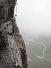
| highway | via_ferrata | A via ferrata is a route equipped with fixed cables, stemples, ladders, and bridges in order to increase ease and security for climbers. These via ferrata require equipment : climbing harness, shock absorber and two short lengths of rope, but do not require a long rope as for climbing. | ||||
When sidewalk/crosswalk is tagged as a separate way | ||||||
| footway | sidewalk | Sidewalk that runs typically along residential road. Use in combination with highway=footway or highway=path | ||||
| footway | crossing | Crosswalk that connects two sidewalks on the opposite side of the road. Often recognized by painted markings on the road, road sign or traffic lights. Use in combination with highway=footway or highway=path. Useful information is presence of tactile_paving=*, wheelchair=* suitability and kerb=* represented as a node on the crosswalk way. | ||||
| footway | traffic_island | The way between two crossings, safespot for pedestrians, has micromapping characteristics as a detailed alternative to =*. Use in combination with highway=footway or highway=path. | ||||
When sidewalk (or pavement) is tagged on the main roadway (see Sidewalks) | ||||||
| sidewalk | both | left | right | no | Specifies that the highways has sidewalks on both sides, on one side or no sidewalk at all | ||||
When cycleway is drawn as its own way (see Bicycle) | ||||||
| highway | cycleway | For designated cycleways. Add foot=*, though it may be avoided if default-access-restrictions do apply. | ||||
Cycleway tagged on the main roadway or lane (see Bicycle) | ||||||
| cycleway | lane | A lane is a route that lies within the roadway | ||||
| cycleway | Deprecated variant for ways with oneway=yes where it is legally permitted to cycle in both directions. Replaced by oneway:bicycle=no. | |||||
| cycleway | Deprecated variant for ways with oneway=yes that have a cycling lane going the opposite direction of normal traffic flow (a "contraflow" lane). Replaced by oneway:bicycle=no + cycleway:left=lane/cycleway:right=lane + cycleway:left:oneway=-1/cycleway:right:oneway=-1. | |||||
| cycleway | track | A track provides a route that is separated from traffic. In the United States, this term is often used to refer to bike lanes that are separated from lanes for cars by pavement buffers, bollards, parking lanes, and curbs. Note that a cycle track may alternatively be drawn as a separate way next to the road which is tagged as highway=cycleway. | ||||
| cycleway | Deprecated variant for ways with oneway=yes that have a cycling track going the opposite direction of normal traffic flow. Replaced by oneway:bicycle=no + cycleway:left=track/cycleway:right=track + cycleway:left:oneway=-1/cycleway:right:oneway=-1. | |||||
| cycleway | share_busway | There is a bus lane that cyclists are permitted to use. | ||||
| cycleway | Deprecated variant for ways with oneway=yes that have a bus lane that cyclists are also permitted to use, and which go in the opposite direction to normal traffic flow (a "contraflow" bus lane). Replaced by oneway:bicycle=no + cycleway:left=share_busway/cycleway:right=share_busway + cycleway:left:oneway=-1/cycleway:right:oneway=-1. | |||||
| cycleway | shared_lane | Cyclists share a lane with motor vehicles, there are markings reminding about this. In some places these markings are known as "sharrows" ('sharing arrows') and this is the tag to use for those. | ||||
Busways tagged on the main roadway or lane (see Bus lanes) | ||||||
| lane | Deprecated variant to tag bus lanes. Replaced by bus/psv lane tagging lanes:bus=* / lanes:psv=*) / bus:lanes=* / psv:lanes=* | |||||
| opposite | Deprecated variant for ways with oneway=yes where buses are legally permitted to travel in both directions. Replaced by oneway:bus=no | |||||
| opposite_lane | Deprecated variant for ways with oneway=yes that have a bus lane which go in the opposite direction to normal traffic flow (a "contraflow" bus lane). Replaced by oneway:bus=no and lanes:bus=* / lanes:psv=*) / bus:lanes=* / psv:lanes=* | |||||
Street parking tagged on the main roadway (see Street parking) | ||||||
| parking:left / :right / :both (hereafter: parking:side) |
lane | street_side | on_kerb | half_on_kerb | shoulder | no | separate | yes | Primary key to record parking along the street. Describes the parking position of parked vehicles in the street. | ||||
| parking:sideorientation=* | parallel | diagonal | perpendicular | To specify the orientation of parked vehicles if there is street parking. | ||||
Lifecycle (see also lifecycle prefixes) | ||||||
| highway | proposed | For planned roads, use with proposed=* and a value of the proposed highway value. | ||||
| highway | construction | For roads under construction. Use construction=* to hold the value for the completed road. | different colours | |||
Attributes | ||||||
| abutters | commercial | industrial | mixed | residential | retail etc. | See Key:abutters for more details. | ||||
| bicycle_road | yes | A bicycle road is a road designated for bicycles. If residential streets get the status of bicycle roads, normally, by special signs, motor traffic is admitted with limited speed, often only for residents. | ||||
| bus_bay | both | left | right | A bus bay outside the main carriageway for boarding/alighting | ||||
| change | yes | no | not_right | not_left | only_right | only_left | Specify the allowed/forbidden lane changes | ||||
| destination | <place name of destination> | Destination when following a linear feature | ||||
| embankment | yes | dyke | A dyke or a raised bank to carry a road, railway, or canal across a low-lying or wet area. | ||||
| embedded_rails | yes | <type of railway> | A highway on which non-railway traffic is also allowed has railway tracks embedded in it but the rails are mapped as separate ways. | ||||
| ford | yes | The road crosses through stream or river, vehicles must enter any water. | ||||
| ice_road | yes | A highway is laid upon frozen water basin, definitely doesn't exist in summer. | ||||
| incline | Number % | ° | up | down | Incline steepness as percents ("5%") or degrees ("20°"). Positive/negative values indicate movement upward/downwards in the direction of the way. | ||||
| junction | roundabout | This automatically implies oneway=yes, the oneway direction is defined by the sequential ordering of nodes within the Way. This applies on a way, tagged with highway=* already. | ||||
| lanes | <number> | The number of traffic lanes for general purpose traffic, also for buses and other specific classes of vehicle. | ||||
| lane_markings | yes | no | Specifies if a highway has painted markings to indicate the position of the lanes. | ||||
| lit | yes | no | Street lighting | ||||
| maxspeed | <number> | Specifies the maximum legal speed limit on a road, railway or waterway. | ||||
| motorroad | yes | no | The motorroad tag is used to describe highways that have motorway-like access restrictions but that are not a motorway. | ||||
| mountain_pass | yes | The highest point of a mountain pass. | ||||
| mtb:scale | 0-6 | Applies to highway=path and highway=track. A classification scheme for mtb trails (few inclination and downhill). | ||||
| mtb:scale:uphill | 0-5 | A classification scheme for mtb trails for going uphill if there is significant inclination. | ||||
| mtb:scale:imba | 0-4 | The IMBA Trail Difficulty Rating System shall be used for bikeparks. It is adapted to mtb trails with artificial obstacles. | ||||
| mtb:description | Text | Applies to highway=path and highway=track. A key to input variable infos related to mtbiking on a way with human words | ||||
| oneway | yes | no | reversible | Oneway streets are streets where you are only allowed to drive in one direction. | ||||
| oneway:bicycle | yes | no | | Used on ways with oneway=yes where it is legally permitted to cycle in both directions. | ||||
| overtaking | yes | no | caution | both | forward | backward | Specifying sections of roads where overtaking is legally forbidden. Use overtaking:forward=yes/no/caution and overtaking:backward=yes/no/caution when it depends on driving direction. | ||||
| parallel | diagonal | perpendicular | marked | no_parking | no_stopping | fire_lane. | Deprecated variant to map parking along streets. See section on street parking above or the street parking page for more details. | |||||
| free | ticket | disc | residents | customers | private | Deprecated variant to map parking conditions along streets. See section on street parking above or the street parking page for more details. | |||||
| passing_places | yes | A way which has frequent passing places (See also: highway=passing_place) | ||||
| priority | forward | backward | Traffic priority for narrow parts of roads, e.g. narrow bridges. | ||||
| priority_road | designated | yes_unposted | end | Specifying roads signposted as priority roads. | ||||
| sac_scale | strolling | hiking | mountain_hiking | demanding_mountain_hiking | alpine_hiking | demanding_alpine_hiking | difficult_alpine_hiking | Applies to highway=path and highway=footway. A classification scheme for hiking trails. | ||||
| service | alley | driveway | parking_aisle etc. | See Key:service for more details. | ||||
| shoulder | no | yes | right | both | left | Presence of shoulder in highway | ||||
| smoothness | excellent | good | intermediate | bad | very_bad | horrible | very_horrible | impassable | Specifies the physical usability of a way for wheeled vehicles due to surface regularity/flatness. See Key:smoothness for more details. | ||||
| surface | paved | unpaved | asphalt | concrete | paving_stones | sett | cobblestone | metal | wood | compacted | fine_gravel | gravel | pebblestone | plastic | grass_paver | grass | dirt | earth | mud | sand | ground | See Key:surface for more details. | ||||
| tactile_paving | yes | no | A paving in the ground to be followed with a blindman's stick. | ||||
| tracktype | grade1 | grade2 | grade3 | grade4 | grade5 | To describe the quality of the surface. See Key:tracktype for more information. | ||||
| traffic_calming | bump | hump | table | island | cushion | yes | etc. | Features used to slow down traffic. See Key:traffic calming for more details. | ||||
| trail_visibility | excellent | good | intermediate | bad | horrible | no | Applies to highway=path, highway=footway, highway=cycleway and highway=bridleway. A classification for hiking trails visibility | ||||
| trailblazed | yes | no | poles | cairns | symbols | Applies to highway=*. Describing trail blazing and marking. See Key:trailblazed for more information. | ||||
| trailblazed:visibility | excellent | good | intermediate | bad | horrible | no | Applies to trailblazed=*. A classification for visibility of trailblazing. See Key:trailblazed:visibility for more information. | ||||
| turn | left | slight_left | through | right | slight_right | merge_to_left | merge_to_right | reverse | The key turn can be used to specify the direction in which a way or a lane will lead. | ||||
| width | <number> | The width of a feature. | ||||
| winter_road | yes | A highway functions during winter, probably can't be driven in summer. | ||||
Other highway features | ||||||
| highway | bus_stop | A small bus stop. Optionally one may also use public_transport=stop_position for the position where the vehicle stops and public_transport=platform for the place where passengers wait. | ||||
| highway | crossing | A.k.a. crosswalk. Pedestrians can cross a street here; e.g., zebra crossing | ||||
| highway | cyclist_waiting_aid | Street furniture for cyclists that are intended to make waiting at esp. traffic lights more comfortable. | ||||
| highway | elevator | An elevator or lift, used to travel vertically, providing passenger and freight access between pathways at different floor levels. | ||||
| highway | emergency_bay | An area beside a highway where you can safely stop your car in case of breakdown or emergency. | ||||
| highway | emergency_access_point | Sign number which can be used to define your current position in case of an emergency. Use with ref=NUMBER_ON_THE_SIGN. See also emergency=access_point | ||||
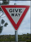
| highway | give_way | A "give way," or "Yield" sign | ||||
| emergency | phone | A calling device can be used to tell on your current position in case of an emergency. Use with ref=NUMBER_ON_THE_SIGN | ||||
| highway | ladder | A vertical or inclined set of steps or rungs intended for climbing or descending of a person with the help of hands. | ||||
| highway | milestone | Highway location marker | ||||
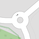
| highway | mini_roundabout | Similar to roundabouts, but at the center there is either a painted circle or a fully traversable island. In case of an untraversable center island, junction=roundabout should be used.
Rendered as anti-clockwise by default direction=anticlockwise. To render clockwise add the tag direction=clockwise. |
||||
| highway | motorway_junction | Indicates a junction (UK) or exit (US). ref=* should be set to the exit number or junction identifier. (Some roads – e.g., the A14 – also carry junction numbers, so the tag may be encountered elsewhere despite its name) | ||||
| highway | passing_place | The location of a passing space | ||||
| highway | platform | A platform at a bus stop or station. | ||||
| highway | rest_area | Place where drivers can leave the road to rest, but not refuel. | ||||
| highway | services | A service station to get food and eat something, often found at motorways | ||||
| highway | speed_camera | A fixed road-side or overhead speed camera. | ||||
| highway | speed_display | A dynamic electronic sign that displays the speed of the passer-by motorist. | ||||
| highway | stop | A stop sign | ||||
| highway | street_lamp | A street light, lamppost, street lamp, light standard, or lamp standard is a raised source of light on the edge of a road, which is turned on or lit at a certain time every night | ||||
| highway | toll_gantry | A toll gantry is a gantry suspended over a way, usually a motorway, as part of a system of electronic toll collection. For a toll booth with any kind of barrier or booth see: barrier=toll_booth | ||||
| highway | traffic_mirror | Mirror that reflects the traffic on one road when direct view is blocked. | ||||
| highway | traffic_signals | Lights that control the traffic | ||||
| highway | trailhead | Designated place to start on a trail or route | ||||
| highway | turning_circle | A turning circle is a rounded, widened area usually, but not necessarily, at the end of a road to facilitate easier turning of a vehicle. Also known as a cul de sac. | ||||
| highway | turning_loop | A widened area of a highway with a non-traversable island for turning around, often circular and at the end of a road. | ||||
| highway | User Defined | All commonly used values according to Taginfo | ||||
Transportation
| No. | Object Name | Object Type | Description | Key | Value | Rendering | Photo |
|---|---|---|---|---|---|---|---|
| 1. | Bridge (Jembatan) | A way (from bamboo, wood, brick, etc) across above a river (valley, edge, etc) | bridge | yes | |||
| 2. | Railway (Jalur Kereta Api) | Way specific for train | railway | rail | |||
| 3. | Tunnel (Terowongan) | Way inside/under ground or mountain and can be used for railway and transportation | tunnel | yes | |||
| 4. | Runway (Landasan Pacu Pesawat) | Way for takeoff and landing the plane | aeroway | runway | |||
| 5. | Cycle Way (Jalur Sepeda) | Way/Road specific for bicycle | highway | cycleway | |||
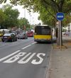
| 6. | Bus Way (Jalur Bus) | Restricted way that can only be accessed by bus | busway | lane |
Waters
| No. | Object Name | Object Type | Description | Key | Value | Rendering | Photo |
|---|---|---|---|---|---|---|---|
| 1. | River (Sungai besar) | Big natural waterway, usually more than 3 meters wide. | waterway | river | |||
| 2. | Stream (Sungai kecil) | Narrow stream of water, usually less than 3 meters wide. | waterway | stream | |||
| 3. | Tidal Channel | A natural intertidal waterway in mangroves, salt marshes and tidal flats with water flow in the direction of the tide. Distinguished from rivers due to the higher salt levels and because the flow of water away from the sea at high tide is equal to the flow of water towards the sea at low tide. | waterway | tidal_channel | |||
| 4. | Embankment (Tanggul) | Wall beside the river used to block/hold the water | man_made | embankment | |||
| 5. | Culvert (Gorong-Gorong) | Water tunnel on the surface or inside the ground | tunnel | culvert | |||
| 6. | Dam (Bendungan) | Solid and continues structure across a river, mainly used to divert, watch, and measure the water stream | waterway | dam | |||
| 7. | Coast Line (Garis Pantai) | A line that separated between land area and sea area | natural | coastline | |||
| 8. | Canal (Subak) | A man-made waterway used to carry useful water for transportation, hydro-power generation or irrigation purposes. The valueusage=irrigation can be used for a canal intended for agriculture.
|
waterway | canal |
Additional Attribute Information about LINE OBJECT
If you draw an object as a line object, you should add some additional information regarding the list of information below:
| No. | Information | Key | Value | Description |
|---|---|---|---|---|
| 1. | Road Direction | oneway |
|
Road direction information. If the road is a one-way road, user can give additional tag oneway=yes. For further information, see this link. |
| 2. | Layer (Tingkatan) | layer |
|
Layer information for line/road object. If the road is right above the ground level road, user can give additional tag layer=1 for the mapped road. If the road is right below the ground level road, user can give additional tag layer=-1 for the mapped road. For further information, see this link. |
| 3. | Road Lane | lanes | User Defined: the value is defined by user based on the information of the mapped object. | Lane information for road object. A road can have two or more lanes. Usually each lane separated by a dashed white line. For example, the mapped road is a three-lane road, user can give additional tag lanes=3 for that road. For further information, see this link. |
| 4. | Object Width | width | User Defined: the value is defined by user based on the information of the mapped object. | Width information for line/road object. This additional tag can be given to a road object or to another line object. For example, the width of the mapped road is 10 meters, user can give additional tag width=10 for that road. For further information, see this link. |
| 5. | Line Surface | surface |
|
Line surface information for the line/road object. For example, the mapped road has an asphalt surface, user can give additional tag surface=asphalt for that road. For further information, see this link. |
| 6. | Road Condition | smoothness |
|
Road condition describes the smoothness of the road and the type of vehicles that can pass the road without any damage. For example, the mapped road is in a quite good condition with some small potholes that usually found on main road, user can give additional tag smoothness=intermediate for that road. For further information, see this link. |


