JA:OsmAnd
| OsmAnd | ||||||||||||||||||||||||||||||||||||||||||||||||||||||||||||||||||||||||||||||||||||||||||||||||||||||||||||||||||||||||||||||||||||||||||||||||
|---|---|---|---|---|---|---|---|---|---|---|---|---|---|---|---|---|---|---|---|---|---|---|---|---|---|---|---|---|---|---|---|---|---|---|---|---|---|---|---|---|---|---|---|---|---|---|---|---|---|---|---|---|---|---|---|---|---|---|---|---|---|---|---|---|---|---|---|---|---|---|---|---|---|---|---|---|---|---|---|---|---|---|---|---|---|---|---|---|---|---|---|---|---|---|---|---|---|---|---|---|---|---|---|---|---|---|---|---|---|---|---|---|---|---|---|---|---|---|---|---|---|---|---|---|---|---|---|---|---|---|---|---|---|---|---|---|---|---|---|---|---|---|---|---|
 | ||||||||||||||||||||||||||||||||||||||||||||||||||||||||||||||||||||||||||||||||||||||||||||||||||||||||||||||||||||||||||||||||||||||||||||||||
| 作者: | Victor Shcherb and contributors | |||||||||||||||||||||||||||||||||||||||||||||||||||||||||||||||||||||||||||||||||||||||||||||||||||||||||||||||||||||||||||||||||||||||||||||||
| ライセンス: | GNU GPL v3 および artwork and design elements CC-BY-ND-NC (free or 24.99 €) | |||||||||||||||||||||||||||||||||||||||||||||||||||||||||||||||||||||||||||||||||||||||||||||||||||||||||||||||||||||||||||||||||||||||||||||||
| 動作環境: | Android および iOS | |||||||||||||||||||||||||||||||||||||||||||||||||||||||||||||||||||||||||||||||||||||||||||||||||||||||||||||||||||||||||||||||||||||||||||||||
| 版数: | 4.8.3 (2024-07-17) | |||||||||||||||||||||||||||||||||||||||||||||||||||||||||||||||||||||||||||||||||||||||||||||||||||||||||||||||||||||||||||||||||||||||||||||||
| 言語: | 英語、 ロシア語、 ドイツ語、 フランス語、 アラビア語、 ブルガリア語、 ボスニア語、 チェコ語、 デンマーク語、 スペイン語、 バスク語、 フィンランド語、 ヘブライ語、 ヒンディー語、 ハンガリー語、 アルメニア語、 インドネシア語、 イタリア語、 日本語、 ジョージア語、 韓国語、 イタリア語、 ラトビア語、 マラーティー語、 オランダ語、 ノルウェー語、 ポーランド語、 ポルトガル語、 Brazilian Portuguese、 ルーマニア語、 スロバキア語、 セルビア語、 スウェーデン語、 ウクライナ語、 ベトナム語 および 中国語
| |||||||||||||||||||||||||||||||||||||||||||||||||||||||||||||||||||||||||||||||||||||||||||||||||||||||||||||||||||||||||||||||||||||||||||||||
| ウェブサイト: | https://osmand.net | |||||||||||||||||||||||||||||||||||||||||||||||||||||||||||||||||||||||||||||||||||||||||||||||||||||||||||||||||||||||||||||||||||||||||||||||
| インストール: | ||||||||||||||||||||||||||||||||||||||||||||||||||||||||||||||||||||||||||||||||||||||||||||||||||||||||||||||||||||||||||||||||||||||||||||||||
| ソースコード: | osmandapp GitHub | |||||||||||||||||||||||||||||||||||||||||||||||||||||||||||||||||||||||||||||||||||||||||||||||||||||||||||||||||||||||||||||||||||||||||||||||
| プログラミング言語: | Java および C++ | |||||||||||||||||||||||||||||||||||||||||||||||||||||||||||||||||||||||||||||||||||||||||||||||||||||||||||||||||||||||||||||||||||||||||||||||
|
オフライン及びオンラインのナビゲーション、OSMとカスタムマップの表示(ベクターデータまたはタイル、オフライン、キャッシュ、オンライン)、POIと住所の検索(オフライン及びオンライン)、OSMのバグとPOIの登録、お気に入り、公共交通情報。積極的に開発中。 | ||||||||||||||||||||||||||||||||||||||||||||||||||||||||||||||||||||||||||||||||||||||||||||||||||||||||||||||||||||||||||||||||||||||||||||||||
| ||||||||||||||||||||||||||||||||||||||||||||||||||||||||||||||||||||||||||||||||||||||||||||||||||||||||||||||||||||||||||||||||||||||||||||||||
OsmAnd はAndroidとiOSの多くのスマートフォンやタブレットで動作するGPSナビゲーションと地図のアプリで、オフラインマップとターンバイターン方式によるナビゲーションが特徴です。OsmAndは、完全でユーザーが使いやすいモバイルGPSアプリを提供するために、100%フリーのOpenStreetMapのデータを組み込んだ共同のオープンソース(GPL)ソフトウェアプロジェクトです。高度なマッピング、ナビゲーション、ルート案内、POI、歴史的なトラッキング機能をサポートしています。洗練され信頼できるグローバルに展開されたソフトウェアで、AndroidとiOSをベースにした多くのスマートフォンやタブレット、Linuxベースのシステムで動作します。
頻繁にアップデートされる地図とPOIのデータを、通常は事前にダウンロードしてナビゲーション端末に保存します。その後の使用にインターネット接続は不要なので、通信料金が発生せず無制限に使用することができます。通信事業者の電波が弱かったり圏外であっても、安定してGPS機能を使用することができます。
OsmAndとOSMデータは、通常のGPS機能をの範囲を超えて拡張できます。Wikipediaやその他の情報源からの地理情報は、モバイルの地図上で見られるPOIとして統合されます。ベクターデータとポリゴンとして保存された詳細地図とPOIデータは、スタンドアローンで使用する一般的なGPS機器よりも充実しています。システム全体で、地図データとそれを操作し表示するためのソフトウェアはクラウドソーシング化されています。ユーザーは短時間・無償でOpenStreetMapのエラー修正、POIデータの充実、OsmAndソフトウェア不具合の報告、機能向上の提案ができます。モバイルGPSのアップデートに、OsmAndは迅速に対応します。
ダウンロードとインストール
ユーザーは、アップルストアやマーケットなどのソフトウェア提供者からOsmAndを入手し、自動でアップデートできます。
無償版
| 全世界 | F-Droid | 無料 |
| 全世界 | Google Play | 無料 |
| 全世界 | iTunes App Store | 無料 |
有償版
| 地域 | サービス | 価格 |
|---|---|---|
| 全世界 | F-Droid | 無料 |
| EU | Amazon (various) | € 19.99[1][2][3][4] |
| EU | Google Play | € 24.99 |
| JP | Google Play | ¥ 2,500 |
| JP | Amazon アプリストア | ¥ 3,300 |
| UK | Amazon Appstore for Android | £ 24.99 |
| USA | Google Play | $ 14.99 |
| USA | Amazon Digital Services | $19.99 |
含まれているサポート言語: アラビア語、中国語、チェコ語、オランダ語、英語、フランス語、ドイツ語、ギリシャ語、ヘブライ語、ヒンディー語、イタリア語、日本語、韓国語、ポーランド語、ポルトガル語、ロシア語、スペイン語、タガログ語、ベトナム語 (さらに増える可能性あり)
無償版のOsmAndには機能の制限があります。無償版を使用する場合は、support the projectから直接寄付ができます。
- OsmAnd: 最新の公開版です。地図のダウンロード上限が7件、POIのWikipediaデータが使用できないという2つの制限があります。
- OsmAnd+: 制限のない有償版で、F-Droid で管理されています。 (OsmAndクラウドによるデータバックアップを除く)
- Nightly Build (Android): 最新の開発版 (リンク先で"OsmAnd Nightly Build (Android)"を選択し、apkファイルをダウンロードして手動インストールしてください。開発版は不安定である可能性があり、自動でアップデートされません。)
OsmAndの他のバージョンやその他のプロジェクトは、OsmAndの公式ダウンロードページを参照してください。
OpenStreetMapの地図データとOsmAndアプリケーション
OpenStreetMap (map data and server side components) and OsmAnd (Android / Java software for mobile use and navigation) are two large, open projects, therefore support concerns need to be initially divided between OpenStreetMap "data" issues, and OsmAnd "software" issues. For instance, problems with the underlying map data (key and value omissions, way connection errors, inconsistencies, etc.) can cause OsmAnd to navigate inefficiently and miss the very best routes. Once the underlying map data is completely cleansed or fully complete OsmAnd software should produce expected results.
The OsmAnd rendered map data files are frequently updated, and each update typically has hundreds if not thousands of corrections and additions. Likewise, Points of Interest (POI) data in particular requires constant vigilance to remain relevant and accurate with numerous organizations moving, or going in or out of business each month. Supplying correcting map information to the OpenStreetMap organization is very easy. You can simply just report problems, and that by itself is very helpful. Or you can actually roll up your sleeves and edit the map data directly. After registering (a simple, two-minute process) you can use the free, very simple to use programs to edit the underlying data directly.
Please do your share of the hard work it is to keep the underlying OpenStreetMap data in pristine condition.
OsmAnd does not use the OpenStreetMap standard tile layer (also known as openstreetmap-carto) to generate its maps, so bugs related to maps rendered for OsmAnd do not belong there. OsmAnd uses its own tile render generation routines, generally defined in the OsmAnd-resources GitHub project.
OpenStreetMapのサポートとヘルプ (データ及びサーバー)
- FAQ Frequently Asked Questions.
- Wiki for more comprehensive documentation.
- Forum great for discussion and peer support. see also Help Desk.
- Help Desk great for brief, pointed Q&A not covered elsewhere.
- Mailing Lists extensive ongoing discussions. Broken down by country and topical area.
OsmAndのサポート
OsmAnd is a large software project with millions of users worldwide. Relatively few people actually do the work to provide virtually everyone with a great application, built upon great data. If you have a support issue and resolve it through a convoluted, time consuming process, please go back and help update the FAQ, the Wiki, the Forum pages, etc. and make the path from support question to satisfactory answer as straight as possible. Make it much easier for the next person with the same issue to get to the solution. Help the coders document and best express the program's features, and explain all the typical use-cases. If you have Java programming experience by all means refactor, streamline and better document the running code, add well tested new features, and take it upon yourself to tackle any open item on the Issue List.
High quality, timely support requires many hands to make light the lifting. Please pitch in and contribute to OSMand's on-going support needs in any way you can.
OsmAndユーザーのためのヘルプ
- The OsmAnd Home Page OsmAnd's official website. Information includes a feature overview, news blog and extensive, maintained help pages.
- The official OsmAnd wiki You will notice that this link redirects to the page you are reading. Years ago, other sites (such as Google Code) hosted wiki information, but as of 2015, all old wiki resources (Google Code, Github, etc.) point to this location.
- Google Groups Forum (Osmand) Great for peer support. This is also a great place to discuss bugs and feature requests.
OsmAndのプログラマーのためのヘルプ
- There are two, equally important OsmAnd code bases:
- Osmand-java A pure Java, maximum cross-platform library, which is not Android specific. No Android libraries are used here.
- Osmand The Android specific version. Use of various Android libraries, and the measured integration of constantly evolving Android GUI features are very much encouraged.
- Help and Technical Articles, whose source code is version controlled at GitHub.
- Application GitHub Issue Tracker admitted bugs & feature request tracker
機能
- ベクターOSM マップ(*.osm.pbf, *.obf) および多数のタイルマップ(Mapnik, Osmarender, Google Maps/Satellite/Terrain, CloudMade, Cyclemap, OpenPisteMap, MapSurfer.Net, Microsoft Maps/Earth/Hybrid)を表示
- POI、公共輸送機関乗り場、OSM bugs、お気に入り、GPXトラック 及びYandex traffic 向けのレイヤー
- オフラインマップ及びOsmAndMapCreatorで作成した住所インデックスを利用可
- オフラインインデックスまたはnominatimを利用した 住所/POI/位置 検索
- CloudMade または YOURSを利用したオンライン経路案内による、方向指示音声ガイド付きナビゲーション
- 速度に応じた自動ズーム
- 移動方向またはコンパスに基づくマップの自動回転
- 履歴とお気に入り
- 自動車/自転車/歩行者 プリセット
- POIの登録
OsmAnd is a map and navigation application with access to the free, worldwide, and high-quality OpenStreetMap data. All map data can be stored on your device's memory card for offline use. Via your device's GPS, OsmAnd offers routing, with visual and voice guidance, for car, bike, and pedestrian. All the main functionalities work both online and offline (no internet needed when navigating).
OsmAnd+ is the pay-version of the app. By buying OsmAnd+ you support the project and development of new features.
Some of the main features:
ナビゲーション
- Works online (fast) or offline (no roaming charges when you are abroad)
- Turn-by-turn voice guidance (recorded and synthesized voices using TalkBack)
- Optional lane and turn lane guidance (using
destination=*andturn:lanes=*), street name display, and estimated time of arrival - Supports intermediate points on your itinerary
- Automatic re-routing whenever you deviate from the route
- Search for places by address, by type (e.g.: restaurant, hotel, gas station, museum), by geographical coordinates, or along the route
- Mark road as impassable per session
地図表示
- Display your position and orientation on the map
- Optionally align the map according to compass or your direction of motion
- Save your most important places as Favorites
- Display POIs (point of interests) around you
- Can display online tile maps
- Can display satellite view (from Bing)
- Can display different overlays like touring/navigation GPX tracks and additional maps with customizable transparency
- Optionally display place names in English, local, or phonetic spelling
- Different mappaint styles
Wikipediaの強力な統合
- High quality information from the two best collaborative projects of the world: OpenStreetMap and Wikipedia.
- Great for touring, sightseeing, and historical backgrounding. Discover new information about the places right around you, or around your family, relatives, associates, etc., even abroad.
- Rapidly become locally acclimated.
- Great way to liven up long trips, learning about the numerous interesting places right along your route.
- Wikipedia server sites tag millions of places around the world with geo tags (latitude/longitude coordinates), these often include cities, towns, villages, historic places, museums, civic centers, etc.
- OsmAnd Plus (the low cost paid version) includes unlimited map downloads and unlimited downloads of condensed Wikipedia place data files, formatted for immediate use in OsmAnd plus map files as Points of Interest (POI)
- Wikipedia places (when downloaded and enabled in OsmAnd plus under Configure Map, POI, Wikipedia (offline)) show up on maps as unobtrusive circles with W inside.
- Briefly touch a W and get a one-line description of that Wikipedia place
- Touch a W a bit longer the name pops up inside a small gray box. Then, just:
- tap the red X to remove that pop up, or
- tap anywhere inside that gray box to bring up a new comprehensive menu. Select either:
- Show POI description This brings up several sentences, sourced from Wikipedia, describing the place. An Internet connection is NOT required, and no data charges will ever accrue.
- Show POI Website this option will take you (via the browser of your choice) directly to the relevant Wikipedia article page. (An Internet connection is required, and your provider may charge you their data transport fees.)
- It's very easy to set the selected POI location as a destination, get directions, save to a favorite for use later, etc.
- Wikipedia places are constantly being updated. Coverage in many areas is outstanding.
- Wikipedia POI files (places) are currently available by Wikipedia site language and not limited by geographic region.
- For example the English Wikipedia file includes places found in the English language Wikipedia servers, including USA, UK, Canada, much of English speaking EU, etc. It also includes coverage of non-English speaking places to the extent they are included in the English language Wikipedia site. (For example the English language Wikipedia covers Paris, Hong Kong, Berlin and many other places throughout the world, discussing those places in English.)
- Wikipedia files can be quite large. The English Wikipedia file is about 300 MB to download and expands to about 1 GB when decompressed.
- These files (and all the OsmAnd map files) may typically be run from your main, or SD memory storage, or from an auxiliary (add-on) memory card (provided your device has a slot for one and most do), even if you do not have root access to your Android operating system. Where the files are stored is easily configured via a menu option, and the software will effortlessly move any existing downloaded files to a new location you choose.
安全のための機能
- Optional automated day/night view switching
- Optional speed limit display, with reminder if you exceed it
- Optional speed-dependent map zooming
- Share your location so that your friends can find you
自転車と歩行者のための機能
- The maps include foot, hiking, and bike paths, great for outdoor activities
- Special routing and display modes for bike and pedestrian
- Optional public transport stops (bus, tram, train) including line names
- Optional trip recording to local GPX file or online service
- Optional speed and altitude display
- Display of contour lines and hill-shading (via additional plugin)
Elevation data is not (yet) used for routing but may be considered when using an external routing engine such as BRouter
OpenStreetMapへの貢献
- Report map bugs
- Upload GPX tracks to OSM directly from the app
- Add POIs and directly upload them to OSM (or later if offline)
- Optional trip recording also in background mode (while device is in sleep mode)
OsmAnd is open source and actively being developed. Everyone can contribute to the application by reporting bugs, improving translations, or coding new features. The project is in a lively state of continuous improvement by all these forms of developer and user interaction. The project progress also relies on financial contributions to fund the development, coding, and testing of new functionalities. By buying OsmAnd+ you help the application to be even more awesome! It is also possible to fund specific new features, or to make a general donation on osmand.net.
利点と欠点
利点
- Open Source (GNU GPL Version 3), although some features are not free and visual elements are CC BY-NC-ND 2.0[5]
- Possibility to use and edit maps completely offline and no time use limitations, like google maps for example
- Store for offline use vector maps and raster satellite images from various sources
- No ads, except one suggesting to buy paid version in configuration to get some paid features
- No trackers, although it has some analytics off by default, the user has the option to share with developers: only downloaded maps and screens visited. No location and position data is ever shared.
- No abusive permission requests, only ask permissions to use the related resource like: GPS location to use it, storage access to save maps, internet access to download maps, camera access to take photos, audio access to record audio...
- Very good customizable options shown during navigation like lanes, radar, max speed...
- Shows Wikimedia Commons and Mapillary images in POIs (only online)
- Can store offline maps and other data in SD card in Android version[6]
- In POI details: quick phone call with just 2 taps, search nearby similar POIs, email and HTTP links, copy coordinates in 7 formats
- Also available in Android Go, an Android version for low resource devices, although the vector maps view is slow
- Save photo, video and audio notes[7]
- Add quickly a POI with certain configured tags (fixed tags and fixed values or fixed tag and values prompt to enter data)[8]
- Quick and simple upload changes to OpenStreetMap (POIs, notes and tracks)
欠点
- No live traffic data
- No 3D view
- Limited voice instructions in embedded pre-recorded voices, but synthesized TTS (text to speech) voices can be used and are better maintained[9]
- Very confusing options and configurations although it has a "clean" main screen interface
- Slow in some older smartphones
- Limited support to areas (can edit only tags in some areas) and relations (only shows route relations associated to POIs)
- A bit limited in some edits to upload to OpenStreetMap like: no tag presets, no edits in way tags
- Doesn't support radar relations, only radar POIs/nodes, but is a planned feature
- No version available in Android Auto, but will be available in near future
- Limited in very long routes in offline app calculation, like 200km or more, although possible with Third-party routing (BRouter) [10]
- Always shows the best route according to configuration like avoid tolls, unpaved roads, but not alternative routes
OsmAndのオフラインベクター地図データに関する高度な情報
- offline map data files that can be used with OsmAnd have *.obf as file extension.
- in latest versions of these map files all vector map data, POIs and address indexes for offline search are included.
- you can generate your own *.obf files by using OsmAndMapCreator.
- when you have several *.obf files for single regions of a certain country, you can combine them with inspector.bat or inspector.sh that is delivered with OsmAndMapCreator. Start this script on a command line without any parameters to see all options and proceed.
- Maybe there is a named street in the OSM data, but OsmAnd cannot find it via its offline address search? Run the above mentioned inspector with parameter -v and [nameofyourmapfile].obf >list.txt ... this will give you a text file with all places that are within that obf file and all streets that are associated to that place. Thus you can find out whether OsmAnd's street list is incomplete (this can have several reasons like missing administrative borders etc.).
OsmAndでサポートされるOSMのPOIカテゴリの例
- OpenStreetMapのPOIカテゴリがOsmAndでレンダリングされる、または検索可能であることがわかっている場合は、対応するキーやタグのページを示す必要があります。
- food(飲食) (bar, bbq, biergarten, cafe, drinking_water, fast_food, food_court, pub, restaurant)
- education(教育) (college, kindergarten, library, school, university)
- emergency(緊急設備) (access_point, ambulance_station, fire_extinguisher, fire_flapper, fire_hose, fire_hydrant, fire_station, phone, police, ses_station, siren)
- transportation(交通機関) (bicycle_parking, bicycle_rental, bus_station, car_rental, car_sharing, car_wash, ferry_terminal, fuel, grit_bin, parking, taxi)
- finance(金融機関) (atm, bank, bureau_de_change)
- healthcare(健康) (baby_batch, dentist, doctors, first_aid, hospital, pharmacy, veterinary)
- entertainment(エンタメ) (architect_office, arts_centre, brothel, cinema, community_center, fountain, nightclub, sauna, stipclub, studio, theatre)
- tourism(観光) (alpine_hut, artwork, attraction, camp_site, caravan_site, chalet, guest_house, hostel, hotel, information, motel, museum, picnic_site, theme_park, viewpoint, zoo)
- historic(歴史) (archaeological_site, battlefield, boundary_stone, castle, fort, memorial, monument, ruins, wayside_cross, wayside_shrine, wreck)
- natural(自然) (bay, beach, cave_entrance, cliff, coastline, fell, glacier, heath, land, marsh, mud, peak, sand, scree, scrub, spring, stone, tree, volcano, water, wetland)
- shop(買い物) (alcohol, bakery, beauty, beverages, bicycle, books, boutique, butcher, car, car_repair, charity, chemist, clothes, computer, confectionery, deli, department_store, doityourself, dry_cleaning, electronics, fabrics, farm, florist, funeral_directors, furniture, garden_centre, general, gift, glaziery, greengrocer, hairdresser, hardware, hearing_aids, hifi, ice_cream, jewelry, kiosk, laundry, mall, massage, money_lender, motorcycle, newsagent, optician, organic, outdoor, pawnbroker, second_hand, shoes, sports, stationery, supermarket, tattoo, toys, travel_agency, variety_store, video)
- leisure(レジャー)(common, dance, dog_park, fishing, garden, golf_course, ice_rink, nature_reserve, marina, miniature_golf, park, pitch, playground, sports_centre, slipway, stadium, track, water_park)
- sport(スポーツ) (10pin, archery, athletics, australian_football, baseball, basketball, beachvolleyball, boules, bowls, canoe, chess, climbing, cricket, cricket_nets, croquet, cycling, diving, dog_racing, equestrian, football, golf, gymnastics, hockey, horse_racing, ice_stock, korfball, motor, multi, orienteering, paddle_tennis, paragliding, pelota, racquet, rowing, rugby, shooting, skateboard, skating, skiing, soccer, swimming, table_tennis, team_handball, tennis, toboggan, volleyball)
- other(その他) (bench, clock, courthouse, crematorium, embassy, emergency_phone, fire_hydrant, fire_station, grave_yard, hunting_stand, internet_access, marketplace, place_of_worship, police, post_box, post_office, prison, public_building, recycling, shelter, telephone, toilets, townhall, vending_machine, waste_basket, waste_disposal)
OsmAnd経由でのOSMへの貢献
OsmAnd supports directly contributing to the OSM database, both online and offline. Corrections are either uploaded to the OSM database instantly, or in offline mode, must be manually uploaded later.
First, you will need to register with OSM.
Then, in OsmAnd go to Menu > Plugins and activate OSM Editing plugin.
Finally, go to Menu > Plugins > OSM editing > Settings and enter your account data (OSM user name and password).
POIの追加
- Tap (long tap) on a location on the map you want the POI to appear.
- Tap on "Actions".
- Select "Create POI".
- Select a POI type.
- Type in the information in each of the fields.
- To add more advanced tags:
- Select "Advanced Mode".
- Select "Add Tag".
- Type "A" in the tag box. You can't see the whole field, so you just have to remember what spot each value is in.
- Type the value in.
- Finally tap "Save".
- You can select your added POI now and tap "Upload" to directly send the POI to OSM.
If you want to add more than one POI and upload afterwards, this is also possible. Add the POIs you want to the map and not upload them directly. To upload all POIs you have create, tap on Menu > My Places. Switch to the tab "OSM Edits". Here you can select all POIs you want to send to OSM and upload them.
ポリゴンの編集
[this section is empty or needs expanding]
See issue 5595.
GPXトラックの記録と登録
- Go to Menu > Plugins and activate the Trip recording plugin.
- Go to the map and tap the button labeled REC in the top-right corner of the screen, next to the button with the satellite dish. This will start recording your trip.
- When you have finished your trip, tap the button again to stop recording.
- Go to Menu > My Places > Tracks.
- Find the recorded track, and tap on it to get its menu and tap on Options (3 dots on right hand side)
- Select Upload to OpenStreetMap
- Edit details if required and tap Upload
スクリーンショット
- OsmAnd for Android
-
 メインメニュー
 -
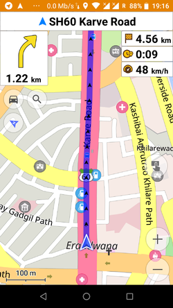 自動車向けナビゲーション
 -
 陰影起伏図レイヤーの表示
 -
 オフラインマップのダウンロード
 -
 ルートの詳細
 -
 POIの作成・編集(オフライン)
 -
 カテゴリー検索 (オフライン;住所や名前による検索にも対応)
 -
 周辺のPOIと営業時間
 -
 検索履歴
検索履歴 -
 OpenRailwayMap のオーバーレイによる鉄道信号表示
 -
 OSMバグの確認と編集


- OsmAnd for iOS
-
 2D地図表示
 -
 3D地図表示
 -
 検索結果
検索結果


OsmAndのカスタマイズ
自作地図の作成
See the help topic Creating own maps and OsmAndMapCreator and OsmAndMapCreator
地図表示スタイルのカスタマイズ
OsmAnd already contains a number of specialized Map styles, from the map screen check them out by tapping the menu button, select "Configure Map", then "Map Style", examples are the "Touring view" map style allowing some advanced options for options for hiking and bike tours, or the "Winter and ski" map style for skiing trips.
You may also define your own map style. This is a bit involved, please check out our forum, our HowTo pages, and start from the default rendering template. Edit the file as you wish, rename it XXX.render.xml and place it on your device under /sdcard/osmand/rendering. Then in OsmAnd select XXX under "Map style".
ルート案内パラメーターのカスタマイズ
Just as with rendering, it is possible to change the parameters used by the routing engine. This can be done by editing routing.xml and placing it next to the maps. This is all documented in the original routing.xml.
OsmAnd地図のデスクトップビューワー
An early version of a Desktop viewer for OsmAnd maps can be downloaded from Sourceforge: https://sourceforge.net/p/offroadosm/wiki/Home/
参照
- ↑ OsmAnd+ page in Amazon Spain
- ↑ OsmAnd+ page in Amazon Germany
- ↑ OsmAnd+ page in Amazon France
- ↑ OsmAnd+ page in Amazon Italy
- ↑ OsmAnd source code
- ↑ How to move OsmAnd's home (maps) folder to the external SD card? (for Android version only)
- ↑ Audio/video notes plugin
- ↑ Quick Action Button
- ↑ What is the difference between TTS (text to speech) and recorded voices?
- ↑ How to calculate routes longer than 250km?
情報源と外部リンク
- OsmAnd Home Page
- OsmAnd Webmap Viewer
- OsmAnd Google Groups Forum
- Issue Tracker
- Source code
- OsmAnd Local Indexes List: Links to .obf maps for download
- Using Osmand on the road: blog post about setting up Osmand on your smartphone
- Bicycle GPS project
- BBBike.org extract service offers OsmAnd maps for an area of your choosing, weekly updates