User:Mwesch/BikeManhattanKosmosRules
Jump to navigation
Jump to search
Introduction
This page contains a set of Kosmos rendering rules for a map that is color-coded to display bike-ability of various ways, roads, and paths by using the Class:bicycle tagging guidelines used in the velomap project.
Options
| Option | Value | Comment |
|---|---|---|
| MinKosmosVersion | 2.1 | Minimal version of Kosmos needed to use these rules |
| LandBackgroundColor | #FFFFFF | |
| SeaColor | #B5D6F1 |
Land Areas
| Rule Name | Targets | Selector | Template | Options | Comment |
|---|---|---|---|---|---|
| University | amenity=university | Polygon (Color=#DEDEFF) | |||
| Park | leisure=park | Polygon (Color=#C7F1A3) Text (MinZoom=14, Color=black, TagToUse=name, FontName=Trebuchet MS, FontStyle=bold, FontSize=14:9;15:12;18:12, TextMode=AreaCenter, OutlineColor=white) | |||
| Coastline | natural=coastline | Polyline (MinZoom=1, Color=#8BCCE5, Width=11:1;17:5, Curved=true) | |||
| Wood | natural=wood | Polygon (Color=#99DB9C) | |||
| Scrub | natural=scrub | Polygon (Color=#99EE9C) | |||
| Fell | natural=fell | Polygon (Color=#CDDB69) | |||
| Farm | landuse=farm | Polygon (Color=#EFDD8B) | |||
| Residential | landuse=residential | Polygon (Color=#DCDCDC) | |||
| Industrial | landuse=industrial | Polygon (Color=#FEADB8) | |||
| Commercial | landuse=commercial | Polygon (Color=#FFAAFF) | |||
| Retail | landuse=retail | Polygon (Color=#FFAAFF) | |||
| Reservoir | landuse=reservoir | Polygon (Color=#007788) | |||
| SwimmingPool | leisure=swimming_pool | Polygon (Color=#99FFFF) Text (MinZoom=17, Color=black, TagToUse=sport, FontName=Trebuchet MS, FontStyle=bold, FontSize=16:8;18:10, TextMode=AreaCenter, OutlineColor=white) | |||
| Basin | landuse=basin | Polygon (Color=#B5D0D0) | |||
| Forest | landuse=forest | Polygon (Color=#CFECA8) | |||
| Cemetery | landuse=cemetery | Polygon (Color=#75ac7d, BackgroundColor=#BBDDBB, HatchStyle=DashedVertical) Text (MinZoom=14, Color=black, TagToUse=name, FontName=Trebuchet MS, FontStyle=bold, FontSize=14:9;15:11;18:12, TextMode=AreaCenter, OutlineColor=white) | |||
| Allotments | landuse=allotments | Polygon (Color=#C8B084) | |||
| School | amenity=school | Polygon (Color=#CCCC99) Text (MinZoom=15, Color=black, TagToUse=name, FontName=Trebuchet MS, FontStyle=bold, FontSize=15:10;18:11, TextMode=AreaCenter, OutlineColor=white) | |||
| Skiing | sport=skiing | Polygon (Color=#CDDB69) | |||
| HorseRacing | sport=horse_racing | Polygon (Color=peru) | |||
| Tennis | sport=tennis | Polygon (Color=#99FF00) Text (MinZoom=17, Color=black, TagToUse=sport, FontName=Trebuchet MS, FontStyle=bold, FontSize=16:8;18:10, TextMode=AreaCenter, OutlineColor=white) | |||
| Baseball | sport=baseball | Polygon (Color=#006600) Text (MinZoom=17, Color=black, TagToUse=sport, FontName=Trebuchet MS, FontStyle=bold, FontSize=16:8;18:10, TextMode=AreaCenter, OutlineColor=white) | |||
| Basketball | sport=basketball | Polygon (Color=#EECC99) Text (MinZoom=17, Color=black, TagToUse=sport, FontName=Trebuchet MS, FontStyle=bold, FontSize=16:8;18:10, TextMode=AreaCenter, OutlineColor=white) | |||
| Pitch | leisure=pitch | Polygon (Color=#8AD2AE) | |||
| GolfCourse | leisure=golf_course | Polygon (Color=#7CCC7C) Text (MinZoom=13, Color=black, TagToUse=name, FontName=Trebuchet MS, FontStyle=bold, FontSize=13:9;15:10;18:24, TextMode=AreaCenter, OutlineColor=white) | |||
| Common | leisure=common | Polygon (Color=#CFECA8) | |||
| ParkingArea | amenity=parking | Polygon (Color=#CCCCCC) |
Water Features
| Rule Name | Targets | Selector | Template | Options | Comment |
|---|---|---|---|---|---|
| Water | natural=water | Polygon (Color=#007788) | |||
| Marsh | natural=marsh | Polygon (Color=#007788, BackgroundColor=#00000000, BorderColor=blue, BorderWidth=1:1;12:1;15:3, HatchStyle=DashedHorizontal) | |||
| River | waterway=river | Polyline (MinZoom=5, Color=#bde1de, Width=5:2;12:2;14:4;17:8, Curved=true, BorderColor=#3066FF00, BorderWidth=300%) | |||
| Drain | waterway=drain | Polyline (MinZoom=13, Color=#007788, Width=13:1;17:2, Curved=true) | |||
| Stream | waterway=stream | Polyline (MinZoom=13, Color=#007788, Width=13:1;17:2, Curved=true) | |||
| Canal | waterway=canal | Polyline (MinZoom=5, Color=#007788, Width=5:1;10:1;17:2, Curved=true) | |||
| Riverbank | waterway=riverbank | Polygon (Color=#007788) | |||
| Land | natural=land | Polygon (Color=white) |
Other Land Features
| Rule Name | Targets | Selector | Template | Options | Comment |
|---|---|---|---|---|---|
| Contours | ele=* | for elevation contours generated by Srtm2Osm | |||
| .Major | ValueNum(e,"ele") % 100 = 0 | Polyline (MinZoom=11, Color=#B0AD8852, Width=11:1;12:2, Curved=true) | Major contours (100m ones) | ||
| .* | Polyline (MinZoom=12, Color=#B0AD8852, Width=1, Curved=true) | all other contours |
Highways
| Rule Name | Targets | Selector | Template | Options | Comment
|
|---|---|---|---|---|---|
| HighwaySteps | highway=steps | Polyline (MinZoom=13, Color=#FFDE93, DashStyle=Dot, Width=13:1;17:6) | EliminateSeams | ||
| HighwayBridleway | highway=bridleway | Polyline (MinZoom=13, Color=#DDDDDD, Width=13:1;17:6) | EliminateSeams | ||
| HighwayBridlewayText | highway=bridleway | Text (MinZoom=15, Color=black, TagToUse=name, FontName=Arial, FontStyle=regular, FontSize=15:6;17:9) | |||
| HighwayUnpaved | highway=unpaved | Polyline (MinZoom=11, Color=#E2E2E2, Width=11:1;14:3;17:10) | EliminateSeams | ||
| HighwayUnpavedText | highway=unpaved | Text (MinZoom=15, Color=black, TagToUse=name, FontName=Arial, FontStyle=regular, FontSize=15:6;17:9) | |||
| HighwayUnsurfaced | highway=unsurfaced | Polyline (MinZoom=11, Color=#E2E2E2, Width=11:1;14:3;17:10) | EliminateSeams | deprecated | |
| HighwayUnclassified | highway=unclassified | Polyline (MinZoom=11, Color=white, Width=11:1;13:1;17:10) | EliminateSeams | ||
| HighwayUnclassifiedText | highway=unclassified | Text (MinZoom=16, Color=black, TagToUse=name, FontName=Arial, FontStyle=regular, FontSize=15:6;17:9) | |||
| HighwayPedestrianPriority | highway=living_street | Polyline (MinZoom=11, Color=white, Width=11:1;13:1;17:10) | EliminateSeams | ||
| HighwayPedestrianPriorityText | highway=living_street | Text (MinZoom=15, Color=black, TagToUse=name, FontName=Arial, FontStyle=regular, FontSize=15:6;17:9) | |||
| HighwayService | highway=service | Polyline (MinZoom=12, Color=#BBBBBB, Width=13:1;18:8) | EliminateSeams | ||
| HighwayServiceText | highway=service | Text (MinZoom=15, Color=black, TagToUse=name, FontName=Arial, FontStyle=regular, FontSize=15:5;17:9) | |||
| HighwayMinor | highway=minor | Polyline (MinZoom=12, Color=white, Width=12:1;13:2;17:13) | EliminateSeams | ||
| HighwayMinorText | highway=minor | Text (MinZoom=15, Color=black, TagToUse=name, FontName=Arial, FontStyle=regular, FontSize=15:5;17:8) | |||
| HighwayTrack | highway=track | Polyline (MinZoom=11, Color=#CCBB77, Width=11:1;14:2;17:5) | EliminateSeams | ||
| HighwayPedestrian | highway=pedestrian | Polyline (MinZoom=13, Color=#009900, Width=14:3;17:14) | EliminateSeams | ||
| HighwayPedestrianArea | highway=pedestrian area=yes | Polygon (MinZoom=13, Color=lightgray, BorderWidth=1) Text (MinZoom=15, Color=black, TagToUse=name, FontName=Arial, FontStyle=regular, FontSize=15:6;17:9, TextMode=AreaCenter) |
EliminateSeams | ||
| HighwayUnclassifiedArea | highway=unclassified area=yes | Polygon (MinZoom=13, Color=white, BorderWidth=1) Text (MinZoom=15, Color=black, TagToUse=name, FontName=Arial, FontStyle=regular, FontSize=15:6;17:9, TextMode=AreaCenter) |
EliminateSeams | ||
| HighwayResidentialArea | highway=residential area=yes | Polygon (MinZoom=13, Color=white, BorderWidth=1) Text (MinZoom=15, Color=black, TagToUse=name, FontName=Arial, FontStyle=regular, FontSize=15:6;17:9, TextMode=AreaCenter) |
EliminateSeams | ||
| HighwayPedestrianText | highway=pedestrian | Text (MinZoom=15, Color=black, TagToUse=name, FontName=Arial, FontStyle=regular, FontSize=15:6;17:9) | |||
| HighwayResidential | highway=residential | EliminateSeams | |||
| .bikeability | class:bicycle=3 | Polyline (MinZoom=11, Color=#006600, BorderColor=gray, Width=11:1;13:1;17:10) | |||
| .bikeability | class:bicycle=2 | Polyline (MinZoom=11, Color=#00CC00, BorderColor=gray, Width=11:1;13:1;17:10) | |||
| .bikeability | class:bicycle=1 | Polyline (MinZoom=11, Color=#99FF00, BorderColor=gray, Width=11:1;13:1;17:10) | |||
| .bikeability | class:bicycle=0 | Polyline (MinZoom=11, Color=#FFFF00, BorderColor=gray, Width=11:1;13:1;17:10) | |||
| .bikeability | class:bicycle=-1 | Polyline (MinZoom=11, Color=#FF9900, BorderColor=gray, Width=11:1;13:1;17:10) | |||
| .bikeability | class:bicycle=-2 | Polyline (MinZoom=11, Color=#FF0000, BorderColor=gray, Width=11:1;13:1;17:10) | |||
| .bikeability | class:bicycle=-3 | Polyline (MinZoom=11, Color=#CC0000, BorderColor=gray, Width=11:1;13:1;17:10) | |||
| .* | Polyline (MinZoom=11, Color=#CC00CC, BorderColor=gray, Width=11:1;13:1;17:10) | ||||
| HighwayResidentialText | highway=residential | ||||
| .oneway | oneway=yes | Text (MinZoom=16, Color=black, TagToUse=name, FontName=Arial, FontStyle=bold, FontSize=17:9;18:12) | |||
| .* | Text (MinZoom=15, Color=black, TagToUse=name, FontName=Arial, FontStyle=bold, FontSize=15:6;17:9, OutlineColor=#FFFFFF, OutlineWidth=30%) | ||||
| HighwayTertiary | highway=tertiary | EliminateSeams | |||
| .Bridge | bridge=yes | Polyline (MinZoom=10, Width=10:1;13:2;17:11, BorderColor=black, BorderWidth=30%) | |||
| .BikeLane | cycleway=lane | Polyline (MinZoom=10, Color=#FF9900, Width=10:1;13:2;17:11, BorderColor=#99FF00, BorderWidth=50%) | |||
| .bikeability | class:bicycle=3 | Polyline (MinZoom=10, Color=#006600, Width=10:1;13:2;17:11, BorderColor=gray) | |||
| .bikeability | class:bicycle=2 | Polyline (MinZoom=10, Color=#00CC00, Width=10:1;13:2;17:11, BorderColor=gray) | |||
| .bikeability | class:bicycle=1 | Polyline (MinZoom=10, Color=#99FF00, Width=10:1;13:2;17:11, BorderColor=gray) | |||
| .bikeability | class:bicycle=0 | Polyline (MinZoom=10, Color=#FFFF00, Width=10:1;13:2;17:11, BorderColor=gray) | |||
| .bikeability | class:bicycle=-1 | Polyline (MinZoom=10, Color=#FF9900, Width=10:1;13:2;17:11, BorderColor=gray) | |||
| .bikeability | class:bicycle=-2 | Polyline (MinZoom=10, Color=#FF0000, Width=10:1;13:2;17:11, BorderColor=gray) | |||
| .bikeability | class:bicycle=-3 | Polyline (MinZoom=10, Color=#CC0000, Width=10:1;13:2;17:11, BorderColor=gray) | |||
| .* | Polyline (MinZoom=10, Color=#FF0000, Width=10:1;13:2;17:11, BorderColor=gray) | ||||
| HighwayTertiaryText | highway=tertiary | ||||
| .oneway | oneway=yes | Text (MinZoom=17, Color=black, TagToUse=name, FontName=Arial, FontStyle=bold, FontSize=17:9;18:12) | |||
| .* | Text (MinZoom=14, Color=#FFFFFF, TagToUse=name, FontName=Arial, FontStyle=bold, FontSize=14:6;17:9, OutlineColor=#FFFFFF) | ||||
| HighwaySecondary | highway=secondary | EliminateSeams | |||
| .Bridge | bridge=yes | Polyline (MinZoom=8, Color=#FF0000, Width=8:1;13:4;17:11, Bordercolor=black, BorderWidth=20%) | |||
| .bikeability | class:bicycle=3 | Polyline (MinZoom=8, Color=#006600, Width=8:1;13:4;17:11, BorderColor=gray) | |||
| .bikeability | class:bicycle=2 | Polyline (MinZoom=8, Color=#00CC00, Width=8:1;13:4;17:11, BorderColor=gray) | |||
| .bikeability | class:bicycle=1 | Polyline (MinZoom=8, Color=#99FF00, Width=8:1;13:4;17:11, BorderColor=gray) | |||
| .bikeability | class:bicycle=0 | Polyline (MinZoom=8, Color=#FFFF00, Width=8:1;13:4;17:11, BorderColor=gray) | |||
| .bikeability | class:bicycle=-1 | Polyline (MinZoom=8, Color=#FF9900, Width=8:1;13:4;17:11, BorderColor=gray) | |||
| .bikeability | class:bicycle=-2 | Polyline (MinZoom=8, Color=#FF0000, Width=8:1;13:4;17:11, BorderColor=gray) | |||
| .bikeability | class:bicycle=-3 | Polyline (MinZoom=8, Color=#CC0000, Width=8:1;13:4;17:11, BorderColor=gray) | |||
| .* | Polyline (MinZoom=8, Color=#FF0000, Width=8:1;13:4;17:11, BorderColor=gray) | ||||
| HighwaySecondaryText | highway=secondary | ||||
| .oneway | oneway=yes | Text (MinZoom=16, Color=black, TagToUse=name, FontName=Arial, FontStyle=bold, FontSize=17:9;18:12) | |||
| .* | Text (MinZoom=14, Color=#FFFFFF, TagToUse=name, FontName=Arial, FontStyle=bold, FontSize=14:6;17:10, OutlineColor=#000000) | ||||
| HighwayPrimary | highway=primary | EliminateSeams | |||
| .Bridge | bridge=yes | Polyline (MinZoom=8, Color=#FF0000, Width=8:1;13:4;17:12, BorderColor=#666666, BorderWidth=30%) | |||
| .bikeability | class:bicycle=3 | Polyline (MinZoom=8, Color=#006600, Width=8:1;13:4;17:12, BorderColor=gray) | |||
| .bikeability | class:bicycle=2 | Polyline (MinZoom=8, Color=#00CC00, Width=8:1;13:4;17:12, BorderColor=gray) | |||
| .bikeability | class:bicycle=1 | Polyline (MinZoom=8, Color=#99FF00, Width=8:1;13:4;17:12, BorderColor=gray) | |||
| .bikeability | class:bicycle=0 | Polyline (MinZoom=8, Color=#FFFF00, Width=8:1;13:4;17:12, BorderColor=gray) | |||
| .bikeability | class:bicycle=-1 | Polyline (MinZoom=8, Color=#FF9900, Width=8:1;13:4;17:12, BorderColor=gray) | |||
| .bikeability | class:bicycle=-2 | Polyline (MinZoom=8, Color=#FF0000, Width=8:1;13:4;17:12, BorderColor=gray) | |||
| .bikeability | class:bicycle=-3 | Polyline (MinZoom=8, Color=#CC0000, Width=8:1;13:4;17:12, BorderColor=gray) | |||
| .* | Polyline (MinZoom=8, Color=#FF0000, Width=8:1;13:4;17:12, BorderColor=gray) | ||||
| HighwayPrimaryLink | highway=primary_link | EliminateSeams | |||
| .Bridge | bridge=yes | Polyline (MinZoom=8, Width=8:1;13:4;17:12, BorderColor=gray, BorderWidth=30%) | |||
| .bikeability | class:bicycle=3 | Polyline (MinZoom=8, Color=#006600, Width=8:1;13:4;17:12, BorderColor=gray) | |||
| .bikeability | class:bicycle=2 | Polyline (MinZoom=8, Color=#00CC00, Width=8:1;13:4;17:12, BorderColor=gray) | |||
| .bikeability | class:bicycle=1 | Polyline (MinZoom=8, Color=#99FF00, Width=8:1;13:4;17:12, BorderColor=gray) | |||
| .bikeability | class:bicycle=0 | Polyline (MinZoom=8, Color=#FFFF00, Width=8:1;13:4;17:12, BorderColor=gray) | |||
| .bikeability | class:bicycle=-1 | Polyline (MinZoom=8, Color=#FF9900, Width=8:1;13:4;17:12, BorderColor=gray) | |||
| .bikeability | class:bicycle=-2 | Polyline (MinZoom=8, Color=#FF0000, Width=8:1;13:4;17:12, BorderColor=gray) | |||
| .bikeability | class:bicycle=-3 | Polyline (MinZoom=8, Color=#CC0000, Width=8:1;13:4;17:12, BorderColor=gray) | |||
| .* | Polyline (MinZoom=8, Color=#FF0000, Width=8:1;13:4;17:12, BorderColor=gray) | ||||
| HighwaySecondaryLink | highway=secondary_link | EliminateSeams | |||
| .Bridge | bridge=yes | Polyline (MinZoom=10, Width=10:1;13:2;17:11, BorderColor=black, BorderWidth=30%) | |||
| .BikeLane | cycleway=lane | Polyline (MinZoom=10, Color=#FF9900, Width=10:1;13:2;17:11, BorderColor=#99FF00, BorderWidth=50%) | |||
| .bikeability | class:bicycle=3 | Polyline (MinZoom=10, Color=#006600, Width=10:1;13:2;17:11, BorderColor=gray) | |||
| .bikeability | class:bicycle=2 | Polyline (MinZoom=10, Color=#00CC00, Width=10:1;13:2;17:11, BorderColor=gray) | |||
| .bikeability | class:bicycle=1 | Polyline (MinZoom=10, Color=#99FF00, Width=10:1;13:2;17:11, BorderColor=gray) | |||
| .bikeability | class:bicycle=0 | Polyline (MinZoom=10, Color=#FFFF00, Width=10:1;13:2;17:11, BorderColor=gray) | |||
| .bikeability | class:bicycle=-1 | Polyline (MinZoom=10, Color=#FF9900, Width=10:1;13:2;17:11, BorderColor=gray) | |||
| .bikeability | class:bicycle=-2 | Polyline (MinZoom=10, Color=#FF0000, Width=10:1;13:2;17:11, BorderColor=gray) | |||
| .bikeability | class:bicycle=-3 | Polyline (MinZoom=10, Color=#CC0000, Width=10:1;13:2;17:11, BorderColor=gray) | |||
| .* | Polyline (MinZoom=10, Color=#FF0000, Width=10:1;13:2;17:11, BorderColor=gray) | ||||
| HighwayTrunk | highway=trunk | Polyline (MinZoom=6, Color=#41A317, Width=6:1;17:14) | EliminateSeams | ||
| HighwayTrunkLink | highway=trunk_link | Polyline (MinZoom=6, Color=#41A317, Width=6:1;17:14) | EliminateSeams | ||
| HighwayMotorway | highway=motorway | EliminateSeams | |||
| .Bridge | bridge=yes | Polyline (MinZoom=6, Color=#809BC0, Width=6:1;17:14, BorderWidth=30%) | |||
| .* | Polyline (MinZoom=6, Color=#809BC0, Width=6:1;17:14) | ||||
| HighwayMotorwayLink | highway=motorway_link | Polyline (MinZoom=6, Color=#809BC0, Width=6:1;17:8) | EliminateSeams | ||
| HighwayCycleWay | highway=cycleway | Polyline (MinZoom=7, Color=#00CC00, Width=7:1;13:2;17:8, Curved=true) | EliminateSeams | ||
| HighwayFootway | highway=footway | EliminateSeams | |||
| .bikesnotallowed | bicycle=no | Polyline (MinZoom=12, Color=#FF0000, DashStyle=Dash, Width=14:1;17:6) | |||
| .bikesallowed | bicycle=yes | Polyline (MinZoom=12, Color=#00CC00, DashStyle=Dash, Width=7:1;14:1;17:6, Curved=true) | |||
| .* | Polyline (MinZoom=12, Color=#CCCCCC, DashStyle=Dash, Width=14:1;17:6) | ||||
| HighwayFootwayText | highway=footway | Text (MinZoom=15, Color=black, TagToUse=name, FontName=Arial, FontStyle=regular, FontSize=15:6;17:9) | |||
| HighwayPath | highway=path | EliminateSeams | |||
| .restricted | access=restricted | Polyline (MinZoom=12, Color=#FF0000, DashStyle=Dot, Width=12:1;17:1) | |||
| .dirtpath | surface=dirt | Polyline (MinZoom=12, Color=#996600, DashStyle=Dash, Width=12:1;17:2) | |||
| .bikepath | bicycle=yes | Polyline (MinZoom=7, Color=#00CC00, Width=7:1;13:1;17:7, Curved=true, OutlineColor=#FFFFFF) | |||
| .* | Polyline (MinZoom=13, Color=#996600, DashStyle=Dot, Width=13:1;18:1) | ||||
| HighwayPathText | highway=path | Text (MinZoom=15, Color=black, DashStyle=Dash,TagToUse=name, FontName=Arial, FontStyle=regular, FontSize=15:6;17:9) |
Transport
| Rule Name | Targets | Selector | Template | Options | Comment |
|---|---|---|---|---|---|
| Rail | railway=rail | Polyline (MinZoom=12, Color=white, DashStyle=Dot, BorderColor=gray, Width=12:1;17:1) | EliminateSeams | ||
| .tunnel | tunnel=yes | Polyline (MinZoom=12, Color=white, DashStyle=solid, BorderColor=gray, BorderDashStyle=Dash, Width=12:1;17:1) | EliminateSeams | ||
| Light-Rail | railway=light_rail | Polyline (MinZoom=12, Color=black, DashStyle=solid, BorderColor=gray, Width=12:1;17:1) | EliminateSeams | ||
| .tunnel | tunnel=yes | Polyline (MinZoom=12, Color=white, DashStyle=solid, BorderColor=black, BorderDashStyle=Dash, Width=12:1;17:1) | EliminateSeams | ||
| Tram | railway=tram | Polyline (MinZoom=6, Color=black, DashStyle=solid, BorderColor=gray, Width=6:1;17:2) | EliminateSeams | ||
| .tunnel | tunnel=yes | Polyline (MinZoom=6, Color=white, DashStyle=solid, BorderColor=black, BorderDashStyle=Dash, Width=6:1;17:2) | EliminateSeams | ||
| Subway | railway=subway | Polyline (MinZoom=6, Color=black, DashStyle=Dash, BorderColor=gray, Width=6:1;17:2) | EliminateSeams | ||
| .tunnel | tunnel=yes | Polyline (MinZoom=6, Color=white, DashStyle=Dash, BorderColor=gray, BorderDashStyle=Dash, Width=6:1;17:2) | EliminateSeams | ||
| RailDisused | railway=disused | Polyline (MinZoom=10, Color=white, DashStyle=Dot, BorderColor=#DDDDDD, Width=10:1;17:4) | EliminateSeams | ||
| CableCar | aerialway=cable_car | Symbol (MinZoom=12, Type=Circle, Density=30, Color=#00000000, BorderWidth=20%, BorderColor=black, Size=12:2;17:10) Polyline (MinZoom=12, Color=black, Width=12:0.5;17:3) |
|||
| DragLift | aerialway=drag_lift | Symbol (MinZoom=12, Type=Circle, Density=30, Color=#00000000, BorderWidth=10%, BorderColor=black, Size=12:2;17:10) Polyline (MinZoom=12, Color=black, Width=12:0.5;17:2) |
|||
| ChairLift | aerialway=chair_lift | Symbol (MinZoom=12, Type=Circle, Density=30, Color=#00000000, BorderWidth=10%, BorderColor=black, BackgroundColor=black, Size=12:2;17:10) Polyline (MinZoom=12, Color=black, Width=12:0.5;17:2) |
|||
| Ferry | route=ferry | Polyline (MinZoom=8, Color=darkgray, DashStyle=Dot, Width=8:0.1;17:4) |
Other Ways
| Rule Name | Targets | Selector | Template | Options | Comment |
|---|---|---|---|---|---|
| BoundaryNationalPark | boundary=national_park | Polyline (MinZoom=9, Color=green, DashStyle=DashDot, Width=9:1.5;17:6) | |||
| Runway | aeroway=runway | Polyline (MinZoom=11, Color=#BBBBCC, Width=11:1;17:30) | |||
| Taxiway | aeroway=taxiway | Polyline (MinZoom=12, Color=#BBBBCC, Width=12:1;17:10) |
Places
| Rule Name | Targets | Selector | Template | Options | Comment |
|---|---|---|---|---|---|
| PlaceCountry | place=country | Text (MinZoom=3, MaxZoom=7, Color=black, TagToUse=name, FontName=Trebuchet MS, FontStyle=bold, FontSize=3:7;7:20, OutlineColor=white) | |||
| PlaceCity | place=city | Text (MinZoom=7, MaxZoom=13, Color=black, TagToUse=name, FontName=Trebuchet MS, FontStyle=bold, FontSize=7:10;17:30, OutlineColor=white, OutlineWidth=20%) | |||
| PlaceTown | place=town | Text (MinZoom=10, MaxZoom=13, Color=black, TagToUse=name, FontName=Trebuchet MS, FontStyle=bold, FontSize=10:10;17:25, OutlineColor=white) | |||
| PlaceVillage | place=village | Text (MinZoom=12, MaxZoom=13, Color=black, TagToUse=name, FontName=Trebuchet MS, FontStyle=bold, FontSize=12:10;17:20, OutlineColor=white) | |||
| PlaceIsland | place=island | Text (MinZoom=12, MaxZoom=13, Color=black, TagToUse=name, FontName=Trebuchet MS, FontStyle=bold, FontSize=12:10;17:20, OutlineColor=white) | |||
| PlaceSuburb | place=suburb | Text (MinZoom=12, MaxZoom=13, Color=black, TagToUse=name, FontName=Trebuchet MS, FontStyle=bold, FontSize=13:10;17:20, OutlineColor=white) | |||
| PlaceHamlet | place=hamlet | Text (MinZoom=15, MaxZoom=16, Color=black, TagToUse=name, FontName=Trebuchet MS, FontStyle=bold, FontSize=15:6;16:8, OutlineColor=white) | |||
| PlaceLocality | place=locality | Text (MinZoom=15, MaxZoom=16, Color=black, TagToUse=name, FontName=Trebuchet MS, FontStyle=bold, FontSize=15:6;16:8, OutlineColor=white) | |||
| ParkingLot | parking=* | Polygon (MinZoom=13, Color=#CCCCCC, BorderColor=#999999, BorderWidth=1) Text (MinZoom=16, Color=black, TagToUse=name, FontName=Arial, FontStyle=regular, FontSize=16:6;17:10, TextMode=AreaCenter) |
|||
| PlaceFarm | place=farm | Text (MinZoom=15, MaxZoom=19, Color=black, TagToUse=name, FontName=Trebuchet MS, FontStyle=bold, FontSize=15:8;17:13, OutlineColor=white) |
Buildings
| Rule Name | Targets | Selector | Template | Options | Comment |
|---|---|---|---|---|---|
| BuildingResidential | building=residential | Polygon (MinZoom=12, Color=#F3D6B6, BorderColor=#6B5B8E, BorderWidth=1) | |||
| BuildingAny | building=* | ||||
| .supermarket | shop=supermarket | Polygon (MinZoom=12, Color=#FF00CC, BorderColor=white, BorderWidth=1) Text (MinZoom=16, Color=black, TagToUse=name, FontName=Arial, FontStyle=bold, FontSize=16:8;17:12, OutlineColor=white, TextMode=AreaCenter) |
|||
| .mall | shop=mall | Polygon (MinZoom=12, Color=#FF00CC, BorderColor=white, BorderWidth=1) Text (MinZoom=16, Color=black, TagToUse=name, FontName=Arial, FontStyle=bold, FontSize=16:8;17:12, OutlineColor=white, TextMode=AreaCenter) |
|||
| .department_store | shop=department_store | Polygon (MinZoom=12, Color=#FF00CC, BorderColor=white, BorderWidth=1) Text (MinZoom=16, Color=black, TagToUse=name, FontName=Arial, FontStyle=bold, FontSize=16:8;17:12, OutlineColor=white, TextMode=AreaCenter) |
|||
| .* | Polygon (MinZoom=12, Color=#999999, BorderColor=#666666, BorderWidth=1) Text (MinZoom=17, Color=black, TagToUse=name, FontName=Arial, FontStyle=bold, FontSize=17:10;18:12, OutlineColor=white, TextMode=AreaCenter) |
POIs
| Rule Name | Targets | Selector | Template | Options | Comment |
|---|---|---|---|---|---|
| UniversityNode | amenity=university | Text (MinZoom=7, MaxZoom=15, Color=black, TagToUse=name, FontName=Trebuchet MS, FontStyle=bold, FontSize=12:10;15:12, OutlineColor=white, OutlineWidth=20%, TextLineOffset=100%) | |||
| RestaurantNode | amenity=restaurant | Icon (MinZoom=16, IconUrl=http://wiki.openstreetmap.org/images/5/58/Restaurant.png, Width=16:15;17:25) Text (MinZoom=17, Color=black, TagToUse=name, FontName=Segoe UI, FontStyle=bold, FontSize=17:10;18:12, TextLineOffset=-100%) |
|||
| CafeNode | amenity=cafe | Icon (MinZoom=16, IconUrl=http://wiki.openstreetmap.org/images/e/e9/Coffee.png, Width=16:15;17:25) Text (MinZoom=17, Color=black, TagToUse=name, FontName=Segoe UI, FontStyle=bold, FontSize=15:5;17:9, TextLineOffset=-100%) |
|||
| RecyclingNode | amenity=recycling | Icon (MinZoom=17, IconUrl=http://wiki.openstreetmap.org/images/e/ef/Recycling.png, Width=16:15;17:25) | |||
| BikeRack | amenity=bicycle_parking | Icon (MinZoom=16, IconUrl=http://wiki.openstreetmap.org/w/images/2/25/Transport_parking_bicycle.n.32.png, Width=16:16;18:32) | |||
| BikeShop | shop=bicycle | Icon (MinZoom=14, IconUrl=http://wiki.openstreetmap.org/w/images/8/85/Bikeshop.png, Width=13:24;18:40) | |||
| TrafficSignals | highway=traffic_signals | Icon (MinZoom=14, IconUrl=http://wiki.openstreetmap.org/images/a/a1/Icon-highway_traffic_signals.png, Width=14:5;18:10) | |||
| EmergencyPhoneNode | amenity=emergency_phone | Icon (MinZoom=13, IconUrl=(unlunked), Width=12:5;17:20) | |||
| ToiletsNode | amenity=toilets | Icon (MinZoom=13, IconUrl=(unlinked), Width=13:15;18:30) Text (MinZoom=16, Color=black, TagToUse=name, FontName=Arial, FontStyle=bold, FontSize=13:15;18:30, TextLineOffset=-100%) |
|||
| DrinkingWaterNode | amenity=drinking_water | Icon (MinZoom=13, IconUrl=http://wiki.openstreetmap.org/w/images/e/e9/Anonymous_aiga_drinking_fountain_bg.png, Width=13:15;18:30) Text (MinZoom=16, Color=black, TagToUse=name, FontName=Arial, FontStyle=bold, FontSize=15:5;17:9, TextLineOffset=-200%) |
|||
| WatertowerNode | man_made=water_tower | Icon (MinZoom=16, IconUrl=http://wiki.openstreetmap.org/images/3/33/Watertower20.png, Width=12:5;17:20) Text (MinZoom=16, Color=black, TagToUse=name, FontName=Arial, FontStyle=bold, FontSize=16:9, TextLineOffset=-100%) |
|||
| Bench | amenity=bench | Icon (MinZoom=16, IconUrl=http://wiki.openstreetmap.org/images/3/3e/Park_bench20x20.png, Width=12:5;17:20) | |||
| Picnic_siteNode | tourism=picnic_site | Icon (MinZoom=14, IconUrl=http://wiki.openstreetmap.org/images/6/68/Picnicsite20.png, Width=13:15;18:30) Text (MinZoom=17, Color=black, TagToUse=name, FontName=Arial, FontStyle=bold, FontSize=15:5;17:9, TextLineOffset=-100%) |
|||
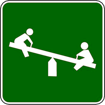
| PlaygroundNode | leisure=playground | Icon (MinZoom=14, IconUrl=http://wiki.openstreetmap.org/w/images/8/85/Playground2010.png, Width=13:15;18:30) | |||
| HWY24sign | bikemanhattan=sign24 | Icon (MinZoom=12, IconUrl=http://wiki.openstreetmap.org/w/images/6/6e/Hwy24.png, Width=12:14;18:40) | |||
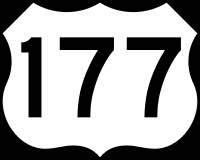
| HWY177sign | bikemanhattan=sign177 | Icon (MinZoom=12, IconUrl=http://wiki.openstreetmap.org/w/images/7/77/Hwy177.png, Width=12:14;18:40) | |||
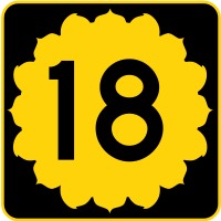
| HWY18sign | bikemanhattan=sign18 | Icon (MinZoom=12, IconUrl=http://wiki.openstreetmap.org/w/images/4/44/Hwy18.png, Width=12:14;18:40) | |||
| HWY113sign | bikemanhattan=sign113 | Icon (MinZoom=12, IconUrl=http://wiki.openstreetmap.org/w/images/4/47/Hwy113.png, Width=12:14;18:40) | |||
| ViewpointNode | tourism=viewpoint | Icon (MinZoom=14, IconUrl=http://wiki.openstreetmap.org/images/1/18/Viewpoint20.png, Width=12:5;17:20) Text (MinZoom=16, Color=black, TagToUse=name, FontName=Arial, FontStyle=bold, FontSize=16:8;17:12, TextLineOffset=-200%) |
|||
| TelephoneNode | amenity=telephone | Icon (MinZoom=14, IconUrl=http://wiki.openstreetmap.org/images/d/dd/Telephone20.png, Width=12:5;17:20) Text (MinZoom=17, Color=black, TagToUse=name, FontName=Arial, FontStyle=bold, FontSize=15:5;17:9, TextLineOffset=-200%) |
|||
| HospitalNode | amenity=hospital | Icon (MinZoom=14, IconUrl=http://wiki.openstreetmap.org/images/1/1b/Hospital20.png, width=13:15;18:30) Text (MinZoom=16, Color=black, TagToUse=name, FontName=Arial, FontStyle=bold, FontSize=15:5;17:9, TextLineOffset=-200%) |
|||
| PostOffice | amenity=post_office | Icon (MinZoom=16, IconUrl=http://wiki.openstreetmap.org/images/b/b4/GCR_COMM_POSTO.png, Width=13:15;18:30) Text (MinZoom=16, Color=black, TagToUse=name;ref, FontName=Trebuchet MS, FontStyle=Italic, FontSize=16:6;17:10, TextLineOffset=-200%) |
|||
| PostBox | amenity=post_box | Icon (MinZoom=16, IconUrl=http://wiki.openstreetmap.org/images/d/d1/Amenity-post_box.png, Width=13:15;18:30) |