Template:Hr:Map Features:highway
Jump to navigation
Jump to search
Highway
Highway tag se primarno koristi za ceste. Najčešće je to i jedini tag. Pogledajte Highway tag usage i Road za upute.
| Key | Vrijednost | Element | Komentar | Rendering | Fotografija | |
|---|---|---|---|---|---|---|
Ceste | ||||||
|
This group lists the 7 main tags for the road network, from most to least functionally important for motor vehicle traffic. | ||||||
| highway | motorway | Za označavanje autoceste u Hrvatskoj - A1, A2, A3 itd...Cesta s ograničenim pristupom (nema bicikala, sporih vozila), s 2 ili više traka plus 1 zaustavnom trakom. Ekvivalentno američkom Freeway, njemačkom Autobahn, itd.. |  |
|||
| highway | trunk | The most important roads in a country's system that aren't motorways. (Need not necessarily be a divided highway.) |  |
|||
| highway | primary | Prema klasifikaciji u Hrvatskoj sve državne ceste. Brzim cestama i cestama namijenjenim za promet samo motornih vozila dodati motorroad=yes.
|
 |
|||
| highway | secondary | Prema klasifikaciji u Hrvatskoj sve županijske ceste. |  |
|||
| highway | tertiary | Prema klasifikaciji u Hrvatskoj sve lokalne ceste. |  |
|||
| highway | unclassified | Nerazvrstane ceste - nema administrativne klasifikacije. Unclassified ceste su obično najniži oblik mreže cesta. Obično uske ceste, da se ne mogu normalno mimoići 2 automobila. Opaska: Ovo nije oznaka za ceste gdje se još treba utvrditi highway tag (pogledaj highway=road za ceste koje trebaju dobiti klasifikaciju).
|
 |
|||
| highway | residential | Ceste tj. ulice koje su unutar i oko naselja, nisu klasificirane niti nerazvrstane (unclassified)... |  |
|||
Link roads | ||||||
| highway | motorway_link | Spojne ceste (rampe ili izlazi) koji vode na i sa autoceste ili nai sa drugog autoceste sa istim restrikcijama kao i autoput. |  |
 | ||
| highway | trunk_link | The link roads (sliproads/ramps) leading to/from a trunk road from/to a trunk road or lower class highway. |  |
 | ||
| highway | primary_link | Spojne ceste (rampe ili izlazi) koji vode na i sa državne ceste ili na i sa druge ceste. |  |
 | ||
| highway | secondary_link | Spojne ceste (rampe ili izlazi) koji vode na i sa sekundarne ceste ili na i sa druge ceste. |  |
 | ||
| highway | tertiary_link | The link roads (sliproads/ramps) leading to/from a tertiary road from/to a tertiary road or lower class highway. |  |
|||
Special road types | ||||||
| highway | living_street | Ulica gjde pješaci imaju prednost nad automobilima, gjde se djeca igraju na ulici, maksimalna brzina je mala. U Hrvatskoj ih zovemo »područje smirenog prometa«, koje označuje mjesto u naselju na kojem se ulazi u područje u kojem se ne smije voziti brže od brzine hoda pješaka jer je dječja igra svugdje dopuštena. |  |
 | ||
| highway | service | Općenito cesta za pristup zgradama, servisnim stanicama, plažama, kampovima, industrijskim pogonima, poslovnim zonama, itd.. Također se koristi i za pristup parkingu i odvozu otpada. koristi se sa service=*, npr. service=parking_aisle kako bi označili put unutar parkingaamenity=parking.
|
 |
 | ||
| highway | pedestrian | Ceste - šetališta koje su uglavnom/isključivo za pješake. Za označavanje pješačkih zona, trgova i sl.(u tom slučaju, dodajte area=yes.
|
 |
 | ||
| highway | track | Ceste za poljoprivredne svrhe (kameni put,makadam,kaldrme,lenije), šljunčane ceste u šumi, itd.; obično neasfaltirane ceste. Za više pogledaj Hr:Key:tracktype. |  |
|||
| highway | bus_guideway | A busway where the vehicle guided by the way (though not a railway) and is not suitable for other traffic. Please note: this is not a normal bus lane, use access=no, psv=yes instead! If the buses are not guided, consider highway=busway.
|
 |
 | ||
| highway | escape | For runaway truck ramps, runaway truck lanes, emergency escape ramps, or truck arrester beds. It enables vehicles with braking failure to safely stop. |  | |||
| highway | raceway | A course or track for (motor) racing |  |
 | ||
| highway | road | Cesta za koju ne znamo klasifikaciju. Ovo je privremena oznaka za ceste dok se pravilo ne istraže. Kada su istražene, treba ažurirati pripadajuću klasifikaciju. |  |
 | ||
| highway | busway | A dedicated roadway for bus rapid transit systems |  | |||
Staze | ||||||
| highway | footway | Pješačke staze koje su uglavnom/isključivo za pješake. Ovo uključuje šetnice i šljunčane staze. Ako je dozvoljeno biciklima, možete dodati oznaku bicycle=yes. Ne bi trebali koristiti za staze gdje se nezna primarna namjena.
|
 |
 | ||
| highway | bridleway | Za konje, pješake i bicikliste. Ekvivalentno oznakama highway=path + horse=designated.
|
 |
 | ||
| highway | steps | Za stepenice na pješačkim stazama. Koristite sa step_count=* kako bi označli broj stepenica.
|
 |
 | ||
| highway | corridor | For a hallway inside of a building. |  | |||
| highway | path | Staza koja nije specifična i koristi se pješke, biciklom, konjem itd. |  |
 | ||
| highway | via_ferrata | A via ferrata is a route equipped with fixed cables, stemples, ladders, and bridges in order to increase ease and security for climbers. These via ferrata require equipment : climbing harness, shock absorber and two short lengths of rope, but do not require a long rope as for climbing. |  | |||
When sidewalk/crosswalk is tagged as a separate way | ||||||
| footway | sidewalk | Sidewalk that runs typically along residential road. Use in combination with highway=footway or highway=path
|
 |
 | ||
| footway | crossing | Pješački prelazi,npr. zebra (vidi i crossing=). |  |
 | ||
| footway | traffic_island | The way between two crossings, safespot for pedestrians, has micromapping characteristics as a detailed alternative to =*. Use in combination with highway=footway or highway=path.
|
 |
|||
When sidewalk (or pavement) is tagged on the main roadway (see Sidewalks) | ||||||
| sidewalk | both | left | right | no | Specifies that the highways has sidewalks on both sides, on one side or no sidewalk at all |  | |||
When cycleway is drawn as its own way (see Bicycle) | ||||||
| highway | cycleway | For designated cycleways. Add foot=*, though it may be avoided if default-access-restrictions do apply.
|
 |
 | ||
Cycleway tagged on the main roadway or lane (see Bicycle) | ||||||
| cycleway | lane | A lane is a route that lies within the roadway |  | |||
| cycleway | Deprecated variant for ways with oneway=yes where it is legally permitted to cycle in both directions. Replaced by oneway:bicycle=no.
|
 | ||||
| cycleway | Deprecated variant for ways with oneway=yes that have a cycling lane going the opposite direction of normal traffic flow (a "contraflow" lane). Replaced by oneway:bicycle=no + cycleway:left=lane/cycleway:right=lane + cycleway:left:oneway=-1/cycleway:right:oneway=-1.
|
 | ||||
| cycleway | track | A track provides a route that is separated from traffic. In the United States, this term is often used to refer to bike lanes that are separated from lanes for cars by pavement buffers, bollards, parking lanes, and curbs. Note that a cycle track may alternatively be drawn as a separate way next to the road which is tagged as highway=cycleway.
|
 | |||
| cycleway | Deprecated variant for ways with oneway=yes that have a cycling track going the opposite direction of normal traffic flow. Replaced by oneway:bicycle=no + cycleway:left=track/cycleway:right=track + cycleway:left:oneway=-1/cycleway:right:oneway=-1.
|
 | ||||
| cycleway | share_busway | There is a bus lane that cyclists are permitted to use. |  | |||
| cycleway | Deprecated variant for ways with oneway=yes that have a bus lane that cyclists are also permitted to use, and which go in the opposite direction to normal traffic flow (a "contraflow" bus lane). Replaced by oneway:bicycle=no + cycleway:left=share_busway/cycleway:right=share_busway + cycleway:left:oneway=-1/cycleway:right:oneway=-1.
|
 | ||||
| cycleway | shared_lane | Cyclists share a lane with motor vehicles, there are markings reminding about this. In some places these markings are known as "sharrows" ('sharing arrows') and this is the tag to use for those. |  | |||
Busways tagged on the main roadway or lane (see Bus lanes) | ||||||
| lane | Deprecated variant to tag bus lanes. Replaced by bus/psv lane tagging lanes:bus=* / lanes:psv=*) / bus:lanes=* / psv:lanes=*
|
 | ||||
| opposite | Deprecated variant for ways with oneway=yes where buses are legally permitted to travel in both directions. Replaced by oneway:bus=no
|
|||||
| opposite_lane | Deprecated variant for ways with oneway=yes that have a bus lane which go in the opposite direction to normal traffic flow (a "contraflow" bus lane). Replaced by oneway:bus=no and lanes:bus=* / lanes:psv=*) / bus:lanes=* / psv:lanes=*
|
|||||
Street parking tagged on the main roadway (see Street parking) | ||||||
parking:left / :right / :both(hereafter: parking:side) |
lane | street_side | on_kerb | half_on_kerb | shoulder | no | separate | yes | Primary key to record parking along the street. Describes the parking position of parked vehicles in the street. |  | |||
parking:sideorientation=*
|
parallel | diagonal | perpendicular | To specify the orientation of parked vehicles if there is street parking. | ||||
Lifecycle (see also lifecycle prefixes) | ||||||
| highway | proposed | For planned roads, use with proposed=* and a value of the proposed highway value.
|
||||
| highway | construction | Ceste u izgradnji/rekonstrukciji označite sa construction=*.
|
 |
 | ||
Attributes | ||||||
| abutters | commercial | industrial | mixed | residential | retail etc. | See Key:abutters for more details. |  | |||
| bicycle_road | yes | A bicycle road is a road designated for bicycles. If residential streets get the status of bicycle roads, normally, by special signs, motor traffic is admitted with limited speed, often only for residents. |  | |||
| bus_bay | both | left | right | A bus bay outside the main carriageway for boarding/alighting |  | |||
| change | yes | no | not_right | not_left | only_right | only_left | Specify the allowed/forbidden lane changes |  | |||
| destination | <place name of destination> | Destination when following a linear feature |  | |||
| embankment | yes | dyke | A dyke or a raised bank to carry a road, railway, or canal across a low-lying or wet area. |  | |||
| embedded_rails | yes | <type of railway> | A highway on which non-railway traffic is also allowed has railway tracks embedded in it but the rails are mapped as separate ways. |  | |||
| ford | yes | Cesta se križa s potokom ili rijekom, vozila moraju ući u vodu! |  | |||
| frontage_road | yes | A frontage road. | ||||
| ice_road | yes | A highway is laid upon frozen water basin, definitely doesn't exist in summer. |  | |||
| incline | Number % | ° | up | down | Incline steepness as percents ("5%") or degrees ("20°"). Positive/negative values indicate movement upward/downwards in the direction of the way. |  | |||
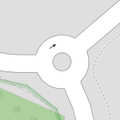
| junction | roundabout | Ova oznaka automatski podrazumjeva oneway=yes, jednosmjerna cesta je definirana slijedom složenih točaka u smjeru u kojem cesta ide. Ova oznaka se koristi na pu, koji je već označen sahighway=*.
|
 |
 | ||
| lanes | <number> | The number of traffic lanes for general purpose traffic, also for buses and other specific classes of vehicle. |  | |||
| lane_markings | yes | no | Specifies if a highway has painted markings to indicate the position of the lanes. |  | |||
| lit | yes | no | Street lighting |  | |||
| maxspeed | <number> | Specifies the maximum legal speed limit on a road, railway or waterway. |  | |||
| motorroad | yes | no | The motorroad tag is used to describe highways that have motorway-like access restrictions but that are not a motorway. |  | |||
| mountain_pass | yes | The highest point of a mountain pass. |  | |||
| mtb:scale | 0-6 | Applies to highway=path and highway=track. A classification scheme for mtb trails (few inclination and downhill).
|
 | |||
| mtb:scale:uphill | 0-5 | A classification scheme for mtb trails for going uphill if there is significant inclination. |  | |||
| mtb:scale:imba | 0-4 | The IMBA Trail Difficulty Rating System shall be used for bikeparks. It is adapted to mtb trails with artificial obstacles. | ||||
| mtb:description | Text | Applies to highway=path and highway=track. A key to input variable infos related to mtbiking on a way with human words
|
||||
| oneway | yes | no | reversible | Oneway streets are streets where you are only allowed to drive in one direction. |  | |||
| oneway:bicycle | yes | no | | Used on ways with oneway=yes where it is legally permitted to cycle in both directions.
|
 | |||
| overtaking | yes | no | caution | both | forward | backward | Specifying sections of roads where overtaking is legally forbidden. Use overtaking:forward=yes/no/caution and overtaking:backward=yes/no/caution when it depends on driving direction.
|
 | |||
| parallel | diagonal | perpendicular | marked | no_parking | no_stopping | fire_lane. | Deprecated variant to map parking along streets. See section on street parking above or the street parking page for more details. | |||||
| free | ticket | disc | residents | customers | private | Deprecated variant to map parking conditions along streets. See section on street parking above or the street parking page for more details. |  | ||||
| passing_places | yes | Put koji ima česta mjesta za prolaz. |  | |||
| priority | forward | backward | Traffic priority for narrow parts of roads, e.g. narrow bridges. |  | |||
| priority_road | designated | yes_unposted | end | Specifying roads signposted as priority roads. |  | |||
| sac_scale | strolling | hiking | mountain_hiking | demanding_mountain_hiking | alpine_hiking | demanding_alpine_hiking | difficult_alpine_hiking | Applies to highway=path and highway=footway. A classification scheme for hiking trails.
|
 | |||
| service | alley | driveway | parking_aisle etc. | Servisna cesta koja se obično nalazi između posjeda za pristup komunalijama. koristiti s highway=service.
|
 | |||
| shoulder | no | yes | right | both | left | Presence of shoulder in highway |  | |||
| side_road | yes | A side road. | ||||
| smoothness | excellent | good | intermediate | bad | very_bad | horrible | very_horrible | impassable | Specifies the physical usability of a way for wheeled vehicles due to surface regularity/flatness. See Key:smoothness for more details. |  | |||
| surface | paved | unpaved | asphalt | concrete | paving_stones | sett | cobblestone | metal | wood | compacted | fine_gravel | gravel | pebblestone | plastic | grass_paver | grass | dirt | earth | mud | sand | ground | See Key:surface for more details. |  | |||
| tactile_paving | yes | no | A paving in the ground to be followed with a blindman's stick. |  | |||
| tracktype | grade1 | grade2 | grade3 | grade4 | grade5 | To describe the quality of the surface. See Key:tracktype for more information. | 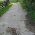 | |||
| traffic_calming | bump | hump | table | island | cushion | yes | etc. | Za označavanje objekata koji su napravljeni kako bi usporili promet u naseljima. |  | |||
| trail_visibility | excellent | good | intermediate | bad | horrible | no | Applies to highway=path, highway=footway, highway=cycleway and highway=bridleway. A classification for hiking trails visibility
|
 | |||
| trailblazed | yes | no | poles | cairns | symbols | Applies to highway=*. Describing trail blazing and marking. See Key:trailblazed for more information.
|
 | |||
| trailblazed:visibility | excellent | good | intermediate | bad | horrible | no | Applies to trailblazed=*. A classification for visibility of trailblazing. See Key:trailblazed:visibility for more information.
|
||||
| turn | left | slight_left | through | right | slight_right | merge_to_left | merge_to_right | reverse | The key turn can be used to specify the direction in which a way or a lane will lead. |  | |||
| width | <number> | The width of a feature. |  | |||
| winter_road | yes | A highway functions during winter, probably can't be driven in summer. |  | |||
Other features | ||||||
| highway | bus_stop | Autobusno stajalište. Veće stanice treba označiti oznakom amenity=bus_station.
|
 | |||
| highway | crossing | A.k.a. crosswalk. Pedestrians can cross a street here; e.g., zebra crossing |  | |||
| highway | cyclist_waiting_aid | Street furniture for cyclists that are intended to make waiting at esp. traffic lights more comfortable. |  | |||
| highway | elevator | An elevator or lift, used to travel vertically, providing passenger and freight access between pathways at different floor levels. |  | |||
| highway | emergency_bay | An area beside a highway where you can safely stop your car in case of breakdown or emergency. |  | |||
| highway | emergency_access_point | Sign number which can be used to define your current position in case of an emergency. Use with ref=NUMBER_ON_THE_SIGN. See also emergency=access_point
|
 | |||
| highway | give_way | A "give way," or "Yield" sign |  | |||
| emergency | phone | A calling device can be used to tell on your current position in case of an emergency. Use with ref=NUMBER_ON_THE_SIGN
|
 | |||
| highway | hitchhiking | Like a bus_stop but for free, uncertain, spontaneous rides with strangers. |  | |||
| highway | ladder | A vertical or inclined set of steps or rungs intended for climbing or descending of a person with the help of hands. |  | |||
| highway | milestone | Highway location marker | ||||
| highway | mini_roundabout | Vrlo mali kružni tok, veći se označavaju sa junction=roundabout.
Renderira se obrnutno o kazaljke na satu po defaultu. Da se rendereira u smjeru kazaljke na satu dodajte oznaku |
 |
 | ||
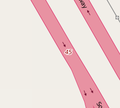
| highway | motorway_junction | Označava izlaze/ulaze s autoceste. ref=* Potrebno je staviti broj izlaza i/ili ime izlaza.
|
 |
 | ||
| highway | passing_place | Lokacija mjesta za prolaz (obično na uskim brdskim cestama, gdje jedno vozilo staje da propusti drugo). |  | |||
| highway | platform | A platform at a bus stop or station. |  |
 | ||
| highway | rest_area | Place where drivers can leave the road to rest, but not refuel. | 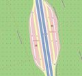 |
 | ||
| highway | services | Servisna stanica gdje možete nešto pojesti, a koje se obično nalaze na autocestama. |  |
 | ||
| highway | speed_camera | Fiksna policijska kamera koja prati ograničenje brzine. |  | |||
| highway | speed_display | A dynamic electronic sign that displays the speed of the passer-by motorist. |  | |||
| highway | stop | A stop sign |  | |||
| highway | street_lamp | A street light, lamppost, street lamp, light standard, or lamp standard is a raised source of light on the edge of a road, which is turned on or lit at a certain time every night |  | |||
| highway | toll_gantry | A toll gantry is a gantry suspended over a way, usually a motorway, as part of a system of electronic toll collection. For a toll booth with any kind of barrier or booth see: barrier=toll_booth
|
 | |||
| highway | traffic_mirror | Mirror that reflects the traffic on one road when direct view is blocked. |  | |||
| highway | traffic_signals | Semafori koji kontroliraju promet. |  | |||
| highway | trailhead | Designated place to start on a trail or route |  | |||
| highway | turning_circle | Krug za okretanje, okrugli, prošireni dio ceste koji je obično na kraju ceste da bi olakšalo okretanje vozila. |  |
 | ||
| highway | turning_loop | A widened area of a highway with a non-traversable island for turning around, often circular and at the end of a road. |  | |||
| highway | User Defined | Pogledajte Taginfo |
||||


