User:Tordanik/SoftwareTest
Jump to navigation
Jump to search
This table in the past was generated automatically by a bot. Learn more.
This table in the past was generated automatically by a bot. Learn more.
This table in the past was generated automatically by a bot. Learn more.
This table in the past was generated automatically by a bot. Learn more.
This table in the past was generated automatically by a bot. Learn more.
This table in the past was generated automatically by a bot. Learn more.
|
The following list is generated automatically by a bot (User:TTTBot). Please use the corresponding item pages to change the properties. |
This page contains tables of programs using OSM data.
General information
| Name | Screenshot | Windows | Mac | Linux | Display map | Navigate | Make track | Monitor | License | Price | Languages | Version | Description |
|---|---|---|---|---|---|---|---|---|---|---|---|---|---|
| <20MB, <512MB, <2GB Maps [1] | 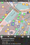
|
no | yes | no | yes | no | no | no | nonfreeproprietary | nonfree1,59€ | EN | 2012-07-01 1.7.1 |
Offline maps and POIs for entire countries as well as selected cities. |
| 2TrackMe [2] | 
|
no | yes | no | yes | yes | yes | no | nonfreeproprietary | nonfree5€ | EN | 2009-08-10 1.2 |
Simple map viewer with wikipedia, geoaching support |
| 700 City Maps [3] | 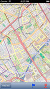
|
no | yes | no | yes | yes | no | no | nonfreeproprietary | nonfree2.99$ for each city's map. | EN | 2012-06-02 2.01 |
|
| 8motions [4] | no | yes | no | yes | yes | yes | no | nonfreeProprietary | free | EN | ? | Dead? | |
| AFTrack GPS-Tracking [5] | 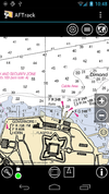
|
no | yes | no | yes | yes | yes | yes | nonfreeproprietary | nonfree3.90€;4.95$;free | EN; DE; IT | 2014-08-02 1.6.4 |
Offline navigation with many map formats - BSB3 (*.kap), NV-digital (*.eap), Bitmaps with calibration file (format: map, gmi, kml, kal, cal, pwm), OSZ (zipped osm tile collection), mbtiles, sqlitedb, Mapsforge vector format and online maps |
| AlaCarte [6] | yes | yes | yes | ? | ? | ? | ? | GNU AGPL 3+ | free | EN | 2013-08-05 0.3 |
||
| ALittleMap [7] | 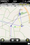
|
no | yes | no | yes | no | yes | no | nonfreeproprietary | free | EN | ? | |
| AlpineQuest GPS Hiking [8] | 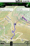
|
no | yes | no | yes | no | yes | yes | nonfreeproprietary | nonfree3€ | EN,FR, | 2012-10-02 1.3.2 |
Orienteering focused |
| Amenity Editor [9] | 
|
yes | yes | yes | ? | ? | ? | ? | GNU AGPL 3+ | free | EN | 2010-12-24 ? |
Very limited but easy to use online editor |
| AndNav2 [10] | 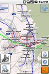
|
no | yes | no | yes | yes | yes | no | GPL | free | EN | ? | No longer actively developed, map (online/offline-"andnav_atlas_format"), routing (online) |
| AndRoad [11] | 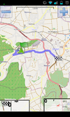
|
no | yes | no | yes | yes | yes | no | GPL | free | EN | ? | Open-source fork of AndNav2 |
| Androzic [12] | 
|
no | yes | no | yes | yes | yes | yes | GPLv3 | free | EN; FR; DE; ES; CS; BG; FI; HU; IT; NL; PL; TR; RU | 2012-02-05 1.4 |
Android navigation client that uses OziExplorer maps (ozf2, ozfx3) |
| Aosm [13] | 
|
no | yes | no | yes | yes | yes | no | nonfreeproprietary | free | ? | ? | Development of this application seems to have stopped |
| Ape@map [14] | 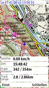
|
no | yes | no | yes | no | yes | yes | nonfreeproprietary | free | EN | ? | |
| APRSISCE/32 [15] | 
|
yes | yes | yes | yes | no | yes | yes | nonfreeproprietary | free | EN; ... | 2012-04-06 2012/04/06 |
Feature rich Amateur Radio Automatic Packet Reporting System client that uses OSM tiles as the base map. Under active development with rapid development release cycle. |
| ArcGIS Editor for OSM [16] | 
|
yes | yes | no | yes | no | no | no | Apache License 2.0 | free | En | 2014-03-07 10.2 |
Allows users to download, edit, and upload OSM data in ArcMap, and/or create feature services based on OSM data in ArcGIS Server |
| ArcGIS for iPhone [17] | 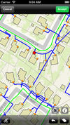
|
no | yes | no | yes | no | no | no | nonfreeproprietary | free | EN | 2012-07-18 2.3.1 |
Shows just different maps |
| ARnav [18] | 
|
no | yes | no | yes | yes | no | no | nonfreeProprietary | free | EN | 2012-03-03 0.9RC2 |
ARnav is an app for Android mobile devices that shows OpenStreetMap points of interest around you in augmented reality mode. |
| aSmartHUD NAVI MAP+ [19] | 
|
no | yes | no | yes | yes | yes | ? | nonfreeproprietary | nonfree1,99$ | 20 | 2012-05-02 1.5 |
vehicle digital dashboard, unified with in-car navigation system |
| Atlas [20] | 
|
yes | yes | yes | yes | yes | no | no | nonfreeproprietary | free | EN; EL | 2014-10-17 1.0.23 |
Atlas is a Java map and navigation application using offline vector maps. |
| Autosputnik 5 [21] | 
|
yes | yes | no | yes | yes | no | yes | nonfreeproprietary | nonfree15€ | EN; RU; UA; BY; KZ; UZ | 2011-03-10 1.0.31970 |
Easy and nice UI, web-like search, routing, navigation. OSM support: http://openstreetmaps.ru |
| B.iCycle [22] | 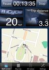
|
no | yes | no | yes | no | yes | yes | nonfreeProprietary | nonfree9.99$ (iOS) $4 (android), | EN | 2013-04-03 4.0.1 |
MTB centered bike computer software |
| BackCountry Navigator [23] | 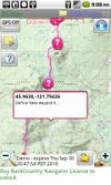
|
no | yes | no | yes | yes | yes | yes | nonfreeproprietary | nonfree9.99$ (fully functional time limited free demo available) | EN | 2011-05-26 4.0.6 |
Hiking focused. Many map formats available; including OpenStreetMaps, NASA landsat, MyTopo.com topo maps of US and Canada, OpenCycleMaps showing terrain worldwide, USGS Color Aerial photography, UK Ordinance Survey Explorer Maps, Topographic Maps of Spain and Italy, Topo maps of New Zealand. |
| BaseCamp [24] | yes | yes | no | yes | no | no | no | nonfreeproprietary | free | ? | 2012-02-10 3.3.1 |
||
| bbTracker [25] | no | yes | no | no | no | yes | yes | GPL | free | EN | 2008-05-02 0.5.3.1 |
simple logger | |
| be-on-road [26] | 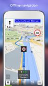
|
no | yes | no | yes | yes | yes | ? | nonfreeproprietary | nonfreeFree | DE; EN; CS; NL; FR; EL; HU; IT; PL; PT; RO; RU; SK; ES; TR; UK | 2013-11-13 3.9.26385 |
Offline multi-language voice navigation app with lane-guidance assistant. Data from OSM and propietary maps. |
| BetterSoftwareGPS | 
|
yes | yes | no | yes | no | no | yes | nonfreeproprietary | free | EN | 2010-05-13 3.5.2.8 |
|
| BetterSoftwareGPSPDA | 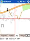
|
no | yes | no | yes | no | no | yes | nonfreeproprietary | free | EN | 2008-08-08 3.5.0.2 |
|
| Big Planet Tracks [27] | no | yes | no | yes | no | yes | yes | GPLv3 | free | EN; ZH-TW; ZH-CN | 2011-07-09 2.1 |
maps (online/offline-"big_planet_tracks") | |
| Bike GPS Mobile [28] | 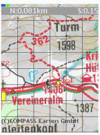
|
? | ? | ? | yes | yes | yes | no | nonfreeproprietary | nonfree50€ | DE | 2010-06-09 3.3 |
Hiking Maps for Austria only! |
| BikeAtor [29] | 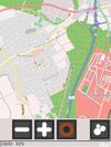
|
no | yes | no | yes | no | yes | yes | nonfreeproprietary | free | EN | 2010-04-13 0.0.9 |
|
| BikeAtor [30] | 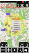
|
no | yes | no | yes | no | yes | yes | nonfreeproprietary | free | DE,EN | 2013-09-26 0.1.1 |
Show Maps, Caches, Speedometer, log GPX... |
| BikeCityGuide http://getfinn.com/ | 
|
no | yes | no | yes | yes | yes | no | nonfreeproprietary | nonfree5Eur per city | EN,DE,FR | 2014-07-24 3.1 |
Designed for cyclists in urban areas incl. Insider tours. |
| Bing imagery analyzer for OSM [31] | 
|
no | yes | no | ? | ? | ? | ? | nonfreeundefined (but open) | nonfreenone | EN | 2010-12-24 0.8[1] |
default bing satellite and aerial photos overlaid with their capture date as set in the HTTP headers for each tile |
| Bluemapia [32] | 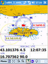
|
no | yes | no | yes | no | no | no | nonfreeproprietary | free | EN | 2009-06-01 0.9.6 |
Marine mapping app for bluemappia.com |
| Brigantine [33] | 
|
yes | yes | yes | yes | ? | ? | ? | nonfreeMIT | free | EN | ? 1306 |
|
| BT747 [34] | 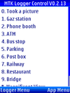
|
yes | yes | yes | no | no | yes | yes | GPL | free | DE; EN | 2010-08-13 2.x.1769 |
MTK GPS chip sets only! |
| BucketMan - coloring your city [35] | 
|
no | yes | no | yes | no | no | no | ? | free | EN; DE; PT | 2014-10-03 2.0 |
A game similar to Pacman but in the streets of the world |
| cachebox [36] | 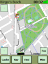
|
no | yes | no | yes | yes | no | no | GPL | free | EN | 2010-08-22 500 |
Geocaching centered |
| Cartagen [37] | 
|
yes | yes | yes | ? | ? | ? | ? | ? | ? | EN | ? | |
| CartoType [38] | 
|
yes | yes | yes | yes | yes | no | no | nonfreecommercial | ? | EN | 2013-07-17 2.9 |
portable library |
| Cetus GPS [39] | 
|
no | yes | no | no | yes | yes | yes | nonfreeproprietary | free | EN | 2005-07-12 1.2b8 |
Army knife |
| Ceyx | 
|
yes | yes | yes | ? | ? | ? | ? | GPL v2+ | free | EN | 2010-10-01 (no stable release) |
|
| CheckTheMonuments [40] | 
|
no | yes | no | yes | ? | ? | ? | nonfreeOpenStreetMap and ShareAlike CC BY-SA; ODbL | ? | DE | ? | Quality Management for Monuments |
| City Maps 2Go [41] | 
|
no | yes | no | yes | no | no | no | nonfreeproprietary | nonfreeiPhone: 2.99$ / 2.69€ Android: free | EN,DE,FR,IT,ES | 2013-07-17 4.5.7 |
City Maps 2Go |
| Cobra [42] | 
|
yes | yes | no | ? | ? | ? | ? | ? | ? | EN | 2010-02-03 0.3.9 |
project paused |
| Compass Navigator 3D [43] | File:Compass Navigator 3D.png | no | yes | no | no | yes | no | no | nonfreeproprietary | free | EN; DE | 2014-08-19 1.0 |
3D compass with a GPS navigation "arrow". Line-of-sight-navigation to OSM POIs and addresses. |
| cotogps [44] | 
|
no | yes | no | no | yes | no | no | GPL | free | DE; EN; FR; IT; PO; SP | 2010-06-25 1.6.1 |
|
| Cruiser [45] | 
|
no | yes | no | yes | yes | no | yes | nonfreeproprietary | free | EN; EL | 2014-10-17 1.2.12 |
Cruiser is an Android map and navigation application using offline vector maps. |
| Cycle Hire [46] | 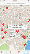
|
no | yes | no | yes | no | no | no | ? | free | DE; EN; ... | 2012-05-12 4.1 |
Find Cycle Hire locations in London |
| CycleStreets Android App [47] | 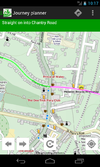
|
no | yes | no | yes | yes | no | no | GPL; | nonfreeFree | EN | 2011-11-17 1.1 |
UK only |
| Dedee GpsLogger [48] | 
|
no | yes | no | ? | no | yes | no | nonfreeproprietary | free | EN | 2011-03-19 1.1 |
|
| directu [49] | 
|
no | yes | no | yes | ? | ? | ? | nonfreeproprietary | free | EN | 2011-04-26 1.2.2 |
Offline map browsing with large OSM datasets (e.g. all of europe) |
| discOSM [50] | yes | yes | yes | yes | no | no | no | ? | ? | ? | 2010-11-08 ? |
Live DVD including OSM data and tools to present the map offline | |
| E.T [51] | no | yes | no | no | yes | yes | yes | nonfreeproprietary | nonfree15€ | EN | ? | ||
| EasyMaps [52] | 
|
no | yes | no | yes | no | no | no | nonfreeproprietary | free | EN | 2010-12-01 1.0.1 |
Just a offline static maps viewer |
| Emerillon [53] | 
|
no | yes | yes | yes | no | no | no | GPL | free | AR; CS; DA; DE; EN; ES; FR; GL; ID; IS; IT; JA; LV; NB; PL; PT; SL; SV; ZH | 2011-09-07 0.1.90 |
Simple map viewer for GNOME Desktop |
| Endomondo [54] | 
|
no | yes | no | yes | no | no | no | nonfreeProprietary | free | ? | ? | An app for recording and logging workouts. It also allows seeing the position on an OSM map. |
| Find & Route [55] | 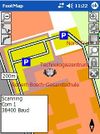
|
no | yes | no | yes | yes | yes | no | nonfreeproprietary | nonfree50€ | DE | 2012-03-08 2.0 |
Fast rendering, no install; easy to use |
| florb [56] | 
|
no | yes | yes | yes | no | yes | yes | nonfreeMIT | free | DE; EN; | 2014-10-12 1.0 |
A simple map viewer and GPX editor |
| ForeverMap [57] | 
|
no | yes | no | yes | yes | no | no | nonfreeproprietary | nonfreeiPhone: 1,59€, Android: 1,59€ (Free Android version available) | EN; DE; FR; SP; IT; RU | 2013-10-05 3.2 |
ForeverMap is an offline navigation app, providing address/POI search and route calculation |
| FoxtrotGPS [58] | no | yes | yes | yes | no | yes | yes | GPL | free | BG; CS; DE; EN; FI; FR; HU; NL; RU; SK | 2012-06-14 1.1.1 |
Simple mapping application (fork of tangoGPS) | |
| FreemapMobile [59] | ? | ? | ? | yes | no | no | no | GPL | free | EN | 2008-06-17 r3 |
||
| Gaia GPS [60] | 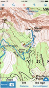
|
no | yes | no | yes | yes | yes | yes | nonfreeproprietary | nonfree19.99$ iOS / $9.99 Android | EN | 2012-07-05 6.4 |
hiking focused logger |
| Galileo Offline Maps [61] | no | yes | no | yes | no | yes | yes | nonfreeproprietary | nonfreefreemium | EN, NL, DE, IT, JP, RU, ES, ZH | 2014-07-28 3.2.2 |
Fast and easy-to-use vector maps with offline search based on OpenStreetMap data. | |
| Geobucket [62] | 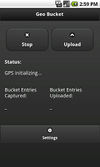
|
no | yes | no | no | no | yes | no | GPL | free | EN | 2012-10-30 1.1 |
Tool to make it dead simple to collect tracks and upload to Geobucket.org for tracing |
| Geocaching Live [63] | ? | ? | ? | yes | no | no | no | nonfreeproprietary | nonfree0€ | DE; EN; | 2010-04-10 0.99.01 |
Can display Geocaches over a map. | |
| GeoGuide 3D Worldwide Maps and Tracks [64] | 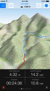
|
no | yes | no | yes | no | yes | yes | nonfreeproprietary | nonfree2.99$ | EN; DE | 2013-04-06 3.1 |
3D Worldwide Maps and Tracks, Allows to download maps for offline use (topo and street) |
| geojson.io [65] | 
|
no | yes | no | ? | ? | ? | ? | nonfreeISC | ? | English | 2014-08-11 rolling |
|
| GeoLogger [http:// |
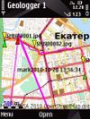
|
no | yes | no | yes | yes | yes | yes | nonfreeproprietary | free | EN,RUS | 2010-10-28 1.0 |
Tracks, geophoto and navigation. Currently offline! |
| Geopaparazzi [66] | 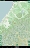
|
no | yes | no | yes | yes | yes | yes | GPL v3 | free | EN; IT; FI; EL; KO; JA; PL; PT; DE | 2014-05-10 3.9.5 |
|
| GeorgeMap [67] | 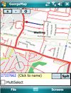
|
no | yes | no | yes | no | yes | yes | BSD | free | EN | 2008-02-12 ? |
|
| GeoTag [68] | 
|
no | yes | no | no | no | yes | no | nonfreeproprietary | free | EN | 2008-03-01 3.04 |
Replaces camera tool with geotagging feature |
| Glob [69] | 
|
no | yes | no | yes | ? | ? | ? | nonfreeFree | ? | EN,FR, | 2014-02-01 2.04 |
|
| GLObal PositioningUtilitieS [70] | 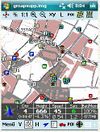
|
no | yes | no | yes | yes | yes | yes | nonfreeproperitary | ? | DE | 2009-10-06 2.03.4 |
|
| Glosm [71] | 
|
yes | yes | yes | ? | ? | ? | ? | GPL v3 | free | EN | ? 0.0.3 |
Framework for developing high-performance geospatial data visualization applications of both interactive and batch nature featuring OpenGL-based 3D first-person and tile renderers |
| Gnome Map Application [72] | 
|
yes | yes | no | yes | ? | ? | no | GPL | free | EN | 2010-07-02 0.4.3 |
Offers a Warp view and rotate view |
| Go Map!! | 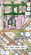
|
no | yes | no | yes | yes | no | no | nonfreeproprietary | ? | En | 2014-10-03 1.2.1 |
Easy to use iPhone/iPad editor for OSM with support for adding POIs, editing ways, offline support, undo-redo, and more. |
| Gobiz Mobile [73] | 
|
no | yes | no | yes | no | yes | yes | nonfreeproprietary | ? | DE; EN | ? | Commercial OSMTracker clone |
| Google Sketchup Plugin [74] | 
|
yes | yes | no | no | no | no | no | BSD | free | EN | 2011-02-22 ? |
Plugin to use OSM in the SketchUp editor |
| Goosm [75] | 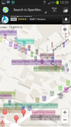
|
no | yes | no | yes | ? | no | no | nonfreeproprietary | free | FR; EN; ... | 2014-02-26 1.0.2 |
Contains an advanced search engine for POIs. Search any tags and display matching results, then send their position to any application that support intent filters if needed (google streetview, waze, navit, etc.). Create, Update or delete a POI, in two clicks. Autocomplete with most often-used tags, or use custom tags. |
| GoPenS [76] | 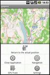
|
no | yes | no | yes | yes | yes | no | GPL | free | EN | 2011-01-10 0.7.5 |
Open source Android GPS for OpenStreetMap, map (online/offline), routing (online) |
| Gosmore [77] | 
|
yes | yes | yes | yes | yes | yes | yes | BSD | free | EN; DE | 2011-11-22 - |
|
| GPS Essentials [78] | 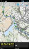
|
no | yes | no | yes | yes | yes | yes | nonfreeproprietary | free | EN | 2012-08-27 3.0 |
All-in-one solution |
| GPS Kit [79] | 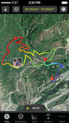
|
no | yes | no | yes | yes | yes | yes | nonfreeproprietary | nonfree9,99$ | EN | 2013-02-25 6.5 |
|
| GPS Logger for Android [80] | 
|
no | yes | no | no | no | yes | no | GPL | free | EN | 2014-06-12 49 |
Battery efficient GPX logger. |
| GPS Navigator aSpass [81] | 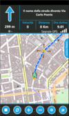
|
yes | yes | no | yes | yes | yes | no | nonfreeproprietary | nonfree3.99 € | EN | 2011-10-24 1.5.0.0 |
Navigator |
| GPS Track for J2ME [82] | 
|
no | yes | no | no | no | yes | no | GPL | free | EN | ? 1.1 |
|
| GPS TrackMaker [83] | yes | yes | yes | yes | no | yes | yes | nonfreeproprietary (free and paid version available) | nonfreefree / 167.44 € | EN; ES; PT | ? 13.8 |
GPS down/upload, track edit, tour planning (no routing), ... | |
| GPS Tuner [84] | 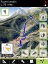
|
no | yes | no | yes | yes | yes | yes | nonfreeproprietary | nonfree$6.99 / free | EN | 2012-05-31 1.0.10 |
Google Earth like 3D Navi with DEM |
| GPS-Mate [85] | 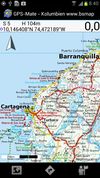
|
yes | yes | no | yes | yes | yes | yes | nonfreeproperitary | nonfree23€ | DE; EN | 2010-05-31 2.2.2 |
|
| GPS-Tracks [86] | 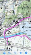
|
no | yes | no | yes | yes | yes | yes | nonfreeproprietary | free | EN; DE; FR; IT | 2012-01-26 1.61 (iPhone); 1.52 (Windows Mobile); 1.30 (Android) |
|
| GPS2Blue [87] | 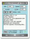
|
no | yes | no | ? | no | yes | no | nonfreeproprietary | free | EN | 2006-05-09 2.0 |
Tunnels GPS stream via virtual Comport |
| gps3D [88] | 
|
yes | yes | yes | yes | no | no | no | GPL | free | EN | 2002-03-11 1.2 |
Very simple 3D Globe |
| GPS4Palm [89] | 
|
no | yes | no | yes | yes | yes | yes | GPL | free | EN | 2007-10-08 0.9.5 |
|
| GpsCycleComputer [90] | 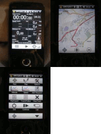
|
no | yes | no | yes | no | yes | yes | nonfreebsd | free | EN | 2012-05-27 4.9 |
simple tracking |
| gpsd [91] | 
|
no | yes | yes | no | no | no | yes | BSD | free | EN | 2010-07-13 2.95 |
Connect to GPS receiver, and analyse the connection |
| GPSdash [92] | 
|
no | yes | no | yes | yes | yes | yes | nonfree$ | ? | EN | 2007-01-06 2.5.0 |
|
| GpsDrive [93] | 
|
no | yes | yes | yes | yes | yes | yes | GPL 2+ | free | EN; DE; DA; EL; ES; ET; FR; GL; HU; ID; IT; JA; NB; NL; PA; RO; RU; SK; SV; TR; VI; ZH | 2012-07-21 2.12svn2685 |
Image: OpenCycleMap downloaded on the fly |
| GPSed Mobile Application [94] | 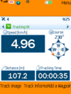
|
yes | yes | no | yes | no | yes | no | nonfreeproprietary | free | EN | ? 3.7 |
Client for gpsed.com but works without this service, too |
| GPSies [95] | 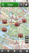
|
no | yes | no | no | no | yes | yes | nonfreeproprietary | free | 7 | 2011-07-14 2.0 |
|
| GPSlog [96] | yes | yes | no | no | no | no | no | GPL | free | EN; FR | 2004-08-13 1.0 |
Console based GPX logger | |
| GPSLogger II [97] | 
|
no | yes | no | yes | yes | yes | yes | nonfreeproprietary | free | EN | 2013-11-01 3.3.1.8 |
The free AIO logging and tracking Solution (developed since 2009) |
| GpsMap [98] | 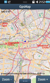
|
no | yes | no | yes | ? | yes | no | nonfreeproprietary | nonfree1.99$ | DE; EN | 2011-03-01 1.1.3 |
|
| GpsMaster [99] | 
|
yes | yes | yes | yes | no | no | no | GPL | free | EN | 2014-04-15 0.6x |
Map Viewer, GPX Viewer, Tour Analyser, Track Editor, Trip Planner, File Format Converter |
| GpsMid [100] | 
|
no | yes | no | yes | yes | yes | yes | GPLv2 | free | EN; DE; FI; CS; PL; RU; FR; IT; ES; SK | 2012-09-08 0.8.2 |
very portable navi for Android and J2ME mobile phones, uses offline vector maps, audio navigation |
| GpsPrune [101] | 
|
yes | yes | yes | yes | no | no | yes | GPL | free | CZ; DE; EN; ES; FR; HU; IT; JA; KO; NL; PL; PT; RU; ZH | 2014-04-01 16.2 |
Track editor, analyser, creator and converter |

|
no | yes | no | yes | yes | yes | yes | nonfreeproprietary | free | DE; EN; | 2014-05-11 3.0 |
Android offline navigation | |
| GPSTracka [102] | 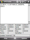
|
no | yes | no | no | no | yes | no | GPL | free | EN | 2010-06-30 0.5 |
|
| gpsVP [103] | 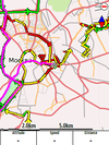
|
yes | yes | no | yes | yes | yes | yes | BSD | free | 14 | 2012-02-05 0.4.24 |
|
| GPSylon [104] | 
|
? | ? | ? | yes | no | yes | no | GPL | free | EN | 2007-04-25 0.53 |
|
| GPX Viewer [105] | 
|
no | yes | yes | yes | no | no | yes | GPL | free | AR; CS; DE; EN; ES; HU; IT; RU; UK; ZH | 2010-08-17 0.2 |
A simple tool to visualize tracks and waypoints stored in a gpx file |
| gpxmap [106] | 
|
yes | yes | yes | ? | ? | ? | ? | GPL | free | EN | 2010-09-02 0.5 |
Renders GPX to image |
| GPXViewer [107] | no | yes | yes | yes | no | no | yes | GPL | free | CS; DE; EL; EN; ES; FR; HR; IT; JA; NL; PL; PT; RU; SL; SV; TH; UK; ZH | 2010-09-19 0.3.1 |
Allow users to easily view GPS traces they have created in the GPX file format | |
| GraphHopper [108] | 
|
yes | yes | yes | yes | ? | ? | ? | Apache License 2.0 | free | EN | 2014-05-13 0.3 |
Routing server and Android library |
| Guide Me [109] | no | yes | no | ? | yes | ? | ? | ? | ? | DE | 2011-10-24 ? |
Navigation for blind persons | |
| gvSIG Mini [110] | 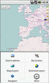
|
no | yes | no | yes | yes | no | no | GPL | free | EN; ES | 2011-03-30 1.2.2 |
supports WMS services, too; maps (online/offline-"custom") |
| gvSIG Mobile Pilot [111] | 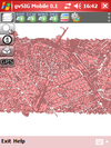
|
no | yes | no | yes | no | yes | no | GPL; | free | DE; EN | 2010-08-02 0.3 |
Pocket GIS |
| Halcyon | 
|
yes | yes | yes | ? | ? | ? | ? | ? | ? | EN | ? | |
| HotSpot Navigator [112] | 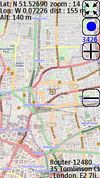
|
no | yes | no | yes | yes | yes | no | nonfreeproprietary | nonfree15$ | EN | 2011-04-25 0.5.2 |
FON Wi-Fi Spots over OSM tiles |
| Hoursome | 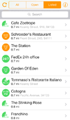
|
no | yes | no | no | no | no | no | nonfreeproprietary | free | EN; DE | 2013-12-05 1.0 |
Display and edit opening hours |
| iD [113] | 
|
no | yes | no | ? | ? | ? | ? | WTFPL | ? | many | 2014-10-06 1.6.0 |
|
| iLOE [114] | 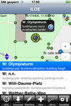
|
no | yes | no | yes | no | no | no | nonfreeproprietary | nonfree0.99$ | EN | 2011-06-30 1.9.4 |
iPhone editor for the advanced user |
| iLOS [115] | 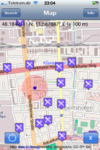
|
no | yes | no | yes | no | no | no | nonfreeproprietary | nonfree1.99$ | EN | 2010-12-07 1.1 |
OSM Map and POI finder |
| inViu routes [http://ENAiKOON GmbH] | no | yes | no | yes | yes | yes | yes | nonfreeproprietary | free | EN; DE; ES; FR | 2013-08-22 3.5.7 |
GPS swiss knife | |
| Jagme [116] | 
|
yes | yes | yes | yes | no | no | yes | GPL | free | DE; EN; HU | 2010-03-02 0.0.3 |
A tool providing map-based services |
| Java Applet | 
|
yes | yes | yes | ? | ? | ? | ? | GPL | free | EN | 2007-12-24 ? |
discontinued, replaced by Potlatch |
| JGPSTrackEdit [117] | 
|
yes | yes | yes | yes | yes | ? | yes | GPLv3 | free | EN; DE | 2013-04-14 1.1.0 |
Tool for editing gps tracks and planning (multiple days) tours. |
| JNav [118] | ? | ? | ? | ? | ? | ? | ? | GPL | free | ? | 2010-06-07 ? |
Seem to be dead? | |
| JOSM [119] | 
|
yes | yes | yes | yes | ? | ? | ? | GPL | free | BG; CS; DA; DE; EN; EN-CA; EN-AU; EN-GB; EL; ES; ET; EU; FI; FR; GL; HU; ID; IT; JA; NB; NL; PL; PT; PT-BR; RU; SK; SV; TR; UK; ZH-CN; ZH-TW; | 2014-09-30 7588 |
Offline highly expandable map editor |
| JPSTrack [120] | 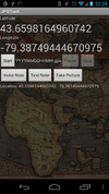
|
no | yes | no | yes | no | yes | ? | BSD (source available) | free | EN | ? early release |
Track logging for OSM w/ photo, voice, text notes |
| Kartograph [121] | 
|
? | ? | ? | ? | ? | ? | ? | GPL/AGPL | free | EN | ? | |
| KDR GPS Tracker [122] | no | yes | no | yes | yes | yes | yes | ? | ? | DE | 2010-08-10 2.68 Rev.3 |
feature-rich Logger (alarms,track convert+management,...) | |
| Keypad-Mapper 3 [123] | no | yes | no | no | no | yes | no | BSD | free | DE; EN; ES; FR; GR; IT; NL; PL; RU | 2013-06-13 3.1.00 |
Bardzo wydajne mapowanie numerów domów. | |
| Keypad-Mapper 3 [124] | no | yes | no | no | no | yes | no | BSD | free | DE; EN; ES; FR; GR; IT; NL; PL; RU | 2013-06-13 3.1.00 |
highly efficient mapping of house numbers | |
| KeypadMapper2 [125] | 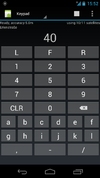
|
no | yes | no | no | no | yes | no | BSD | free | EN; DE; RU | 2012-06-08 1.8 |
Dedicated to housenumber mapping |
| kMaps [126] | 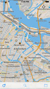
|
no | yes | no | yes | no | no | no | nonfreeproprietary | nonfreeFree | EN | 2014-10-16 1.1.18 |
Free offline maps, covering the entire world |
| Kogutowicz [127] | yes | yes | yes | ? | ? | ? | ? | Apache | free | EN | 2010-06-06 0.2 |
under development | |
| komoot - Outdoor Routplaner [128] | 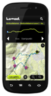
|
no | yes | no | yes | yes | yes | yes | nonfreeproprietary | free | DE | 2012-11-12 4.3 |
|
| komoot iPhone App [129] | 
|
no | yes | no | yes | yes | yes | yes | nonfreefreemium | ? | DE; EN | 2013-08-07 5.2 |
free usage in a small region, larger/different regions can be bought |
| Kosmos [130] | 
|
yes | yes | yes | ? | ? | ? | ? | nonfreeproperiatary | free | EN | 2009-06-05 2.5.405.6 |
deprecated, sucessor is Maperitive |
| Layar Reality Browser | no | yes | no | yes | no | no | no | nonfreeproprietary | free | EN | ? 4.0.4 |
Augmented Reality browser mixes camera image with virtual reality | |
| Leisure [131] | 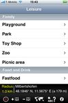
|
no | yes | no | yes | yes | no | no | nonfreeproprietary | nonfree0.99 | DE; EN; FR | 2010-12-15 2.3 |
|
| Level0 [132] | 
|
no | yes | no | ? | ? | ? | ? | WTFPL | ? | EN | 2014-05-20 1.1 |
Web-based OSM data editor |
| Level0 [133] | 
|
no | yes | no | ? | ? | ? | ? | WTFPL | ? | EN | 2014-05-20 1.1 |
網頁版開放街圖編輯器 |
| LiveMapViewer [134] | 
|
yes | yes | yes | yes | yes | no | no | nonfreeproprietary | free | ? | ? | Simple tool to see live changes in OSM. |
| Loadstone GPS [135] | no | yes | no | no | no | yes | no | GPL | free | many | 2010-05-25 0.74 |
for the blind | |
| LocA [136] | 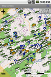
|
no | yes | no | yes | yes | yes | yes | nonfreeproprietary | free | EN; CZ | ? 0.1.1. |
Geocaching focused logger |
| LocateMe [137] | 
|
no | yes | no | yes | no | yes | no | nonfreeproprietary | free | EN | 2009-12-27 ? |
Share your Position to others |
| Location Tagger [138] | 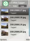
|
no | yes | no | no | no | yes | no | nonfreeproprietary | free | EN | 2010-05-21 1.0 |
Writes without interaction the location in a Photo. |
| Locations Tagger [139] | 
|
no | yes | no | no | no | yes | no | nonfreeproprietary | free | EN | 2012-02-23 1.2 |
|
| LocationWizard [140] | 
|
yes | yes | no | yes | no | no | no | nonfreeproprietary | nonfree85$ | EN | 2011-07-30 1.1 |
Map multiple addresses, find nearby client |
| LockOnMe [141] | 
|
no | yes | no | yes | no | no | yes | nonfreeproprietary | free | EN | ? | Location-sharing app, displaying targets and/or associated Points Of Interest on OSM & fun radars |
| Locus [142] | 
|
no | yes | no | yes | yes | yes | yes | nonfreeproprietary | nonfreefree, paid | EN; AR; CZ; DA; DE; EL; ES; FI; FR; HU; IT; JA; KO; NL; PL; PT; RU; SK | 2014-02-21 v2.19.1 |
Online/Offline map viewer (area downloader or tile cache), support slippy (non-free too) and vector maps (MapsForge library), guiding, routing and basic navigation (online only), track recording with detailed POIs (including photos) and altitude correction, extensive geocaching support, WMS maps and more |
| lokiGo [143] | 
|
? | ? | ? | yes | yes | yes | no | nonfreeproprietary | free | EN | 2010-02-17 ? |
embedds map in JARs |
| Looking4Cache [144] | 
|
no | yes | no | yes | no | no | no | nonfreefree;proprietary | nonfreefree;8,99$ | DE; EN | 2013-08-15 1.3 |
Geocaching App with a lot of functions. Including vector maps for complete offline caching. |
| LoroDux [145] | 
|
no | yes | no | no | no | no | no | GPL | free | DE | 2010-10-14 alpha |
Routing for visually impaired/blind users |
| luckyGPS [146] | 
|
yes | yes | yes | yes | ? | yes | ? | GPL | free | DE; EN; HU | 2010-11-22 0.751 |
|
| Maemo Mapper [147] | 
|
no | yes | no | yes | yes | yes | no | GPL | free | EN | 2010-03-15 3.0 |
|
| Maep [148] | 
|
no | yes | no | yes | no | yes | no | GPL | free | EN | 2010-06-05 1.3.6 |
Map viewer only |
| maloo outdoor [149] | yes | yes | no | yes | no | yes | yes | nonfreeproprietary | nonfree2.99$;2.99€ | EN | 2013-11-16 2.0.0.0 |
Outdoor App designed for hiking and other activities like biking or jogging. | |
| Map Mobile Navigator [150] | 
|
no | yes | no | yes | yes | yes | yes | nonfreeproprietary | free | 12+ | 2011-05-03 4.8.14 |
|
| Map-Hiker | 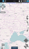
|
no | yes | no | yes | yes | no | yes | nonfreeproprietary | free | UK; EN; RU; FR; DE; PL; TR; FA | 2011-12-06 1.1.33 |
Easy to use, flexible UI, GPS, Compass, Placemarks |
| MapDiff [151] | yes | yes | yes | ? | ? | ? | ? | BSD | nonfree20$;35€ | EN | 2008-03-06 1.0 |
Visualizes User Activities | |
| Mapdroid [152] | 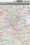
|
no | yes | no | yes | no | no | no | LGPL | free | EN | ? alpha |
Open Source proof-of-concept Android OpenStreetMap viewer. |
| MapDroyd [153] | 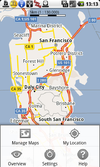
|
no | yes | no | yes | no | no | no | nonfreeproprietary | free | EN; DE | 2012-05-23 v1.1.6 |
Offline vector map viewer for Android. Compact one-off data downloads |
| Maperitive [154] | 
|
yes | yes | yes | ? | ? | ? | ? | nonfreeproprietary | free | EN | 2011-11-08 2.3.32 |
Desktop based |
| mapFactor Navigator free [155] | 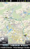
|
yes | yes | no | yes | yes | yes | yes | nonfreeproprietary | free | CZ; DE; EN; RU; ... | 2013-05-20 12.1.10 |
professional framework for OSM-based car navigation |
| Mapgen.pl | 
|
no | yes | yes | ? | ? | ? | ? | ? | ? | EN | 2010-11-17 1.12 |
easy to use cause limited concept |
| Mapnik [156] | yes | yes | yes | ? | ? | ? | ? | LGPL | free | EN | 2013-06-03 2.2.0 |
||
| MapOSMatic [157] | 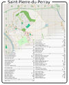
|
yes | yes | yes | ? | ? | ? | ? | AGPLv3 | free | 7 | 2012-04-19 (unstable) |
Mapnik render and streetlist |
| MapOut [158] | 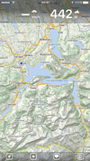
|
no | yes | no | yes | no | yes | yes | nonfreeproprietary | nonfree4.49€ | EN; DE | 2014-03-26 2.2.2 |
Offline map covering the whole world, OpenGL vector rendering |
| mAPP [159] | 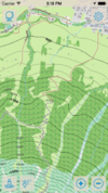
|
no | yes | no | yes | no | yes | yes | nonfreeproprietary | nonfreeInApp Purchases | DE; EN | 2014-01-14 1.0 |
Offline topo vector maps for iPhone and iPad |
| mAPPedplanet [160] | 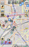
|
no | yes | no | yes | yes | yes | no | nonfreeproprietary | nonfreefree, paid | EN; DE | 2012-10-21 v3.0 |
Online/Offline map viewer (own area vector maps with special informations), many standard tools build in |
| MapQuest [161] | no | yes | no | yes | no | no | no | nonfreeproprietary | free | EN | 2011-02-19 1.0.0-beta |
||
| MapQuest4Mobile | 
|
no | yes | no | yes | ? | ? | ? | nonfreeproprietary | free | EN | 2011-02-16 1.0b |
|
| MapRoulette [162] | 
|
no | yes | no | ? | ? | ? | ? | Apache | nonfreenone | EN | 2014-07-29 20140729 |
Towards a better map, one bug at a time. |
| Maps (-) [163] | no | yes | no | yes | no | no | no | Apache License 2.0 | free | EN | 2010-04-19 1.6.0 |
Map viewer only. Caches tiles to SD card for offline viewing. | |
| MAPS.ME [164] | 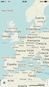
|
no | yes | no | yes | no | no | no | nonfreeproprietary | nonfreeFree/$4.99 for Pro | EN; RU; CS; DE; ES; FR; IT; JA; KO; NL; UK; ZH-HANT; PL; PT; HU; TH; ZH-HANS; AR; DA; TR | ? 3.0.2 |
Offline maps of all countries, fast renderer, offline search, whole planet fits to 12Gb |
| Maps4Mac [165] | 
|
no | yes | no | yes | yes | yes | yes | GPL | free | EN | 2011-03-23 Beta 2 |
An offline map browser for MacOS |
| Mapsforge [166] | 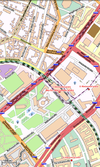
|
no | yes | no | yes | no | no | no | LGPL3 | free | EN; DE; FI; IT | 2014-05-08 0.4.0 |
map application library |
| MapStalt Mini [167] | 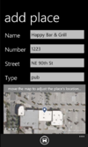
|
yes | yes | no | no | no | ? | ? | nonfreeproprietary | nonfreefree as in beer | EN | 2011-08-01 1.0.0.0 |
"MapStalt puts to power to complete the map into the hands of the mobile user" (grammar by Microsoft) |
| MapTap [168] | 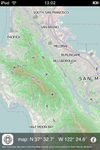
|
no | yes | no | ? | ? | ? | ? | nonfreeproprietary | nonfree5€ | EN | 2010-04-19 1.5 |
|
| MapTool [169] | 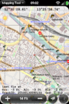
|
no | yes | no | yes | no | no | yes | nonfreeproprietary | free | EN | ? 4.7.0 |
|
| Mapzen POI Collector [170] | 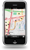
|
no | yes | no | yes | no | no | no | nonfreeproprietary | free | EN | 2010-12-19 1.2.5 |
Easy to use app to map just POIs |
| Marble [171] | 
|
yes | yes | yes | yes | yes | yes | yes | LGPL | free | DE; EN; ... | 2013-08-14 1.6 |
Virtual globe with multiple projections, tiles and vector data, routing and POI search |
| Marble Touch | no | yes | no | yes | yes | yes | ? | GPL | free | . | 2012-02-12 1.3.2 |
Mobile version of Marble | |
| Maverick [172] | 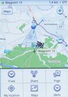
|
no | yes | no | yes | yes | yes | yes | nonfreeproprietary | nonfreefree, pd version available | EN | ? 1.95 |
Geocaching support, POI Radar |
| MB-Ruler [173] | 
|
yes | yes | no | ? | ? | ? | ? | nonfreeproprietary | free | DE; EN; ... | ? 4.0 |
Onscreen triangular ruler and protractor |
| Memphis [174] | yes | yes | yes | ? | ? | ? | ? | LGPL | free | EN | 2010-06-07 0.2.3 |
map rendering application and library | |
| Merkaartor [175] | 
|
yes | yes | yes | ? | ? | ? | ? | GPL | free | EN | 2012-06-12 0.18.1 |
Good editor with styling |
| Minimap [176] | 
|
no | yes | no | yes | no | yes | no | nonfreeproprietary | free | EN; DE; FR | 2010-04-01 1.1 |
|
| mkgmap [177] | 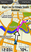
|
yes | yes | yes | ? | ? | ? | ? | GPL | free | ? | ? | Make OSM maps for your Garmin device |
| Mobile Atlas Creator [178] | 
|
yes | yes | yes | yes | no | no | no | GPL | free | ? | 2011-06-21 1.9b6 |
Tiles export for lot of mobile offline nav tools |
| Mobile GMaps [179] | 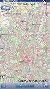
|
no | yes | no | yes | yes | yes | no | nonfreeCC-nc-nd | ? | EN | 2009-08-22 1.42.01 |
|
| Mobile Trail Explorer [180] | 
|
no | yes | no | yes | no | yes | yes | GPL | free | 5 | 2009-03-24 1.14 |
|
| MojoTracker [181] | no | yes | no | no | no | yes | yes | BSD | free | EN | 2010-11-13 0.2.3 |
||
| MoNa [182] | 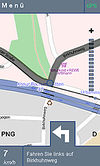
|
no | yes | no | yes | yes | no | yes | GPL | free | DE | 2010-07-13 1.0.6 |
MoNa ist eine unter JavaME entwickelte Ortungs- und Navigationslösung, welche sich die freien Daten des OpenStreetMap-Projektes zu nutzen macht. |
| MoNav [183] | 
|
yes | yes | yes | yes | yes | yes | no | GPL | free | EN | 2011-04-23 0.3 |
Contraction Hierarchies routing, custom speed profiles, extremely fast and resource conservative routing, can handle huge graphs like Europe on mobile devices. Only source code available for download - has to be compiled by yourself! |
| More Maps [184] | 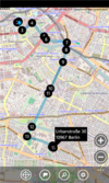
|
yes | yes | no | yes | yes | ? | no | nonfreeproprietary | nonfree0.99 € | DE,EN | 2012-06-06 2.1.0.0 |
|
| MOSME | 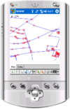
|
no | yes | no | ? | ? | ? | ? | GPL | free | EN | 2007-12-24 ? |
discontinued |
| MotionX-GPS [185] | 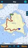
|
no | yes | no | yes | yes | yes | yes | nonfreeproprietary | nonfree1.99$, 1.79€ | EN | 2013-08-20 21.1 |
|
| Multi Map [186] | 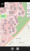
|
yes | yes | no | yes | no | no | no | nonfreeproprietary | free | EN | 2011-10-19 1.0 |
Very simple map viewer |
| Mumpot [187] | 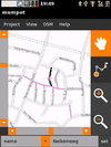
|
no | yes | yes | yes | ? | yes | ? | GPL | free | DE; EN; ... | 2009-04-20 0.6 |
Touchscreen based Data editor |
| My Tracks [188] | 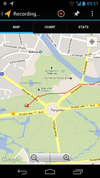
|
no | yes | no | no | no | yes | yes | Apache License 2.0 | free | EN; | 2012-08-04 2.0 |
recording tracks (no OSM features) |
| myTracks [189] | 
|
no | yes | no | yes | no | yes | no | nonfree9.95 Euro | ? | DE; EN; FR | 2010-10-10 2.2.11 |
Viewer for GPS tracks, waypoints and geotagged photos |
| MyTrails [190] | 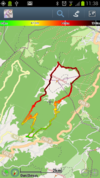
|
no | yes | no | yes | yes | yes | yes | nonfreeproprietary | nonfreefree;paid | DE; EN; FR; IT; ES; PT; NL | 2012-05-31 1.2.40 |
MyTrails is an Android application that makes it easy and fun to view online and offline maps, and to record and share GPS tracks. It is designed to offer an uncluttered map area, and the smoothest map navigation (drag, pinch-zooming, etc.) on a mobile device. |
| NASA World Wind [191] | 
|
yes | yes | yes | yes | ? | ? | ? | ? | ? | EN | 2007-02-14 1.4.0 |
3D Globe that can be extended by a lots of AddOns, Layers,... |
| Nauta [192] | 
|
no | yes | no | no | no | yes | no | GPL | free | EN | 2008-11-19 3.17 |
|
| Navatar [193] | no | yes | no | yes | yes | no | no | nonfreeproprietary | free | PL | 2011-08-31 1.3.3 |
Poland only | |
| NavDroyd [194] | 
|
no | yes | no | yes | yes | no | no | nonfreeproprietary | nonfree5€ | DE; EN; FR; IT; SP; PO | 2012-03-27 1.4.2 |
|
| NAVeGIS [195] | 
|
yes | yes | no | yes | yes | yes | yes | GPLv3 | free | EN; ES; FR; GE; GR; IT | 2014-09-19 1.8.0.6 |
|
| NavFree [196] | 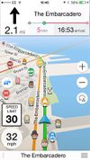
|
no | yes | no | yes | yes | no | no | nonfreeproprietary | nonfreeFor Android is free. For iOS the first country is free, then €2.69. | EN; ES; DA; DE; FR; SW; IT and others | ? 1.9.8.8675 |
Free satnav app. Maps available: Andorra, Argentina, Australia, Austria, Benelux (Belgium, Netherlands, Luxembourg), Brazil, Canada, Croatia, Czech Republic, Denmark, Estonia, Finland, France, Germany, Hungary, India, Ireland, Italy, Latvia, Lithuania, Mexico, Monaco, Netherlands, New Zealand, Norway, Poland, Portugal, Slovakia, Slovenia, South Africa, Spain, Sweden, Switzerland, UK. |
| NaviComputer [197] | 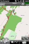
|
yes | yes | no | yes | no | yes | no | nonfreeproprietary | free | 7 | 2010-11-24 0.95 |
|
| Navigon Urban [198] | 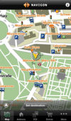
|
no | yes | no | yes | yes | no | ? | nonfreeproprietary | nonfree4.49€ | DE; EN | 2013-02-20 1.2.0 |
Offline router esp. for pedestrians/cyclists |
| Naviki [199] | 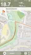
|
no | yes | no | yes | no | yes | no | nonfreeproprietary | free | DE | 2011-02-24 1.5 |
Only Germany supported |
| Navio [200] | 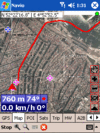
|
yes | yes | no | yes | yes | yes | yes | nonfree25$ | ? | EN | ? 3.15 |
|
| NaviPOWM [201] | 
|
yes | yes | no | yes | yes | yes | yes | GPL | free | EN | 2011-07-05 0.2.6 |
|
| Navit [202] | 
|
yes | yes | yes | yes | yes | yes | yes | GPLv2 | free | 43 | 2013-01-13 0.2.0 |
Most popular OpenSource Car navigation tool; maps (offline-"custom"), vector-rendered |
| Navitel [203] | 
|
yes | yes | no | yes | yes | yes | no | nonfreeproprietary | nonfree17€ | EN; RU | 2011-06-10 5.0.0.1620 |
Popular in Russia |
| Navlet [204] | 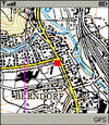
|
no | yes | no | yes | no | yes | no | GPL | free | EN | ? 0.11 |
can use WMS servers, too |
| NavSys [205] | 
|
no | yes | yes | yes | yes | yes | yes | GPL | free | EN | 2005-03-11 0.0.9 |
Navi and Mediaplayer |
| Nik4 [206] | yes | yes | yes | ? | ? | ? | ? | WTFPL | ? | EN | 2014-06-04 1.4 |
Mapnik-to-image exporting script | |
| Nogago [207] | 
|
no | yes | no | yes | yes | yes | yes | nonfreeOpenSource | nonfreefree, offline maps: 4,95 Euro; licence key: 7,99 Euro | DE; EN; NE | 2012-12-22 3.14 |
Topographic Offline-Maps and Navigation for Hiking, Cycling and Biking |
| Nomino [208] | yes | yes | yes | yes | ? | ? | ? | AGPL | free | EN; FR; CA | ? | ||
| Noni GPSPlot for Windows Mobile [209] | 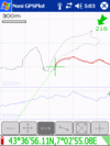
|
no | yes | no | yes | no | yes | yes | nonfreeproprietary | free | EN | 2010-08-22 3.0.2 |
|
| Offline Maps [210] | 
|
yes | yes | no | yes | no | ? | ? | nonfreeproprietary | nonfree1.49 € | EN | 2011-06-23 1.3.0.0 |
|
| OffMaps 2 [211] | 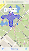
|
no | yes | no | yes | no | no | no | nonfreeproprietary | nonfree1,59€ | DE,EN | 2011-03-01 1.05 |
Offline maps and POIs for selected destinations around the world. Combines OSM map with Wikipedia Articles. |
| OMaps [212] | 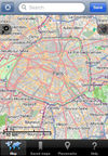
|
no | yes | no | yes | no | no | no | nonfreeproprietary | nonfree1,99$ | EN | 2010-06-12 1.3.3 |
|
| Open Car InfoTainmenT system [213] | 
|
yes | yes | yes | yes | no | yes | no | GPL | free | EN | 2008-06-12 0.1.0-rc1 |
Navi as part of an car infotainment system |
| Open GPS Tracker [214] | no | yes | no | yes | no | yes | yes | GPLv3 | free | EN; NL; DE; IT; FR; CH | 2012-01-02 1.3.1 |
Offline GPS tracker with optional osmdroid map activity | |
| Open Source Routing Machine [215] | 
|
no | yes | yes | ? | yes | ? | ? | BSD | free | EN | ? 0.3.6 |
Routing server, Contraction Hierarchies routing, extremely fast |
| OpenBusMap [216] | 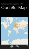
|
yes | yes | no | yes | no | no | no | nonfreeproprietary | free | EN | 2012-04-10 1.1.0.0 |
Public Transport map viewer |
| OpenCityMap [217] | 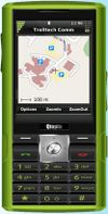
|
no | yes | no | yes | no | yes | no | GPL | free | EN | 2008-06-01 0.1.1 |
|
| OpenFixMap [218] | 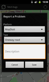
|
no | yes | no | yes | no | no | no | GPL | free | EN; FR; ET; DE; RU | 2014-04-06 0.5.4 |
Display errors from keepright, mapdust and openstreetbugs |
| OpenMaps [219] | 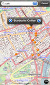
|
no | yes | no | yes | yes | no | no | nonfreeproprietary | nonfree2,39€ , free | EN | 2011-10-12 4.5.4 |
Share & comment on OSM places via Twitter |
| openMarkers [220] | 
|
no | yes | no | ? | ? | ? | ? | GPL & CC. | free | Multiples | 2011-09-27 6.0 |
Rate the OSM places by price |
| OpenSatNav [221] | 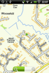
|
no | yes | no | yes | yes | yes | no | GPLv3 | free | EN | 2009-12-29 0.9 |
Routing and recording trip; maps (online+cache); navigation (online) |
| OpenSeaMap [222] | 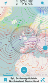
|
no | yes | no | yes | no | no | yes | nonfreeproprietary | ? | DE,EN,FR | 2013-08-10 2.1 |
App for searching and offline caching |
| OpenStreetMap Watch List [223] | ? | ? | ? | yes | no | no | no | ? | ? | EN | ? | API for analyzing and visualizing changes in OSM data | |
| OpenStreetMap-in-a-Box (osminabox) [224] | 
|
yes | yes | yes | yes | ? | ? | ? | New BSD License | nonfreen/a | EN,DE | 2013-03-31 1.1 |
A ready-made map and geodata server including a highly configurable converter which synchronizes OpenStreetMap data. |
| Openstreetnav [225] | 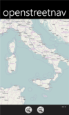
|
yes | yes | no | yes | no | no | no | nonfreeproprietary | free | EN | 2012-10-03 1.1 |
Very simple map viewer |
| OpenTrail [226] | 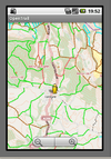
|
no | yes | no | yes | yes | yes | no | GPL | free | EN | 2013-02-10 0.1 beta |
Freemap for Android |
| OpenTripPlanner for Android [227] | 
|
no | yes | no | yes | no | yes | no | Apache License v2.0 | free | EN; DE; ES; FR; GL; PT; RO | 2014-07-07 v2.0.5 |
An Android app for multi-modal trip planning using any OpenTripPlanner server |
| OruxMaps [228] | 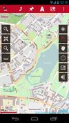
|
no | yes | no | yes | yes | yes | no | nonfreefreeware | free | EN; DE | 2013-10-06 v5.5.11 |
OruxMaps is a map viewer. It can work in two modes: online with google, microsoft, yandex,... maps, and offline, with calibrated maps for OruxMaps, or online maps which have been saved |
| OSG-Explorer [229] | 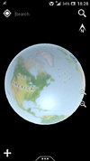
|
no | yes | no | yes | no | no | no | nonfreeproprietary | free | EN | 2013-10-27 1.1.x |
OpenStreetMap 3D on Android |
| OSM [230] | 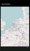
|
yes | yes | no | yes | ? | ? | no | nonfreeproprietary | free | EN | 2012-01-13 1.1.0.0 |
Map viewer |
| OSM Analysis [231] | 
|
no | yes | no | ? | ? | ? | ? | ? | nonfreenone | EN | 2013-12-05 ? |
Screenshot of OSM Analysis tool, East of England. |
| OSM Gpx Uploader [232] | 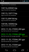
|
no | yes | no | no | no | no | no | nonfreeproprietary | free | EN | 2013-05-23 1.4 |
Generic GPX file uploader |
| osm-android [233] | no | yes | no | yes | no | yes | no | GPLv3 | free | ? | 2009-10-21 0.0.9 |
renders OpenStreetMap maps and calculates routes | |
| OSM2Facebook [234] | 
|
no | yes | no | ? | ? | ? | ? | ? | ? | EN | 2011-03-02 1.0 |
Posts your changesets to the facebook wall and helps to deploy OpenStreetMap in Social-Networks. |
| OSM2Go [235] | 
|
no | yes | yes | yes | no | yes | no | GPL | free | EN | 2010-02-21 0.8.3 |
Mobile, touchscreen based editor |
| OSM2Palm [236] | 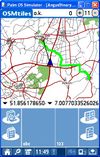
|
yes | yes | no | yes | no | yes | yes | GPL | free | EN | 2009-05-24 1.6 |
|
| OSM2World [237] | 
|
yes | yes | yes | ? | ? | ? | ? | LGPL | free | EN | 2012-01-11 0.1.9 |
Creates a 3D model of the world from OSM data. |
| Osm2xp [238] | 
|
yes | yes | yes | ? | ? | ? | ? | GPL v3 | free | EN | 2012-08-03 2.0.2 |
osm2xp generated scenery under x-plane 10. |
| OsmAnd [239] | 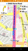
|
no | yes | no | yes | yes | yes | yes | GPL v3 | nonfreefree or 5.99€ | EN; RU; DE; FR; AR; BG; BS; CS; DA; ES; EU; FI; HE; HI; HU; HY; ID; IT; JP; KA; KO; IT; LV; MR; NL; NO; PL; PT; RO; SK; SR; SV; UK; VI; ZH | 2014-07-16 1.8.2 |
|
| OSMapTuner [240] | 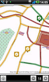
|
no | yes | no | yes | no | no | no | nonfreeproprietary | free | ? | 2012-03-14 1.0 |
Simple editor for manipulating tags on your smartphone |
| Osmarender | 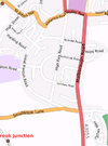
|
yes | yes | yes | ? | ? | ? | ? | GPL | free | EN | ? | |
| Osmbrowser [241] | no | yes | yes | ? | ? | ? | ? | ? | ? | EN | 2010-06-10 ? |
Viewer for large OSM files | |
| OSMBugs [242] | 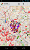
|
no | yes | no | yes | no | no | no | GPL | free | EN; DE | 2013-10-19 0.5.3 |
Display and edit Bugs from Notes, Keepright and Mapdust |
| osmdroid [243] | 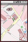
|
no | yes | no | ? | no | no | no | Apache License 2.0 | free | EN | 2014-01-24 4.1 |
Replaces GMaps views; maps (online/offline-"andnav2") |
| osmeditor | 
|
yes | yes | yes | ? | ? | ? | ? | GPL | free | EN | 2009-12-24 ? |
discontinued |
| Osmeditor (QT) | 
|
yes | yes | yes | ? | ? | ? | ? | GPL | free | EN | 2006-12-24 ? |
discontinued |
| OSMembrane [244] | 
|
yes | yes | yes | ? | ? | ? | ? | GPL | free | EN | 2011-02-18 845 |
Frontend for Osmosis |
| OSMfocus | 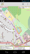
|
no | yes | no | yes | no | no | no | ? | free | EN | 2014-10-09 0.1.1rc1 |
Shows details of nearby objects from OSM so they can be verified during a survey |
| OSMLogger [245] | 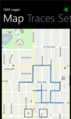
|
yes | yes | no | yes | no | yes | no | nonfreeproprietary | free | EN | 2012-04-07 0.9.0.0 |
Record GPX traces |
| OSMLY [http://osmly.com] | 
|
no | yes | no | yes | ? | ? | ? | BSD | free | EN | 2013-09-19 1.0.0 |
A simple import editor |
| OsmPad [246] | 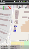
|
no | yes | no | yes | no | no | no | ? | free | EN; DE | 2012-04-19 1.0 |
Utility to gather house numbers for OpenStreetMap |
| Osmpedit | 
|
? | ? | ? | ? | ? | ? | ? | GPL | free | EN | 2006-12-24 ? |
discontinued |
| Osmrender.pl | 
|
no | yes | yes | ? | ? | ? | ? | GPL | free | EN | ? | deprecated, successor is Mapgen.pl |
| OSMroute [247] | yes | yes | yes | yes | no | yes | no | GPL | free | EN | 2010-10-13 alpha |
Very early stage! | |
| OsmSharp [248] | 
|
yes | yes | yes | ? | ? | ? | ? | GPLv3 | free | EN | 2013-04-06 3.1 |
OSM routing and optimisation library. |
| OSMTrack [249] | 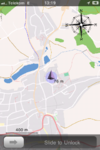
|
no | yes | no | yes | no | yes | yes | nonfreeproprietary | nonfree0,99$ | EN, DE, FR | 2011-12-22 3.0.3 |
Easy to use tracking app with offline, user-updateable vector map and direct upload to OpenStreetMap |
| OSMtracker | no | yes | no | yes | no | yes | no | GPLv3 | free | DE; EN | 2010-02-08 0.10.1 |
||
| OSMTracker for Android [250] | no | yes | no | yes | no | yes | yes | GPLv3 | free | AR; DA; DE; EL; ES; EU; EN; FI; FR; GL; HY; IT; IW; JA; MY; NB; NL; NN; PL; PT; RU; SK; SV; TH; UK; ZH | 2013-09-16 0.6.6 |
Offline GPS tracker with fast POI placement shortcuts. Exports in GPX format with waypoints, suitable for editing in JOSM. Clone of OSMtracker (Windows Mobile) | |
| OSMZmiany [251] | 
|
no | yes | no | yes | no | no | no | nonfreeproprietary | free | ? | ? | A tool to view node edits in near real-time |
| outdoor-gps [252] | 
|
no | yes | no | no | yes | yes | yes | nonfree$ | ? | EN | 2009-11-14 1.3 R276 |
|
| OziExplorer [253] | 
|
yes | yes | no | yes | yes | yes | yes | nonfreeproprietary | nonfree30€ | EN | 2010-05-05 3.95.5k |
Featurerich |
| Parsefsh [254] | yes | yes | yes | ? | ? | ? | ? | GNU GPLv3 | free | ? | ? 1.0 |
Decodes Raymarine FSH | |
| Parsetrk [255] | no | yes | yes | ? | ? | ? | ? | GNU GPLv3 | free | ? | ? 1.0 |
Decodes Garmin TRK Subfiles | |
| Path Tracker [256] | no | yes | no | yes | no | yes | no | nonfreeproprietary | nonfree1,99$ | EN | 2008-09-27 1.4.2 |
||
| PathAway GPS [257] | 
|
no | yes | no | yes | yes | yes | yes | nonfreeproprietary | nonfree60-95$ | EN; DE | 2009-10-01 5.0 |
Deals with a lot of geo datums |
| Pocket Earth Offline Maps & Travel Guides [258] | 
|
no | yes | no | yes | yes | yes | no | nonfreeproprietary | nonfree0.99$ | EN,DE,FR,ES,NL,RU,CS | 2014-09-06 2.3 |
OpenGL powered Offline Maps (OSM) and Travel Guides (wikivoyage) with Wikipedia Articles, GPS Track Recording, Online Routing, and other advanced features and customization |
| PocketGIS [259] | 
|
yes | yes | no | yes | yes | yes | yes | nonfreeproprietary | nonfree0 | RU; | 2011-04-16 0.95/0.60 "Сейда" |
Easy and nice UI, web-like search, routing, navigation. |
| PocketNavigator [260] | 
|
no | yes | no | yes | yes | no | no | nonfreeproprietary | free | EN | 2012-03-16 3.3 |
Android navigation application, aiming at pedestrians. Information on the next waypoint can be encoded in tactile feedback. |
| POI+ [http://App Store] | 
|
no | yes | no | yes | no | no | no | GNU GPLv3 | free | EN; CA; JA; DE:PL | 2013-06-04 1.6.1 |
Simple iOS app for adding and editing a POI |
| POI-Witch | ? | ? | ? | ? | ? | ? | ? | ? | ? | EN | ? alpha |
POI logger | |
| Potlatch 1 [261] | 
|
yes | yes | yes | ? | ? | ? | ? | PD | free | DE; EN | 2010-12-24 1.4 |
|
| Potlatch 2 [262] | 
|
no | yes | no | ? | ? | ? | ? | WTFPL | ? | EN | ? | |
| PTGMAP [263] | 
|
no | yes | no | yes | yes | yes | yes | nonfreeproprietary | free | EN | 2010-11-16 1.2.9 |
|
| Pushpin OSM [264] | 
|
no | yes | no | yes | no | no | no | nonfreeproprietary | free | EN | 2012-12-06 1.1 |
Simple POI editor. |
| Pyrender | 
|
yes | yes | yes | ? | ? | ? | ? | ? | ? | EN | ? | |
| Pyroute [265] | 
|
yes | yes | yes | yes | no | no | no | GPL | free | EN | ? | Routing tool, predecessor of rana |
| PyS60Editor [266] | no | yes | no | ? | ? | ? | ? | ? | ? | EN | ? | ||
| QGIS [267] | File:Qgis08 grass6 toolbox.png | yes | yes | yes | ? | ? | ? | ? | GPL | free | EN, ? | ? 2.4.0 |
a free, multiplatform GIS application |
| QGIS [268] | 
|
yes | yes | yes | ? | ? | ? | ? | GPL | free | DE; EN | 2010-07-29 1.5 |
Plugin adding OSM support to QGIS |
| QpeGPS [269] | 
|
no | yes | no | yes | yes | yes | yes | GPL | free | EN | 2008-06-04 0.2.3.4 |
|
| QuoVadis [270] | 
|
yes | yes | no | yes | yes | yes | yes | nonfreeproprietary | nonfree0,00 € - 279,95 € | DE; EN | ? 7.0.1.31 |
|
| QuoVadis Mobile [271] | 
|
yes | yes | no | yes | yes | yes | yes | nonfreeproprietary | nonfree19.99 € | DE; EN | 2014-02-27 1.0.3.3 |
QuoVadis Mobile ist Ihre "Alles-Inklusive-App", wenn es um Navigation, GPS und Karten geht. On- und Off-Road, zu Fuß, mit dem Fahrrad oder Auto, immer dabei und kinderleicht in der Bedienung. Tracking ermöglicht Live-Übertragung und Darstellung von Positionen. |
| Rana | 
|
no | yes | yes | yes | yes | yes | yes | GPL | free | EN | ? | Touchscreen based Navi |
| RawEditor [272] | 
|
no | yes | no | ? | ? | ? | ? | GPL | free | EN | ? | Webfrontend to edit OSM XML directly |
| RMaps [273] | 
|
no | yes | no | yes | no | yes | yes | GPL | free | EN; RU | 2011-08-28 0.8.9 |
Maps and a compass, maps (online/offline-"rmaps") |
| Roadee [274] | 
|
no | yes | no | yes | no | no | no | nonfreeproprietary | nonfree1,99$ | EN | 2009-10-21 1.2 |
|
| RoadMap [275] | 
|
yes | yes | yes | yes | yes | yes | no | GPL | free | EN | 2009-02-02 1.2.1 |
|
| RoadMap Editor [276] | 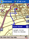
|
yes | yes | yes | yes | yes | yes | no | GPL | free | EN; HE | ? | Fork of RoadMap |
| RoadNav [277] | 
|
yes | yes | yes | yes | yes | yes | no | GPL | free | EN | 2007-10-19 0.9 |
|
| RouteConverter [278] | 
|
yes | yes | yes | yes | no | no | yes | GPL | free | DE; EN; FR; NE; ES | 2014-04-04 2.12 |
GPS routes analyser with an experimental branch for offline routing with mapsforge maps |
| Routino [279] | 
|
no | yes | yes | ? | ? | ? | ? | Affero GPLv3 | free | EN; DE; NL; FR; RU | 2014-06-26 2.7.2 |
Flexible router with web interface and routing data analyser. |
| Routino Frontend [280] | no | yes | no | no | no | no | no | GPL | free | EN | 2010-06-27 1.4 |
UI for routino engine and Maemo Mapper | |
| RTKLIB [281] | 
|
yes | yes | yes | ? | ? | ? | ? | Free | free | EN | 2013-04-29 2.4.2 |
Open source program package for GNSS positioning |
| RTrender | 
|
yes | yes | no | ? | ? | ? | ? | nonfreeproprietary | free | EN | 2010-10-30 ? |
Realtime OSM rendering |
| Run.GPS [282] | no | yes | no | yes | no | yes | yes | nonfreeproprietary | nonfree20€ | DE; EN; ... | 2010-07-07 2.37 |
Sport focused logger | |
| Seewetter Pro [283] | 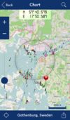
|
no | yes | no | yes | no | no | no | nonfreeproprietary | nonfree€5.99 | DE | 2012-01-21 2.1 |
App for searching and offline caching |
| ShareNav [284] | 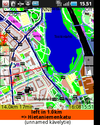
|
yes | yes | yes | yes | yes | yes | yes | GPLv2 | nonfree€2.99 on Google Play Store (may vary depending on local taxes) | EN; DE; FI; CS; PL; RU; FR; IT; ES; SK | 2012-11-12 0.8.8 |
very portable navi for Android&J2ME mobile phones, uses offline vector maps, audio navigation |
| Shozu [285] | ? | ? | ? | no | no | yes | no | nonfreeproprietary | free | EN | ? | phototagging app | |
| Shp-to-osm.jar [286] | ? | ? | ? | ? | ? | ? | ? | GPL | free | EN | 2010-05-08 0.8.2 |
Easy to use, nice UI | |
| ShugenDoMap [287] | 
|
yes | yes | no | ? | ? | ? | ? | nonfreeproprietary | free | EN | 2011-11-19 alpha |
Realtime 3D OSM rendering on multiple platforms. |
| SikaSimplex [288] | 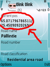
|
no | yes | no | no | no | yes | no | GPL | free | EN | 2009-09-08 0.0.1 |
Log Roads directly to OSM |
| Simple OSM [289] | 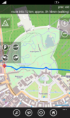
|
yes | yes | no | yes | yes | yes | yes | nonfreeproprietary | nonfree1.99€ | EN | ? 2.13.0.0 |
OpenStreetMap for Windows Phone. Displays online maps, record tracks and provides several OSM unrelated features. |
| Skobbler GPS Navigation [290] | 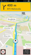
|
no | yes | no | yes | yes | no | no | nonfreeproprietary | nonfreeAndroid: €1.00, free Version available (no offline maps); iOS: €1.79 | EN; DA; NL; FR; DE; HU; IT; PO; RO; RU; ES; SV; TR | 2014-09-11 6.0 |
Online and offline worldwide turn-by-turn navigation. Includes pedestrian and cyclist route planner, TripAdvisor, Foursquare and speed camera warning integration. |
| smrender [291] | 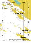
|
yes | yes | yes | ? | ? | ? | ? | GNU GPLv3 | free | ? | ? 3.0 |
|
| Spatial Manager Desktop™ [292] | 
|
yes | yes | no | yes | no | no | no | nonfreeproprietary | nonfree$149,00 - $499,00 | EN; ES | 2014-06-06 1.0.1 |
Manage spatial data in a simple, fast and inexpensive way. Includes its own OSM data provider |
| Spatial Manager™ for AutoCAD [293] | 
|
yes | yes | no | yes | no | no | no | nonfreeproprietary | nonfree$99,00 - $179,00 | EN; ES | 2014-06-06 1.0.1 |
Powerful AutoCAD plug-in. Imports spatial data in a simple, fast and inexpensive way. Includes its own OSM data provider |
| Splitimg [294] | no | yes | yes | ? | ? | ? | ? | GNU GPLv3 | free | ? | ? 1.0 |
Splits Garmin's IMG/ADM into Subfiles | |
| Sports Tracker [295] | no | yes | no | yes | no | yes | yes | nonfreeproprietary | free | EN; DE; IT; ES | 2011-04-27 4.16 |
For sportsmen even with heartrate | |
| TangoGPS | 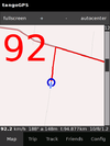
|
no | yes | yes | yes | ? | yes | yes | GPL | free | DE; EN; ... | 2010-06-25 0.99.4 |
Logger even for heartrate-monitors! |
| TEAM - Tutor for editable audio maps [296] | 
|
yes | yes | no | yes | no | no | no | GPL | free | DE; EN | 2010-09-07 3.0 |
Audible Maps Generator for accessibility |
| Terra Map GPS [297] | 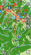
|
no | yes | no | yes | yes | yes | yes | nonfreeproprietary | nonfree2.99$;4.99$ | DE; EN; IT; FR; ES | ? 2.3 |
Amazingly clear map rendering, nice UI, import of KMZ, KML, GPX files. |
| The Map [298] | 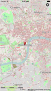
|
no | yes | no | yes | no | no | yes | nonfreeproprietary | nonfree1,99£ | EN | 2011-10-13 3.0.1 |
Offline Viewer for lots of countries. |
| TileMill [299] | 
|
yes | yes | yes | yes | no | no | no | BSD | free | EN | 2012-10-10 0.10.1 |
Mapnik webfrontend for custom mapstyles |
| Track'n Trail [300] | 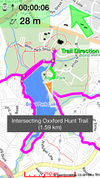
|
no | yes | no | yes | no | yes | no | nonfreeproprietary | nonfree0.99$ | DE; EN; FR | 2010-09-28 1.0.1 |
Direct upload to openstreetmap.org |
| Track2Karte [301] | 
|
yes | yes | no | yes | no | no | no | nonfreeproprietary | free | DE | ? | Very Simple Track Viewer |
| Track@Way [302] | 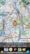
|
no | yes | no | yes | yes | yes | yes | GPL | free | DE; EN; EUS; NL; FR; IT; NO; ES; RU; FI; RO; . | 2014-05-29 2.1.5 |
A fast and easy to use map and tracking software. Ability to export tracks in GPX including your recorded POIs. Different maps to choose (OSM, Mapquest etc.). Many options and a support forum. |
| Trackator Lite [303] | File:Http://www.trackalia.com/include/trackator/images/Screenshot 2.png | no | yes | no | yes | yes | yes | no | nonfreeproprietary | free | ES; EN | 2013-07-13 1.01 |
Trackator is an application to record all your outdoor activities. You can record your route, add waypoints with comments, pictures, ... You can also report the equipment used in each activity. |
| TrackMyJourney [304] | no | yes | no | yes | yes | yes | yes | nonfreeproprietary | nonfree12/18 EUR for 6/12 months | EN | ? 0.8.0 |
Limited Free Version Available | |
| Trackspace [305] | 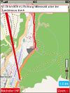
|
no | yes | no | yes | yes | yes | yes | nonfreeproprietary | free | DE | 2010-12-24 1.85 |
Some features might require a premium account |
| Trafficman Maps [306] | 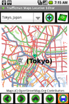
|
no | yes | no | yes | no | no | no | nonfreeproprietary | free | EN | 2009-07-30 1.2 |
Displays maps and lets you share a link by email |
| Trails [307] | no | yes | no | yes | no | yes | yes | nonfreeproprietary | nonfree3,99$ | DE; EN | 2013-11-11 6.00 |
||
| Trakkcor [308] | 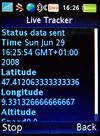
|
? | ? | ? | no | no | yes | no | ? | ? | DE; EN; ... | 2008-06-29 0.3 |
discontinued! |
| TravelDroyd [309] | 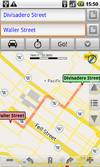
|
no | yes | no | yes | no | no | no | nonfreeproprietary | nonfree5€+books | 20 | ? | Combining offline OSM+wikipedia articles for travelguides that you have to buy |
| Traveling Salesman [310] | 
|
yes | yes | yes | yes | yes | no | no | GPL | free | EN | 2013-05-02 1.0.3-RC1 |
Highly modular router |
| TrekBuddy [311] | 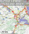
|
no | yes | no | yes | yes | yes | yes | nonfreenonfree | free | EN, localizations | 2014-07-29 1.2.6 |
Highly customizable navigation/map display tool |
| TripAdvisor [312] | no | yes | no | yes | no | no | no | nonfreeproprietary | free | EN | 2011-11-11 1.3.3 |
Dedicated Apps for 20 huge cities to find hotels | |
| TripGo [313] | 
|
no | yes | no | yes | no | no | no | nonfreeproprietary | ? | EN | 2014-08-29 4.0.1 |
Calendar-aware trip planner with real-time transport suggestions |
| True Offline Maps 2.0 [314] | 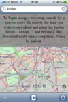
|
no | yes | no | yes | no | yes | no | nonfreeproprietary | nonfree4.99$ | EN | ? | |
| TTGPSLogger [315] | 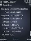
|
no | yes | no | no | no | yes | no | GPL | free | EN,DE | 2012-11-12 0.5.4 |
The GPS tracking log can be written in NMEA, GPX, or KML format by using Built-in GPS or Bluetooth GPS |
| Turbo GPS [316] | 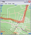
|
yes | yes | no | yes | yes | yes | yes | nonfreeproprietary | free | DE; EN; ... | 2012-09-07 2.73 |
TurboGPS is a fast all in one GPS tool. Moving maps custom or online, tracks, way points. |
| UK TravelOptions [317] | 
|
no | yes | no | yes | no | no | no | nonfreeproprietary | free | EN | 2011-01-06 ? |
Vector map viewing with tilting/spinning 3D buildings & transport data of London. |
| VataviaMap [318] | yes | yes | yes | yes | no | no | no | Artistic License;GPL | free | EN | 2011-22-03 0.0.0.3 |
Display for several map sources like OSM, Yahoo and others ... Desktop version requires .NET-Framework 2.0 or newer, tested with MONO-framework under Linux and MacOS | |
| Vectorial Map [319] | 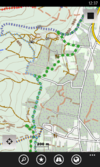
|
yes | yes | no | yes | no | yes | no | nonfreeproprietary | nonfreedepends on platform | EN | 2014-03-15 1.0 |
Vectorial Map is map viewer and track logger for Mapsforge offline vector maps (*.map) with support for custom XML styles like provided by OpenAndroMaps.org. It is based on a platform independent custom render engine. |
| VectorMaps GB [320] | 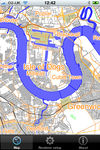
|
no | yes | no | yes | no | no | no | nonfreeproprietary | nonfree£1.19 | EN | 2012-06-20 1.5 |
Vector Maps viewer for England, Wales, Scotland |
| Vespucci [321] | 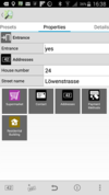
|
no | yes | no | yes | no | yes | yes | Apache license 2.0 | free | EN; ZH; FR; DE; JA; PT; VI; IT; RU; IS; HU; PL; CA; ES; EL; HR; FA; EU; UK; CL; CS; NO; DA; RO; TR | 2014-09-01 0.9.5 |
OSM editor |
| VGPS [322] | 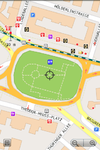
|
no | yes | no | yes | yes | no | no | nonfreeproprietary | nonfree5$ | EN | 2011-11-28 8.0 |
OSM and Garmin offline map with routing turn-by-turn navigation for Android and J2ME mobile phones |
| ViewRanger GPS [323] | no | yes | no | yes | ? | yes | ? | nonfreeproprietary | nonfreefree (purchases available) | EN,DE | 2011-04-14 ? |
proprietary outdoors-oriented map app for mobile phones, OSM & cycle & piste maps | |
| Viking [324] | 
|
yes | yes | yes | yes | yes | yes | yes | GPL | free | CS; DA; DE; EL; EN; ES; FI; FR; HR; ID; IT; JA; LT; LV; NB; NL; PL; PT; RU; SL; SV; UK; ZH | 2013-02-11 1.4 |
GTK+2 application to manage GPS data |
| VisualGPS [325] | 
|
yes | yes | no | yes | no | no | no | nonfreeproprietary | free | EN | 2009-03-29 4.2 |
GPS signal analyses |
| VisualGPSce [326] | 
|
no | yes | no | yes | no | no | no | nonfreeproprietary | free | EN | ? | GPS signal analyses |
| vlkGPS [327] | 
|
? | ? | ? | no | no | yes | yes | GPL | free | 5 | 2010-06-25 0.93 |
|
| VoxTrek Navigation GPS [328] | 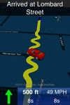
|
no | yes | no | yes | yes | ? | ? | nonfreeproprietary | nonfree2,99$ | 20 | 2010-07-12 2.1 |
Navigation for blind users |
| Wandersmann [329] | 
|
? | ? | ? | yes | no | no | no | GPL | free | EN | ? | J2ME app that uses online OpenStreetMap maps, OpenStreetBugs support |
| We-Travel [http://Main We-Travel.biz site] | 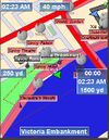
|
no | yes | no | yes | yes | yes | no | nonfreeproprietary | free | EN | 2010-02-09 0.9.12 |
Highly modular and customizable navi |
| Wheelmap Website [330] | 
|
no | yes | no | yes | yes | no | no | nonfreeproprietary | free | DE; EN; FR; IT; IS; JP; ES | 2011-03-28 1.0 |
Browsing for wheelchair accessible places |
| WhereAmI [331] | 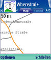
|
no | yes | no | yes | no | yes | yes | GPL | free | EN | 2009-08-26 0.14a |
Postcodes and GSM CellID support |
| Wialon [332] | no | yes | no | yes | yes | yes | yes | nonfreeproperitary | ? | DE, EN | 2012-05-30 1205 |
||
| Wikimap [333] | 
|
no | yes | no | yes | no | no | no | nonfreeproprietary | nonfree2,99$ | EN | 2010-08-09 1.6 |
Displays POIs of alimni.net |
| WindRose [334] | 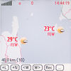
|
? | ? | ? | yes | no | yes | yes | Apache v2 | free | EN | 2010-07-22 0.6.0 |
Displays weather, too |
| Wisepilot [335] | 
|
yes | yes | no | yes | yes | no | no | nonfreeproprietary | nonfree€1.79 monthly | EN; DE; ES; FR; SV; and much more | 2014-04-03 5.0.2 |
online turn-by-turn navigation |
| World Maps Offline [336] | 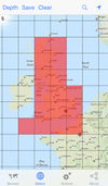
|
no | yes | no | yes | no | no | no | nonfreeproprietary | nonfree0.99$;0.69£;0.79€ | EN | ? 1.9.0 |
World Maps Offline lets you select map areas and save them to your iPhone, iPod Touch or iPad for browsing without an internet connection. |
| xMaps [337] | 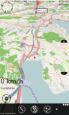
|
yes | yes | no | yes | yes | ? | no | nonfreeproprietary | free | DE,EN | 2011-01-18 1.2 |
Very simple map viewer |
| XNavigator [338] | 
|
? | ? | ? | yes | no | no | no | GPL2 | free | DE; EN | 2012-02-26 1.4.1 |
3D OSM viewer using SRTM DEM, Routing with OpenRouteService |
| YAAC [339] | 
|
yes | yes | yes | yes | no | yes | yes | GPL | free | EN; ... | 2013-12-27 1.0-beta30(27-Dec-2013) |
Amateur Radio Automatic Packet Reporting System client written in Java that uses OSM data to render maps on the fly. Under active development with rapid development release cycle. |
| YourPocketMap [340] | 
|
yes | yes | no | yes | no | no | yes | nonfreeproprietary | free | EN | 2010-11-11 0.1.3 |
|
| ZANavi [341] | 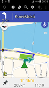
|
no | yes | no | yes | yes | no | yes | GPL | free | many | 2013-07-12 2.0.15 |
Offline Navigation System for Android |
Map display features
| Name | Shows map as vector | Shows map as bitmap | Stores map-data on-board | Stores map-data off-board (downloads from internet) | Rotate map | 3D view |
|---|---|---|---|---|---|---|
| <20MB, <512MB, <2GB Maps | yes | no | yes | no | yes | no |
| 2TrackMe | no | yes | yes | no | no | no |
| 700 City Maps | no | yes | yes | no | yes | no |
| 8motions | no | yes | no | yes | no | no |
| AFTrack GPS-Tracking | no | yes | yes | yes | yes | no |
| ALittleMap | ? | ? | ? | ? | ? | ? |
| AlpineQuest GPS Hiking | no | yes | yes | yes | yes | no |
| AndNav2 | no | yes | yes (cache) | yes | ? | ? |
| AndRoad | no | yes | yes (cache) | yes | ? | ? |
| Androzic | no | yes | yes | yes | no | no |
| Aosm | no | yes | yes (cache) | yes | no | no |
| Ape@map | no | yes | yes (cache) | no | yes | no |
| APRSISCE/32 | no | yes | yes | yes | no | no |
| ArcGIS Editor for OSM | yes | no | yes | yes | no | no |
| ArcGIS for iPhone | no | yes | no | yes | ? | no |
| ARnav | no | yes | yes (cache) | yes | no | no |
| aSmartHUD NAVI MAP+ | yes | no | yes | no | yes | yes |
| Atlas | yes | yes | yes | yes | no | ? |
| Autosputnik 5 | yes | no | yes | no | yes | yes |
| B.iCycle | no | yes | yes (cache) | yes | ? | no |
| BackCountry Navigator | ? | ? | yes | yes | yes | no |
| BaseCamp | yes | yes | yes | no | yes;no | yes |
| be-on-road | yes | no | yes | no | yes | yes |
| BetterSoftwareGPS | no | yes | ? | ? | ? | ? |
| BetterSoftwareGPSPDA | no | yes | ? | ? | ? | ? |
| Big Planet Tracks | no | yes | yes | no | ? | no |
| Bike GPS Mobile | ? | ? | ? | ? | ? | ? |
| BikeAtor | no | yes | yes | yes | yes | no |
| BikeAtor | no | yes | yes | yes | yes | no |
| BikeCityGuide | yes | no | yes | no | yes | no |
| Bluemapia | yes | yes | yes | yes | yes | no |
| Brigantine | yes | yes | yes | yes | ? | ? |
| BucketMan - coloring your city | no | yes | yes | yes | no | no |
| cachebox | no | yes | yes | no | ? | no |
| CartoType | yes | yes | yes | yes | yes | yes |
| CheckTheMonuments | ? | ? | ? | ? | ? | ? |
| City Maps 2Go | yes | yes | yes | no | no | no |
| Cruiser | yes | yes | yes | yes | no | ? |
| Cycle Hire | ? | ? | ? | ? | ? | no |
| CycleStreets Android App | no | yes | yes (cache) | yes | no | no |
| directu | ? | ? | ? | ? | ? | ? |
| discOSM | yes | no | yes | no | no | no |
| EasyMaps | no | yes | yes | yes | ? | no |
| Emerillon | no | yes | no | yes | no | no |
| Endomondo | ? | ? | no | yes | ? | no |
| Find & Route | yes | no | yes | no | yes | no |
| florb | no | yes | yes | yes | no | no |
| ForeverMap | yes | no | yes | no | yes | no |
| FoxtrotGPS | no | yes | yes (cache) | yes | no | no |
| FreemapMobile | no | yes | yes (cache) | yes | no | no |
| Gaia GPS | no | yes | yes (cache) | yes | yes | no |
| Galileo Offline Maps | yes | yes | yes | yes | yes | no |
| Geocaching Live | no | yes | yes | yes | no | no |
| GeoGuide 3D Worldwide Maps and Tracks | ? | ? | yes (cache) | yes | no | yes |
| GeoLogger | no | yes | no | yes | yes | no |
| Geopaparazzi | yes | yes | yes | yes | yes | no |
| GeorgeMap | yes | yes | yes (cache) | yes | no | no |
| Glob | ? | ? | yes (cache) | yes | yes | yes |
| GLObal PositioningUtilitieS | yes | yes | yes | no | yes | yes |
| Gnome Map Application | yes | yes | yes | no | ? | ? |
| Go Map!! | yes | yes | yes | yes | no | no |
| Gobiz Mobile | ? | ? | ? | ? | ? | ? |
| Goosm | no | no | no | yes | yes | ? |
| GoPenS | no | yes | yes (cache) | yes | yes | no |
| Gosmore | yes | no | yes | no | yes | yes |
| GPS Essentials | no | yes | yes (cache) | yes | no | no |
| GPS Kit | no | yes | no | yes | ? | no |
| GPS Navigator aSpass | no | yes | yes | yes | ? | no |
| GPS TrackMaker | ? | ? | ? | ? | ? | ? |
| GPS Tuner | yes | yes | yes | yes | yes | yes |
| GPS-Mate | no | yes | yes | yes | yes | no |
| GPS-Tracks | no | yes | yes (cache) | yes | yes | no |
| gps3D | no | yes | no | yes | no | yes |
| GPS4Palm | no | yes | yes (cache) | yes | ? | no |
| GpsCycleComputer | no | yes | yes (cache) | yes | no | no |
| GPSdash | no | yes | yes | no | yes | no |
| GpsDrive | no | yes | yes | yes | no | no |
| GPSed Mobile Application | ? | ? | ? | ? | ? | ? |
| GPSLogger II | no | yes | yes | yes | no | no |
| GpsMap | no | yes | yes | yes | no | no |
| GpsMaster | no | yes | no | yes | no | no |
| GpsMid | yes | yes | yes | yes | yes | yes |
| GpsPrune | no | yes | no | yes | no | yes |
| GpsTicker3 | yes | no | yes | no | yes | ? |
| gpsVP | yes | yes | yes | no | yes | yes |
| GPSylon | no | yes | no | yes | no | no |
| GPX Viewer | no | yes | no | yes | no | no |
| GPXViewer | no | yes | no | yes | no | no |
| GraphHopper | ? | ? | yes | no | ? | ? |
| gvSIG Mini | yes | yes | yes (cache) | yes | yes | no |
| gvSIG Mobile Pilot | yes | yes | yes | yes | ? | ? |
| HotSpot Navigator | no | yes | yes | yes | no | no |
| iLOE | no | yes | yes (cache) | no | no | no |
| iLOS | no | yes | yes (cache) | no | no | no |
| inViu routes | no | yes | yes (cache) | yes | no | no |
| Jagme | no | yes | no | yes | no | no |
| JGPSTrackEdit | no | yes | yes (cache) | no | ? | ? |
| JOSM | yes | yes | yes | no | ? | ? |
| JPSTrack | ? | ? | ? | ? | ? | no |
| KDR GPS Tracker | yes | yes | yes | yes | ? | ? |
| kMaps | yes | no | yes | no | no | no |
| komoot - Outdoor Routplaner | no | yes | yes (cache) | yes | yes | no |
| komoot iPhone App | no | yes | yes (cache) | yes | yes | no |
| Layar Reality Browser | yes | no | no | yes | yes | yes |
| Leisure | no | yes | no | yes | no | no |
| LiveMapViewer | ? | ? | ? | ? | ? | ? |
| LocA | no | yes | yes | yes | yes | no |
| LocateMe | no | yes | ? | ? | ? | no |
| LocationWizard | no | yes | no | yes | no | no |
| LockOnMe | yes | yes | no | yes | no | no |
| Locus | yes | yes | yes | yes | yes | no |
| lokiGo | yes | no | yes | no | ? | no |
| Looking4Cache | yes | yes | yes | yes | yes | no |
| luckyGPS | yes | yes | yes | yes | yes | no |
| Maemo Mapper | no | yes | yes (cache) | yes | ? | no |
| Maep | ? | ? | ? | ? | ? | ? |
| maloo outdoor | no | yes | yes | yes | yes | no |
| Map Mobile Navigator | no | yes | yes (cache) | yes | yes | no |
| Map-Hiker | no | yes | yes (cache) | yes | yes | no |
| Mapdroid | no | yes | yes (cache) | yes | no | no |
| MapDroyd | yes | no | yes | no | yes | no |
| mapFactor Navigator free | yes | no | yes | no | yes | yes |
| MapOut | yes | no | yes | no | yes | no |
| mAPP | yes | no | yes | yes | yes | no |
| mAPPedplanet | yes | yes | yes | yes | yes | no |
| MapQuest | no | no | no | yes | yes | no |
| MapQuest4Mobile | no | yes | no | yes | ? | no |
| Maps (-) | no | yes | yes (cache) | yes | ? | no |
| MAPS.ME | yes | no | yes | no | yes | no |
| Maps4Mac | yes | no | yes | no | no | no |
| Mapsforge | yes | yes | yes | yes | no | no |
| MapTool | no | yes | yes (cache) | yes | no | no |
| Mapzen POI Collector | ? | ? | ? | ? | ? | ? |
| Marble | no | yes | yes | yes | no | no |
| Marble Touch | yes | yes | yes (cache) | yes | no | no |
| Maverick | no | yes | yes | yes | yes | no |
| Minimap | no | yes | no | yes | yes | no |
| Mobile Atlas Creator | no | yes | no | yes | no | no |
| Mobile GMaps | no | yes | yes (cache) | yes | yes | no |
| Mobile Trail Explorer | no | yes | yes (cache) | yes | no | no |
| MoNa | yes | yes | no | yes | no | no |
| MoNav | no | yes | yes | yes | yes | no |
| More Maps | no | yes | yes (cache) | yes | ? | ? |
| MotionX-GPS | no | yes | yes (cache) | yes | yes | no |
| Multi Map | no | yes | yes (cache) | yes | ? | no |
| Mumpot | yes | yes | yes | yes | ? | no |
| myTracks | no | yes | no | yes | no | no |
| MyTrails | no | yes | yes | yes | yes | no |
| NASA World Wind | ? | ? | no | yes | ? | yes |
| Navatar | yes | no | no | yes | yes | no |
| NavDroyd | yes | no | yes | no | yes | yes |
| NAVeGIS | yes | no | yes | no | yes | no |
| NavFree | yes | no | yes (cache) | no | yes | yes |
| NaviComputer | no | yes | yes (cache) | yes | no | no |
| Navigon Urban | yes | no | yes | no | yes | yes |
| Naviki | ? | ? | ? | ? | ? | ? |
| Navio | no | yes | ? | ? | yes | no |
| NaviPOWM | yes | no | yes | no | yes | no |
| Navit | yes | no | yes | no | yes | yes |
| Navitel | yes | no | yes | no | yes | yes |
| Navlet | yes | yes | yes | yes | ? | no |
| NavSys | ? | ? | ? | ? | ? | ? |
| Nogago | yes | yes | yes | yes | yes | Contour Lines |
| Nomino | yes | no | no | yes | no | no |
| Noni GPSPlot for Windows Mobile | no | yes | yes | no | yes | no |
| Offline Maps | no | no | yes | yes | ? | ? |
| OffMaps 2 | yes | no | yes | no | yes | no |
| OMaps | no | yes | yes (cache) | yes | ? | no |
| Open Car InfoTainmenT system | yes | no | yes | no | ? | no |
| Open GPS Tracker | no | yes | yes (cache) | yes | no | no |
| OpenBusMap | no | yes | no | yes | ? | no |
| OpenCityMap | yes | yes | yes | no | ? | no |
| OpenFixMap | ? | ? | ? | ? | ? | ? |
| OpenMaps | no | yes | yes (cache) | yes | ? | no |
| OpenSatNav | no | yes | yes (cache) | yes | no | no |
| OpenSeaMap | no | yes | yes | yes | no | no |
| OpenStreetMap Watch List | ? | ? | ? | ? | ? | ? |
| OpenStreetMap-in-a-Box (osminabox) | yes | yes | yes | yes | ? | ? |
| Openstreetnav | no | yes | no | yes | ? | no |
| OpenTrail | no | no | no | no | yes | planned |
| OpenTripPlanner for Android | no | yes | no | yes | yes | yes |
| OruxMaps | yes | yes | yes | yes | yes | no |
| OSG-Explorer | yes | yes | no | yes | yes | yes |
| OSM | no | yes | no | yes | ? | no |
| osm-android | ? | ? | ? | ? | ? | ? |
| OSM2Go | yes | no | yes | no | yes | no |
| OSM2Palm | no | yes | yes | no | ? | no |
| OsmAnd | yes | yes | yes | yes | yes | no |
| OSMapTuner | yes | no | yes (cache) | no | no | no |
| OSMBugs | ? | ? | ? | ? | ? | ? |
| OSMfocus | yes | yes | no | yes | no | no |
| OSMLogger | no | yes | no | yes | ? | no |
| OSMLY | yes | no | no | no | ? | ? |
| OsmPad | no | yes | yes | yes | no | no |
| OSMroute | yes | no | yes | no | no | no |
| OSMTrack | yes | yes | yes | no | yes | no |
| OSMtracker | no | yes | yes | no | no | ? |
| OSMTracker for Android | no | yes | yes (cache) | yes | no | no |
| OSMZmiany | ? | ? | ? | ? | ? | ? |
| OziExplorer | yes | yes | yes | yes | yes | yes |
| Path Tracker | no | yes | no | yes | no | no |
| PathAway GPS | yes | yes | yes | yes | yes | no |
| Pocket Earth Offline Maps & Travel Guides | yes | no | yes | no | yes | no |
| PocketGIS | yes | no | yes | no | yes | no |
| PocketNavigator | no | yes | yes (cache) | yes | yes | no |
| POI+ | ? | ? | ? | ? | ? | ? |
| PTGMAP | yes | yes | yes | no | yes | no |
| Pushpin OSM | no | yes | no | yes | no | no |
| Pyroute | yes | no | yes | no | no | no |
| QpeGPS | no | yes | yes | no | ? | no |
| QuoVadis | yes | yes | yes | yes | yes | yes |
| QuoVadis Mobile | no | yes | yes | yes | yes | no |
| Rana | yes | no | yes | no | ? | no |
| RMaps | no | yes | yes | no | yes | no |
| Roadee | no | yes | yes | yes | ? | no |
| RoadMap | yes | no | yes | no | yes | yes |
| RoadMap Editor | yes | no | yes | no | yes | yes |
| RoadNav | yes | no | yes | no | ? | yes |
| RouteConverter | no | yes | no | yes | no | no |
| Run.GPS | no | yes | yes (cache) | yes | ? | no |
| Seewetter Pro | no | yes | yes | yes | no | no |
| ShareNav | yes | yes | yes | yes | yes | yes |
| Simple OSM | no | yes | yes (cache) | yes | no | ? |
| Skobbler GPS Navigation | yes | no | yes | yes | yes | yes |
| Spatial Manager Desktop™ | yes | no | yes | no | no | no |
| Spatial Manager™ for AutoCAD | yes | no | yes | no | no | no |
| Sports Tracker | no | yes | yes (cache) | yes | no | no |
| TangoGPS | no | yes | yes (cache) | yes | ? | no |
| TEAM - Tutor for editable audio maps | yes | no | yes | yes | no | no |
| Terra Map GPS | yes | no | yes | no | yes | no |
| The Map | yes | no | yes | no | no | no |
| TileMill | yes | no | yes | no | ? | ? |
| Track'n Trail | ? | ? | ? | ? | ? | no |
| Track2Karte | no | yes | no | yes | no | no |
| Track@Way | no | yes | yes | yes | ? | no |
| Trackator Lite | no | yes | yes | yes | no | no |
| TrackMyJourney | yes | yes | yes | yes | yes | yes |
| Trackspace | no | yes | yes (cache) | no | yes | no |
| Trafficman Maps | no | yes | no | yes | no | no |
| Trails | no | yes | yes (cache) | yes | ? | no |
| TravelDroyd | yes | no | yes | no | yes | no |
| Traveling Salesman | yes | no | yes | no | yes | no |
| TrekBuddy | no | yes | yes | no | yes | no |
| TripAdvisor | no | yes | yes (cache) | yes | ? | yes |
| TripGo | yes | no | yes (cache) | yes | no | no |
| True Offline Maps 2.0 | no | yes | yes | no | yes | no |
| Turbo GPS | no | yes | yes | yes | yes | no |
| UK TravelOptions | yes | no | yes (cache) | yes | yes | yes |
| VataviaMap | no | yes | yes | yes | ? | no |
| Vectorial Map | yes | yes | yes | yes | no | no |
| VectorMaps GB | yes | no | yes | no | ? | no |
| Vespucci | yes | yes | yes (cache) | no | no | no |
| VGPS | yes | no | yes | no | yes | no |
| ViewRanger GPS | no | no | no | no | ? | ? |
| Viking | no | yes | yes (cache) | yes | no | no |
| VisualGPS | ? | ? | ? | ? | no | no |
| VisualGPSce | ? | ? | ? | ? | no | no |
| VoxTrek Navigation GPS | no | yes | yes | yes | yes | yes |
| Wandersmann | no | yes | no | yes | ? | ? |
| We-Travel | yes | yes | yes | no | ? | yes |
| Wheelmap Website | no | yes | no | yes | yes | no |
| WhereAmI | yes | yes | yes (cache) | yes | ? | no |
| Wialon | yes | yes | yes | no | yes | ? |
| Wikimap | no | yes | yes (cache) | yes | ? | no |
| WindRose | no | yes | yes | no | ? | no |
| Wisepilot | yes | yes | no | yes | yes | yes |
| World Maps Offline | no | yes | yes | yes | no | no |
| xMaps | no | yes | yes (cache) | yes | ? | yes |
| XNavigator | yes | no | yes (cache) | yes | yes | yes |
| YAAC | yes | no | yes | no | no | no |
| YourPocketMap | no | yes | yes (cache) | yes | yes | yes |
| ZANavi | yes | no | yes | no | yes | yes |
| Name | Navigate to point | Find location | Find nearby POIs | Navigate along predefined route | Create route manually | Calculate route | Calculate route without internet | Car routing | Bike routing | Foot routing | Turn restrictions | Navigation with voice | Keep on road | Works without GPS |
|---|---|---|---|---|---|---|---|---|---|---|---|---|---|---|
| 2TrackMe | yes | yes | no | ? | ? | ? | ? | no | no | no | no | no | no | no |
| 700 City Maps | yes | yes | no | ? | ? | ? | ? | no | no | no | no | ? | ? | ? |
| 8motions | yes | yes | no | ? | ? | ? | ? | yes | no | no | no | no | no | ? |
| AFTrack GPS-Tracking | yes | yes | yes | ? | ? | yes | yes | ? | ? | ? | ? | no | ? | ? |
| AndNav2 | no | yes | yes | no | ? | yes | ? | yes | yes | yes | ? | yes | ? | ? |
| AndRoad | ? | yes | yes | no | ? | yes | no | yes | yes | yes | ? | yes | ? | ? |
| Androzic | yes | yes | yes | yes | ? | no | no | ? | ? | ? | no | no | no | yes |
| Aosm | no | yes | yes | ? | ? | ? | ? | no | no | no | no | no | no | ? |
| ARnav | yes | no | yes | ? | ? | ? | ? | no | no | yes | no | no | no | no |
| aSmartHUD NAVI MAP+ | yes | ? | no | ? | ? | ? | ? | yes | no | no | ? | no | no | ? |
| Atlas | yes | no | no | no | ? | yes | yes | yes | yes | yes | yes | no | no | yes |
| Autosputnik 5 | yes | yes | yes | ? | ? | ? | ? | yes | no | no | yes | yes | yes | yes |
| BackCountry Navigator | no | yes | no | ? | ? | no | no | ? | ? | ? | ? | no | ? | ? |
| be-on-road | yes | yes | yes | ? | ? | yes | yes | yes | no | yes | yes | yes | yes;no | yes |
| Bike GPS Mobile | yes | no | no | ? | ? | ? | ? | no | yes | no | ? | no | no | ? |
| BikeCityGuide | yes | yes | yes | ? | ? | yes | yes | no | yes | no | ? | yes | ? | ? |
| cachebox | yes | no | yes | ? | ? | ? | ? | no | no | no | no | no | no | yes |
| CartoType | yes | yes | yes | yes | ? | yes | yes | yes | yes | yes | yes | ? | yes | yes |
| Cetus GPS | yes | yes | ? | ? | ? | ? | ? | ? | ? | ? | ? | ? | ? | ? |
| Compass Navigator 3D | yes | yes | yes | ? | ? | no | no | no | no | no | no | no | ? | ? |
| cotogps | yes | yes | ? | ? | ? | ? | ? | no | no | no | no | ? | ? | ? |
| Cruiser | yes | yes | yes | no | ? | yes | yes | yes | yes | yes | yes | no | no | yes |
| CycleStreets Android App | yes | yes | yes | no | ? | yes | no | no | yes | no | no | no | no | yes |
| E.T | yes | yes | no | ? | ? | ? | ? | ? | ? | ? | ? | ? | ? | ? |
| Find & Route | yes | yes | yes | ? | ? | ? | ? | no | yes | yes | ? | no | no | yes |
| ForeverMap | yes | yes | yes | no | ? | yes | ? | yes | yes | yes | ? | no | no | no |
| Gaia GPS | yes | yes | ? | no | ? | no | no | no | no | no | no | ? | ? | ? |
| GeoLogger | ? | yes | ? | ? | ? | ? | ? | ? | ? | ? | ? | ? | ? | ? |
| Geopaparazzi | no | yes | yes | no | ? | no | no | no | no | no | no | no | no | yes |
| GLObal PositioningUtilitieS | yes | yes | yes | ? | ? | ? | ? | ? | ? | ? | ? | ? | ? | ? |
| Go Map!! | ? | ? | ? | ? | ? | ? | ? | ? | ? | ? | ? | ? | ? | ? |
| GoPenS | yes | ? | ? | no | ? | yes | ? | yes | yes | yes | ? | yes | ? | ? |
| Gosmore | yes | yes | yes | no | ? | yes | ? | yes | yes | yes | yes | yes | ? | ? |
| GPS Essentials | yes | yes | no | no | ? | yes | no | ? | ? | ? | no | yes | yes | no |
| GPS Kit | yes | ? | ? | ? | ? | ? | ? | no | no | no | no | ? | ? | ? |
| GPS Navigator aSpass | yes | yes | yes | ? | ? | ? | ? | ? | ? | ? | yes | yes | ? | no |
| GPS Tuner | ? | ? | ? | ? | ? | ? | ? | yes | yes | yes | ? | ? | ? | ? |
| GPS-Mate | yes | yes | yes | ? | ? | ? | ? | ? | ? | ? | ? | no | ? | ? |
| GPS-Tracks | yes | yes | yes | no | ? | no | no | no | no | no | no | ? | no | yes |
| GPS4Palm | yes | no | no | ? | ? | ? | ? | ? | ? | ? | ? | ? | ? | ? |
| GPSdash | yes | ? | ? | ? | ? | ? | ? | ? | ? | ? | ? | no | ? | ? |
| GpsDrive | ? | ? | ? | ? | ? | ? | ? | yes | yes | yes | ? | ? | ? | yes |
| GPSLogger II | yes | no | no | yes | ? | yes | yes | ? | ? | ? | no | no | no | yes |
| GpsMid | yes | yes | yes | no | no | yes | yes | yes | yes | yes | yes | yes | no | yes |
| GpsTicker3 | yes | no | yes | yes | ? | yes | yes | yes | yes | yes | no | no | no | yes |
| gpsVP | yes | yes | yes | ? | ? | ? | ? | ? | ? | ? | ? | no | no | yes |
| Guide Me | ? | ? | ? | ? | ? | ? | ? | ? | ? | ? | ? | yes | ? | ? |
| gvSIG Mini | yes | yes | yes | no | ? | yes | no | ? | ? | ? | ? | ? | ? | ? |
| HotSpot Navigator | yes | no | yes | ? | ? | ? | ? | no | no | no | no | no | no | yes |
| inViu routes | yes | no | no | no | ? | yes | no | yes | no | no | yes | no | no | yes |
| JGPSTrackEdit | ? | ? | ? | ? | ? | ? | ? | ? | ? | ? | ? | ? | ? | ? |
| KDR GPS Tracker | yes | yes | yes | ? | ? | ? | ? | ? | ? | ? | no | no | ? | ? |
| komoot - Outdoor Routplaner | yes | yes | yes | ? | ? | ? | ? | no | yes | yes | no | yes | yes | yes |
| komoot iPhone App | yes | yes | yes | ? | ? | ? | ? | no | yes | yes | no | yes | yes | yes |
| Leisure | yes | yes | yes | ? | ? | ? | ? | no | no | no | no | no | no | no |
| LiveMapViewer | ? | ? | ? | ? | ? | ? | ? | ? | ? | ? | ? | ? | ? | ? |
| LocA | yes | no | yes | no | ? | no | no | no | no | no | no | ? | ? | yes |
| Locus | yes | yes | yes | yes | yes | yes | with co-app | yes | yes | yes | no | yes | no | yes |
| lokiGo | yes | yes | yes | ? | ? | ? | ? | no | no | yes | ? | no | ? | ? |
| Maemo Mapper | ? | ? | ? | ? | ? | ? | ? | ? | ? | ? | ? | ? | ? | ? |
| Map Mobile Navigator | yes | yes | no | ? | ? | ? | ? | no | no | no | no | no | no | ? |
| Map-Hiker | no | no | yes | ? | ? | ? | ? | yes | yes | yes | no | no | no | yes |
| mapFactor Navigator free | yes | yes | yes | no | ? | yes | yes | yes | no | yes | yes | yes | yes;no | yes |
| mAPPedplanet | yes | yes | yes | yes | no | yes | no | yes | yes | yes | no | yes | no | no |
| Maps4Mac | ? | no | yes | ? | ? | ? | ? | no | no | no | no | ? | ? | yes |
| Marble | no | yes | no | ? | ? | ? | ? | yes | yes | yes | no | yes | no | yes |
| Marble Touch | yes | yes | yes | ? | ? | ? | ? | yes | yes | yes | yes | yes | yes | ? |
| Maverick | yes | yes | yes | no | ? | no | no | no | no | no | no | ? | ? | ? |
| Mobile GMaps | ? | yes | yes | ? | ? | ? | ? | no | no | no | no | no | no | ? |
| MoNa | yes | yes | ? | ? | ? | ? | ? | yes | no | no | yes | no | ? | no |
| MoNav | yes | yes | no | ? | ? | ? | ? | yes | yes | yes | no | no | ? | ? |
| More Maps | yes | ? | ? | ? | ? | ? | ? | ? | ? | ? | ? | no | ? | no |
| MotionX-GPS | yes | no | no | ? | ? | ? | ? | no | no | no | no | ? | yes;no | no |
| MyTrails | yes | yes | yes | yes | ? | yes | no | yes | yes | yes | yes | yes | no | no |
| Navatar | yes | yes | yes | no | ? | yes | ? | yes | no | no | yes | no | yes | no |
| NavDroyd | yes | yes | ? | no | ? | yes | ? | yes | no | yes | no | yes | ? | ? |
| NAVeGIS | yes | yes | yes | no | ? | yes | ? | yes | no | no | yes | yes | yes | yes |
| NavFree | ? | ? | ? | ? | ? | ? | ? | ? | ? | ? | ? | ? | ? | ? |
| Navigon Urban | yes | yes | yes | ? | ? | ? | ? | no | yes | yes | no | yes | no | ? |
| Navio | ? | ? | ? | ? | ? | ? | ? | ? | ? | ? | ? | ? | ? | ? |
| NaviPOWM | ? | ? | ? | ? | ? | ? | ? | yes | yes | yes | ? | no | ? | ? |
| Navit | yes | yes | yes | no | ? | yes | yes | yes | no | yes | yes | yes | yes | no |
| Navitel | yes | yes | yes | no | ? | yes | yes | yes | yes | yes | yes | yes | yes | yes |
| NavSys | ? | ? | ? | ? | ? | ? | ? | ? | ? | ? | ? | ? | ? | ? |
| Nogago | yes | yes | yes | yes | ? | yes | yes | no | yes | yes | yes | yes | no | yes |
| Open Source Routing Machine | ? | ? | ? | ? | ? | ? | ? | ? | ? | ? | yes | ? | ? | ? |
| OpenMaps | yes | yes | yes | ? | ? | ? | ? | yes | yes | yes | yes | ? | ? | ? |
| OpenSatNav | no | no | yes | no | ? | yes | ? | yes | yes | yes | ? | ? | ? | ? |
| OpenTrail | ? | yes | yes | ? | ? | ? | ? | ? | ? | ? | ? | ? | ? | ? |
| OruxMaps | ? | ? | ? | yes | ? | no | no | ? | ? | ? | ? | ? | ? | ? |
| OsmAnd | yes | yes | yes | yes | ? | yes | yes | yes | yes | yes | yes | yes | yes | yes |
| outdoor-gps | yes | no | no | ? | ? | ? | ? | ? | ? | ? | ? | yes | yes | no |
| OziExplorer | ? | ? | ? | ? | ? | ? | ? | ? | ? | ? | ? | no | ? | yes |
| PathAway GPS | yes | yes | yes | ? | ? | ? | ? | ? | ? | ? | ? | yes;no | yes | no |
| Pocket Earth Offline Maps & Travel Guides | yes | yes | yes | ? | ? | yes | no | ? | ? | ? | no | no | no | yes |
| PocketGIS | yes | yes | yes | ? | ? | ? | ? | yes | no | no | no | yes | no | yes |
| PocketNavigator | yes | yes | no | no | ? | yes | ? | yes | yes | yes | no | no | yes | no |
| PTGMAP | ? | ? | ? | ? | ? | ? | ? | yes | yes | yes | ? | ? | ? | ? |
| QpeGPS | ? | ? | ? | ? | ? | ? | ? | ? | ? | ? | ? | no | ? | ? |
| QuoVadis | yes | yes | yes | yes | ? | yes | yes | yes | yes | yes | yes | yes | yes | yes;no |
| QuoVadis Mobile | yes | yes | yes | yes | ? | yes | yes | yes | yes | yes | yes | yes | yes | yes;no |
| Rana | ? | ? | yes | ? | ? | ? | ? | ? | ? | ? | ? | no | ? | ? |
| RoadMap | yes | yes | no | ? | ? | ? | ? | ? | ? | ? | no | no | ? | yes |
| RoadMap Editor | yes | yes | no | ? | ? | ? | ? | ? | ? | ? | no | no | ? | yes |
| RoadNav | ? | ? | ? | ? | ? | ? | ? | ? | ? | ? | ? | yes | ? | yes |
| ShareNav | yes | yes | yes | no | no | yes | yes | yes | yes | yes | yes | yes | yes | yes |
| Simple OSM | yes | yes | yes | ? | ? | ? | ? | yes | no | yes | yes | no | no | no |
| Skobbler GPS Navigation | yes | yes | yes | ? | ? | yes | yes | yes | yes | yes | yes | yes | yes | no |
| Terra Map GPS | yes | no | no | yes | ? | no | no | no | yes | yes | no | no | no | yes |
| Track@Way | yes | no | no | yes | ? | no | no | no | no | no | no | no | no | no |
| Trackator Lite | yes | yes | ye | yes | ? | yes | yes | yes | no | no | no | no | yes | yes |
| TrackMyJourney | yes | yes | yes | ? | ? | ? | ? | yes | yes | yes | ? | no | yes | partial |
| Trackspace | yes | no | no | ? | ? | ? | ? | no | no | no | no | no | ? | ? |
| Traveling Salesman | ? | yes | ? | ? | ? | ? | ? | ? | ? | ? | ? | ? | no | yes |
| TrekBuddy | ? | ? | ? | ? | ? | ? | ? | ? | ? | ? | no | no | no | yes |
| Turbo GPS | yes | yes | yes | ? | ? | ? | ? | ? | ? | ? | ? | ? | ? | yes |
| VGPS | yes | yes | yes | no | ? | yes | ? | yes | no | no | yes | yes | yes | yes |
| Viking | no | yes | no | ? | ? | ? | ? | yes | no | no | yes | no | no | yes |
| VoxTrek Navigation GPS | yes | ? | ? | ? | ? | ? | ? | yes | no | no | ? | yes | ? | ? |
| We-Travel | yes | yes | yes | ? | ? | ? | ? | yes | yes | yes | ? | yes | ? | ? |
| Wheelmap Website | yes | ? | yes | ? | ? | ? | ? | no | no | no | no | no | no | no |
| Wialon | yes | yes | yes | ? | ? | ? | ? | ? | ? | ? | ? | ? | ? | ? |
| Wisepilot | yes | yes | yes | ? | ? | ? | ? | yes | no | yes | yes | yes | ? | no |
| xMaps | yes | ? | ? | ? | ? | ? | ? | ? | ? | ? | ? | no | ? | no |
| ZANavi | yes | yes | yes | no | ? | yes | yes | yes | no | no | yes | yes | yes | no |
Track making features
| Name | Customizable log interval | GPX format | KML format | NMEA format | All formats | Geo-tagged notes | Geo-tagged photos | Geo-tagged audio | Fast POI buttons |
|---|---|---|---|---|---|---|---|---|---|
| 2TrackMe | no | yes | no | yes | gpx;nmea | no | yes | no | ? |
| 8motions | yes | yes | yes | no | gpx;kml | yes | yes | no | no |
| AFTrack GPS-Tracking | yes | yes | yes | no | gpx;kml;pcx;igc;ovl | yes | no | no | yes |
| ALittleMap | ? | ? | ? | ? | ? | ? | ? | ? | ? |
| AlpineQuest GPS Hiking | ? | yes | no | no | gpx | ? | ? | ? | ? |
| AndNav2 | no | yes | no | no | gpx | no | yes | no | no |
| AndRoad | ? | ? | ? | ? | ? | ? | ? | ? | ? |
| Androzic | yes | yes | yes | no | gpx,kml | ? | ? | ? | yes |
| Aosm | ? | ? | ? | ? | ? | ? | ? | ? | ? |
| Ape@map | yes | yes | no | yes | gpx;nmea | yes | no | no | no |
| APRSISCE/32 | yes | no | no | no | none | no | no | no | yes |
| aSmartHUD NAVI MAP+ | ? | ? | ? | ? | ? | ? | ? | ? | ? |
| B.iCycle | no | yes | yes | no | gpx;kml | ? | ? | ? | no |
| BackCountry Navigator | ? | yes | no | no | gpx | ? | ? | ? | yes |
| bbTracker | yes | yes | yes | no | gpx;kml | yes | no | no | ? |
| be-on-road | ? | ? | ? | ? | ? | ? | ? | ? | ? |
| Big Planet Tracks | ? | yes | no | no | gpx | no | no | no | yes |
| Bike GPS Mobile | yes | yes | yes | no | gpx;kml;Bike GPS;Fugawi;Kompass | yes | no | no | no |
| BikeAtor | ? | yes | no | no | gpx | ? | ? | ? | ? |
| BikeAtor | no | no | no | no | no | ? | ? | ? | no |
| BikeCityGuide | ? | ? | ? | ? | ? | ? | ? | ? | ? |
| BT747 | yes | no | no | no | GPX, KML, CSV, HTML, PLT, TRK | no | yes | no | yes |
| Cetus GPS | ? | yes | no | no | gpx | yes | no | no | ? |
| Dedee GpsLogger | ? | ? | ? | ? | ? | ? | ? | ? | ? |
| E.T | ? | ? | ? | ? | ? | ? | ? | ? | yes |
| Find & Route | no | yes | no | yes | gpx;nmea | ? | ? | ? | no |
| florb | no | yes | no | no | gpx | no | no | no | yes |
| FoxtrotGPS | no | yes | no | no | gpx | no | yes | no | no |
| Gaia GPS | ? | ? | ? | ? | ? | ? | ? | ? | ? |
| Galileo Offline Maps | yes | yes | yes | no | gpx, kml, csv | no | no | no | ? |
| Geobucket | no | no | no | no | wkt | ? | ? | ? | ? |
| GeoGuide 3D Worldwide Maps and Tracks | yes | yes | no | no | gpx | ? | ? | ? | ? |
| GeoLogger | ? | ? | ? | ? | ? | ? | ? | ? | ? |
| Geopaparazzi | yes | yes | no | no | gpx;mbtiles;spatialite | no | no | no | yes |
| GeorgeMap | ? | ? | ? | ? | ? | ? | ? | ? | ? |
| GeoTag | no | ? | ? | ? | ? | no | yes | no | ? |
| GLObal PositioningUtilitieS | yes | yes | yes | yes | gpx,kml,nmea,csv | yes | no | no | yes |
| Gobiz Mobile | ? | ? | ? | ? | ? | yes | no | no | yes |
| GoPenS | ? | yes | no | no | gpx | ? | ? | ? | ? |
| Gosmore | ? | ? | ? | ? | ? | ? | ? | ? | ? |
| GPS Essentials | yes | yes | yes | no | gpx;kml | yes | yes | no | yes |
| GPS Kit | ? | yes | yes | no | gpx;kml | no | yes | no | ? |
| GPS Logger for Android | yes | yes | yes | no | gpx;kml | no | no | no | no |
| GPS Navigator aSpass | no | ? | ? | ? | ? | ? | ? | ? | ? |
| GPS Track for J2ME | yes | yes | yes | no | gpx;kml;csv | no | no | no | no |
| GPS TrackMaker | ? | yes | yes | no | gpx;kml;… | ? | ? | ? | ? |
| GPS Tuner | ? | ? | ? | ? | ? | ? | ? | ? | ? |
| GPS-Mate | ? | yes | yes | yes | gpx,kml,nmea,csv,txt,loc,tur | yes | no | no | yes |
| GPS-Tracks | no | yes | no | no | gpx | no | yes | no | yes |
| GPS2Blue | no | no | no | yes | nmea | no | no | no | no |
| GPS4Palm | ? | ? | ? | ? | ? | ? | ? | ? | ? |
| GpsCycleComputer | yes | ? | ? | ? | ? | ? | ? | ? | yes |
| GPSdash | ? | ? | ? | ? | ? | yes | no | no | yes |
| GpsDrive | ? | yes | no | no | gpx | ? | ? | ? | ? |
| GPSed Mobile Application | ? | yes | no | no | gpx;proprietary | ? | ? | ? | yes |
| GPSies | ? | yes | no | no | gpx | ? | ? | ? | ? |
| GPSLogger II | yes | yes | yes | yes | gpx;kml;nmea;gpl | yes | no | no | yes |
| GpsMap | no | yes | no | no | gpx | ? | ? | ? | ? |
| GpsMid | yes | yes | no | yes | gpx;nmea | no | yes | yes | yes |
| GpsTicker3 | ? | ? | ? | ? | ? | ? | ? | ? | ? |
| GPSTracka | yes | yes | yes | no | gpx;kml;csv | no | yes | no | ? |
| gpsVP | yes | yes | no | no | gpx;ozi;plt | yes | no | no | ? |
| GPSylon | ? | ? | ? | ? | ? | ? | ? | ? | yes |
| gvSIG Mobile Pilot | ? | no | no | no | SHP; GML; KML; GPX | ? | ? | ? | ? |
| HotSpot Navigator | no | no | no | no | bin | no | no | no | yes |
| inViu routes | yes | yes | yes | no | gpx;jpg;kml | yes | yes | yes | yes |
| JPSTrack | ? | ? | ? | ? | ? | ? | ? | ? | ? |
| KDR GPS Tracker | ? | ? | ? | ? | ? | no | yes | no | yes |
| Keypad-Mapper 3 | no | yes | no | no | gpx,osm,jpg | yes | yes | no | no |
| Keypad-Mapper 3 | no | yes | no | no | gpx,osm,jpg | yes | yes | no | no |
| KeypadMapper2 | no | yes | no | no | gpx,osm | ? | ? | ? | no |
| komoot - Outdoor Routplaner | ;no | yes | no | no | gpx | yes | yes | no | yes |
| komoot iPhone App | ;no | yes | no | no | gpx | yes | yes | no | yes |
| Loadstone GPS | no | no | no | no | NMEA | no | no | no | yes |
| LocA | yes | yes | yes | no | gpx;kml;loc | ? | ? | ? | ? |
| LocateMe | ? | ? | ? | ? | ? | no | no | no | no |
| Location Tagger | no | ? | ? | ? | ? | no | yes | no | ? |
| Locations Tagger | ? | yes | no | no | gpx | yes | no | no | yes |
| Locus | yes | yes | yes | yes | gpx;kml;nmea | no | yes | yes | yes |
| lokiGo | ? | ? | ? | ? | ? | ? | ? | ? | ? |
| luckyGPS | ? | ? | ? | ? | ? | ? | ? | ? | ? |
| Maemo Mapper | ? | yes | no | no | gpx | yes | no | no | yes |
| Maep | ? | ? | ? | ? | ? | ? | ? | ? | ? |
| maloo outdoor | yes | yes | no | no | gpx | ? | ? | ? | no |
| Map Mobile Navigator | yes | yes | yes | yes | gpx;kml;nmea;ozi | yes | yes | no | yes |
| mapFactor Navigator free | ? | no | no | yes | nmea | ? | ? | ? | ? |
| MapOut | no | yes | no | no | gpx | no | no | no | no |
| mAPP | yes | yes | no | no | gpx | yes | no | no | yes |
| mAPPedplanet | yes | yes | no | no | gpx | no | yes | no | yes |
| Maps4Mac | no | yes | no | no | gpx | yes | no | no | yes |
| Marble | no | no | yes | no | kml | ? | ? | ? | yes |
| Marble Touch | ? | ? | ? | ? | ? | ? | ? | ? | ? |
| Maverick | ? | yes | yes | no | gpx;kml | yes | yes | yes | yes |
| Minimap | ? | ? | ? | ? | ? | no | no | no | no |
| Mobile GMaps | ? | ? | ? | ? | ? | ? | ? | ? | ? |
| Mobile Trail Explorer | yes | yes | yes | no | gpx;kml | yes | no | yes | yes |
| MojoTracker | no | yes | yes | no | gpx;kml | no | yes | no | no |
| MoNav | ? | ? | ? | ? | ? | ? | ? | ? | ? |
| MotionX-GPS | ? | yes | yes | no | gpx;kml | ? | ? | ? | ? |
| Mumpot | ? | ? | ? | ? | ? | ? | ? | ? | yes |
| My Tracks | ? | yes | yes | no | gpx;kml | no | no | no | yes |
| myTracks | yes;no | yes | no | no | gpx | no | yes | no | no |
| MyTrails | yes | yes | no | no | gpx | yes | no | no | yes |
| Nauta | ? | no | no | yes | nmea | ? | ? | ? | ? |
| NAVeGIS | ? | no | no | no | img | no | no | no | ? |
| NaviComputer | ? | yes | no | no | gpx | ? | ? | ? | ? |
| Naviki | ? | ? | ? | ? | ? | ? | ? | ? | ? |
| Navio | ? | ? | ? | ? | ? | ? | ? | ? | ? |
| NaviPOWM | yes | no | no | yes | nmea | no | no | no | no |
| Navit | ? | yes | no | yes | bin, garmin, gpx, nmea | ? | ? | ? | ? |
| Navitel | yes | yes | no | no | gpx | ? | ? | ? | ? |
| Navlet | ? | yes | no | no | gpx | no | no | no | no |
| NavSys | ? | ? | ? | ? | ? | ? | ? | ? | ? |
| Nogago | yes | yes | yes | no | gpx;kml;csv;tcx | no | no | no | yes |
| Noni GPSPlot for Windows Mobile | ? | yes | no | no | gpx | yes | no | no | yes |
| Open Car InfoTainmenT system | ? | ? | ? | ? | ? | ? | ? | ? | ? |
| Open GPS Tracker | yes | yes | yes | no | gpx;kml | yes | yes | yes | no |
| OpenCityMap | no | yes | no | no | gpx | no | yes | no | yes |
| OpenSatNav | no | yes | no | no | gpx | no | no | no | no |
| OpenTrail | ? | ? | ? | ? | ? | ? | ? | ? | ? |
| OpenTripPlanner for Android | no | ? | ? | ? | ? | no | no | no | no |
| OruxMaps | yes | yes | yes | no | gpx;kml | no | no | no | no |
| osm-android | ? | ? | ? | ? | ? | ? | ? | ? | ? |
| OSM2Go | ? | ? | ? | ? | ? | ? | ? | ? | ? |
| OSM2Palm | ? | yes | no | no | gpx | ? | ? | ? | ? |
| OsmAnd | yes | yes | no | no | gpx | no | no | no | yes |
| OSMLogger | no | ? | ? | ? | ? | ? | ? | ? | ? |
| OSMroute | no | yes | no | yes | gpx;nmea | no | no | no | no |
| OSMTrack | ? | yes | no | no | gpx | ? | ? | ? | no |
| OSMtracker | yes | yes | no | yes | gpx;nmea | yes | yes | yes | yes |
| OSMTracker for Android | yes | yes | no | no | gpx | yes | yes | yes | yes |
| outdoor-gps | ? | yes | no | no | gpx | yes | no | no | ? |
| OziExplorer | yes | ? | ? | ? | ? | ? | ? | ? | ? |
| Path Tracker | ? | ? | ? | ? | ? | ? | ? | ? | ? |
| PathAway GPS | yes | yes | yes | no | gpx;kml | yes | no | no | yes |
| Pocket Earth Offline Maps & Travel Guides | ? | ? | ? | ? | ? | ? | ? | ? | ? |
| PocketGIS | no | no | no | yes | nmea, lmt | no | yes | no | yes |
| PTGMAP | ? | yes | no | no | gpx;gdb;mps | ? | ? | ? | ? |
| QpeGPS | ? | ? | ? | ? | ? | ? | ? | ? | ? |
| QuoVadis | yes | no | no | no | ewc;img;tdb;tiff;png;bmp;shp;dxf;online-maps | yes | yes | yes | yes |
| QuoVadis Mobile | yes | yes | no | no | online-map;qmz;gpx | ? | ? | ? | yes |
| Rana | yes | ? | ? | ? | ? | ? | ? | ? | ? |
| RMaps | ? | yes | yes | no | gpx,kml | no | no | no | ? |
| RoadMap | ? | ? | ? | ? | ? | ? | ? | ? | ? |
| RoadMap Editor | ? | ? | ? | ? | ? | ? | ? | ? | ? |
| RoadNav | ? | ? | ? | ? | ? | no | no | no | ? |
| Run.GPS | ? | ? | ? | ? | ? | no | yes | no | ? |
| ShareNav | yes | yes | no | yes | gpx;nmea | yes | yes | yes | yes |
| Shozu | no | ? | ? | ? | ? | no | yes | no | no |
| SikaSimplex | yes | yes | no | no | gpx | yes | no | no | ? |
| Simple OSM | yes | yes | no | no | gpx | ? | ? | ? | no |
| Sports Tracker | no | yes | yes | no | gpx;kml;csv | no | yes | no | no |
| TangoGPS | ? | yes | no | no | gpx | no | yes | no | ? |
| Terra Map GPS | no | no | no | no | png | yes | yes | no | yes |
| Track'n Trail | yes | yes | no | no | gpx | yes | no | no | yes |
| Track@Way | yes | yes | no | no | gpx | yes | no | no | yes |
| Trackator Lite | yes | yes | yes | no | gpx;kml;igc | no | yes | no | yes |
| TrackMyJourney | yes | yes | yes | yes | gpx;kml;nmea;csv;txt;ozi | yes | yes | yes | yes |
| Trackspace | yes | yes | yes | no | gpx;kml;tsf | ? | ? | ? | ? |
| Trails | yes;no | yes | no | no | gpx | no | no | no | ? |
| Trakkcor | no | ? | ? | ? | ? | no | no | no | no |
| TrekBuddy | yes | yes | no | yes | gpx;nmea | yes | yes | yes | no |
| True Offline Maps 2.0 | ? | ? | ? | ? | ? | ? | ? | ? | yes |
| TTGPSLogger | yes | yes | yes | yes | gpx;kml;nmea | no | no | no | no |
| Turbo GPS | yes | yes | yes | no | gpx;kml;loc | no | no | no | ? |
| Vectorial Map | yes | yes | yes | no | jpg;png;gpx;kml;kmz | yes | no | no | yes |
| Vespucci | yes | yes | no | no | gpx | no | no | no | no |
| ViewRanger GPS | ? | no | no | no | ? | no | no | no | ? |
| Viking | no | yes | yes | no | gpx;kml | no | yes | no | no |
| vlkGPS | yes | yes | yes | no | gpx;kml;csv;loc | yes | no | no | no |
| We-Travel | yes | yes | yes | no | gpx;kml | yes | yes | no | yes |
| WhereAmI | yes | yes | no | no | gpx | yes | yes | yes | no |
| Wialon | yes | yes | yes | yes | gpx,kml,nmea,csv | yes | no | no | yes |
| WindRose | yes | yes | no | no | gpx;wrx | yes | no | no | yes |
| YAAC | no | no | no | no | none | no | no | no | yes |
Monitoring features
| Name | Show current track | Open existing track | Altitude diagram | Show DOP value | Satellite view | Show live NMEA data | Send current position via SMS | Upload current position |
|---|---|---|---|---|---|---|---|---|
| AFTrack GPS-Tracking | yes | yes | yes | yes | yes | no | yes | yes |
| AlpineQuest GPS Hiking | yes | ? | yes | ? | no | no | no | no |
| Androzic | yes | yes | no | ? | ? | ? | yes | yes |
| Ape@map | yes | yes | yes | ? | yes | no | yes | yes |
| APRSISCE/32 | yes | yes | no | yes | yes | yes | no | no |
| Autosputnik 5 | no | no | no | no | yes | no | ? | ? |
| B.iCycle | yes | yes? | yes | no | no | no | no | yes |
| BackCountry Navigator | yes | yes | ? | ? | no | no | no | no |
| bbTracker | yes | yes | yes | yes | ? | ? | no | no |
| BetterSoftwareGPS | ? | ? | ? | ? | ? | yes | no | no |
| BetterSoftwareGPSPDA | ? | ? | ? | ? | ? | yes | no | no |
| Big Planet Tracks | yes | ? | no | ? | ? | ? | no | no |
| BikeAtor | yes | yes | no | no | no | no | ? | ? |
| BikeAtor | yes | yes | no | yes | yes | no | no | no |
| BT747 | yes | yes | yes | yes | yes | yes | no | yes |
| Cetus GPS | no | no | yes | yes | yes | ? | no | no |
| Cruiser | ? | ? | ? | ? | ? | ? | ? | ? |
| E.T | yes | no | yes | yes | yes | no | no | no |
| florb | yes | yes | no | yes | no | no | no | no |
| FoxtrotGPS | yes | yes | no | no | no | no | no | yes |
| Gaia GPS | ? | ? | ? | ? | ? | ? | ? | ? |
| Galileo Offline Maps | yes | yes | ? | ? | ? | ? | ? | ? |
| GeoGuide 3D Worldwide Maps and Tracks | yes | yes | yes | ? | ? | ? | ? | ? |
| GeoLogger | ? | ? | ? | ? | ? | ? | ? | ? |
| Geopaparazzi | yes | yes | no | no | ? | no | ? | ? |
| GeorgeMap | yes | no | no | no | yes | no | ? | ? |
| GLObal PositioningUtilitieS | yes | yes | yes | yes | yes | yes | yes | yes |
| Gobiz Mobile | yes | no | yes | yes | yes | yes | no | no |
| Gosmore | ? | ? | ? | ? | ? | ? | ? | ? |
| GPS Essentials | yes | yes | yes | yes | yes | no | no | no |
| GPS Kit | yes | yes | yes | yes | no | no | ? | ? |
| GPS TrackMaker | yes | yes | yes | ? | ? | ? | yes | yes |
| GPS Tuner | ? | ? | ? | ? | ? | ? | ? | ? |
| GPS-Mate | yes | yes | yes | yes | yes | yes | no | no |
| GPS-Tracks | yes | yes | no | yes | no | no | no | no |
| GPS4Palm | no | no | yes | yes | yes | no | no | no |
| GpsCycleComputer | ? | ? | ? | ? | ? | ? | no | yes |
| gpsd | no | no | no | no | yes | no | ? | ? |
| GPSdash | yes | yes | yes | yes | yes | yes | no | no |
| GpsDrive | yes | yes | yes | yes | yes | yes | no | no |
| GPSies | yes | yes | ? | ? | ? | no | ? | ? |
| GPSLogger II | yes | yes | yes | yes | no | no | yes | no |
| GpsMid | yes | yes | yes | yes | yes | yes | yes | no |
| GpsPrune | no | yes | yes | no | no | no | ? | ? |
| GpsTicker3 | ? | ? | ? | ? | ? | ? | ? | ? |
| gpsVP | yes | yes | no | yes | no | no | no | no |
| GPX Viewer | no | yes | yes | no | no | no | ? | ? |
| GPXViewer | no | yes | no | no | no | no | ? | ? |
| inViu routes | yes | yes | yes | yes | yes | no | yes | yes |
| Jagme | no | yes | no | no | no | no | ? | ? |
| JGPSTrackEdit | ? | ? | ? | ? | ? | ? | ? | ? |
| KDR GPS Tracker | yes | yes | yes | yes | yes | yes | no | no |
| komoot - Outdoor Routplaner | yes | yes | yes | no | no | no | yes | yes |
| komoot iPhone App | yes | yes | yes | no | no | no | yes | yes |
| LocA | ? | ? | ? | ? | ? | ? | ? | ? |
| LockOnMe | no | no | no | no | no | no | yes | no |
| Locus | yes | yes | yes | yes | yes | record | yes | yes |
| maloo outdoor | yes | yes | yes | yes | no | no | no | no |
| Map Mobile Navigator | yes | yes | yes | yes | yes | no | yes | yes |
| Map-Hiker | no | yes | no | no | no | no | ? | ? |
| mapFactor Navigator free | yes | yes | ? | ? | yes | ? | no | no |
| MapOut | yes | yes | yes | no | no | no | no | no |
| mAPP | yes | yes | no | no | no | no | no | no |
| Maps4Mac | yes | yes | no | no | no | no | no | no |
| MapTool | yes | yes | no | yes | no | no | yes | yes |
| Marble | yes | yes | yes | no | no | no | no | no |
| Maverick | yes | yes | ? | ? | ? | ? | no | yes |
| Mobile Trail Explorer | yes | yes | yes | yes | yes | no | yes | yes |
| MojoTracker | no | no | yes | yes | no | no | no | no |
| MoNa | ? | ? | ? | ? | yes | ? | no | no |
| MotionX-GPS | yes | ? | yes | ? | ? | no | ? | ? |
| My Tracks | yes | yes | yes | yes | no | no | no | yes |
| MyTrails | yes | yes | no | yes | no | no | no | no |
| NAVeGIS | no | no | no | no | yes | ? | ? | ? |
| Navio | yes | yes | yes | yes | yes | ? | ? | ? |
| NaviPOWM | no | no | no | yes | yes | no | no | no |
| Navit | yes | ? | no | yes | no | no | no | no |
| NavSys | ? | ? | ? | ? | ? | ? | ? | ? |
| Nogago | yes | yes | yes | no | no | no | yes | yes |
| Noni GPSPlot for Windows Mobile | yes | yes | yes | yes | ? | ? | ? | ? |
| Open GPS Tracker | yes | yes | no | ? | ? | ? | no | no |
| OpenSeaMap | ? | no | no | yes | no | no | ? | ? |
| OSM2Palm | yes | yes | ? | ? | ? | ? | ? | ? |
| OsmAnd | yes | yes | no | no | ? | no | no | yes |
| OSMTrack | yes | yes | no | yes | no | no | no | no |
| OSMTracker for Android | yes | yes | no | yes | no | no | no | no |
| outdoor-gps | yes | yes | yes | yes | yes | yes | no | no |
| OziExplorer | yes | yes | yes | yes | yes | ? | no | no |
| PathAway GPS | yes | yes | yes | yes | yes | yes | yes | yes |
| PocketGIS | yes | yes | no | no | yes | yes | no | no |
| PTGMAP | yes | yes | ? | ? | ? | ? | ? | ? |
| QpeGPS | ? | ? | ? | ? | ? | ? | ? | ? |
| QuoVadis | yes | yes | yes | yes | ? | yes;no | yes | yes |
| QuoVadis Mobile | yes | yes | yes | yes | no | no | yes | yes |
| Rana | yes | no | no | yes | no | no | no | no |
| RMaps | yes | ? | no | ? | ? | ? | no | no |
| RouteConverter | no | yes | yes | ? | ? | no | ? | ? |
| Run.GPS | ? | ? | ? | ? | ? | ? | no | yes |
| ShareNav | yes | yes | yes | yes | yes | yes | yes | no |
| Simple OSM | yes | yes | no | yes | no | no | no | yes |
| Sports Tracker | yes | yes | yes | yes | yes | no | no | yes |
| TangoGPS | yes | ? | ? | ? | ? | ? | no | yes |
| Terra Map GPS | yes | yes | no | yes | no | no | yes | no |
| The Map | no | yes | no | no | no | no | ? | ? |
| Track@Way | yes | yes | yes | yes | yes | ? | no | no |
| TrackMyJourney | yes | yes | yes | yes | yes | yes | no | yes |
| Trackspace | yes | yes | yes | no | ? | no | no | yes |
| Trails | yes | yes | yes | ? | ? | no | no | no |
| TrekBuddy | yes | yes | yes | yes | yes | no | no | no |
| Turbo GPS | yes | yes | yes | yes | yes | yes | no | yes |
| Vespucci | yes | yes | no | yes | no | no | no | no |
| Viking | yes | yes | yes | yes | yes | no | no | no |
| vlkGPS | yes | yes | yes | yes | yes | no | yes | no |
| WhereAmI | yes | no | no | no | yes | yes | no | no |
| Wialon | yes | yes | yes | yes | yes | yes | yes | yes |
| WindRose | yes | no | yes | yes | no | no | yes | no |
| YAAC | yes | yes | no | yes | yes | yes | no | no |
| YourPocketMap | no | no | no | no | no | no | ? | ? |
| ZANavi | ? | ? | ? | ? | ? | ? | ? | ? |
OpenStreetMap editing features
| Name | Add POIs | Edit / Delete POIs | Edit arbitrary tags of existing OSM objects | Edit geometries | Support imagery offset DB | Upload to OSM |
|---|---|---|---|---|---|---|
| Amenity Editor | yes | yes | yes | no | ? | yes |
| ArcGIS Editor for OSM | yes | yes | yes | yes | ? | yes |
| BikeAtor | no | no | no | no | ? | no |
| Bluemapia | yes | ? | ? | ? | ? | yes |
| geojson.io | ? | ? | ? | ? | ? | ? |
| Geopaparazzi | yes | yes | ? | ? | ? | no |
| GeorgeMap | no | no | yes | no | ? | yes |
| Go Map!! | yes | yes | yes | yes | ? | yes |
| Google Sketchup Plugin | ? | ? | ? | ? | ? | ? |
| Goosm | yes | yes | yes | no | ? | yes |
| GPS TrackMaker | ? | ? | ? | ? | ? | no |
| GpsMaster | no | yes;no | yes;no | yes;no | yes;no | yes;no |
| GpsMid | yes | yes | yes | not directly, will open web browser editor for area | ? | yes |
| GPSylon | ? | ? | ? | ? | ? | ? |
| gvSIG Mobile Pilot | ? | ? | ? | ? | ? | ? |
| iD | yes | yes | yes | yes | no | yes |
| iLOE | yes | yes | yes | no | ? | yes |
| Java Applet | ? | ? | ? | ? | ? | ? |
| JGPSTrackEdit | no | no | no | no | ? | no |
| JOSM | yes | yes | yes | yes | yes | yes |
| Level0 | yes | yes | yes | yes | ? | yes |
| Level0 | yes | yes | yes | yes | ? | yes |
| MapStalt Mini | ? | ? | ? | ? | ? | ? |
| Mapzen POI Collector | yes | yes | yes | no | ? | yes |
| Merkaartor | yes | yes | yes | yes | no | yes |
| MOSME | ? | ? | ? | ? | ? | ? |
| Mumpot | ? | yes | ? | ? | ? | yes |
| Nomino | no | no | yes | no | ? | yes |
| Offline Maps | ? | ? | ? | ? | ? | ? |
| OpenMaps | yes | yes | yes | no | ? | yes |
| OSM Gpx Uploader | no | no | no | no | ? | no |
| OSM2Go | yes | yes | yes | yes | ? | yes |
| OsmAnd | yes | yes | yes for nodes | ? | ? | yes |
| OSMapTuner | no | yes | yes | no | ? | yes |
| osmeditor | ? | ? | ? | ? | ? | ? |
| Osmeditor (QT) | ? | ? | ? | ? | ? | ? |
| OSMLY | no | no | yes | yes | ? | yes |
| Osmpedit | ? | ? | ? | ? | ? | ? |
| OSMtracker | ? | ? | ? | ? | ? | ? |
| OSMTracker for Android | yes | no | no | no | ? | no |
| POI+ | yes | yes | yes | no | ? | yes |
| Potlatch 1 | yes | yes | yes | yes | no | yes |
| Potlatch 2 | yes | yes | yes | yes | no | yes |
| Pushpin OSM | yes | yes | yes | no | ? | yes |
| PyS60Editor | ? | ? | ? | ? | ? | ? |
| QGIS | ? | ? | ? | ? | ? | ? |
| QGIS | ? | ? | ? | ? | ? | ? |
| QuoVadis | yes | yes | yes | yes;no | ? | no |
| RawEditor | ? | ? | yes | no | ? | yes |
| ShareNav | yes | yes | yes | not directly, will open web browser editor for area | ? | yes |
| Trackator Lite | ? | ? | ? | ? | ? | ? |
| Vespucci | yes | yes | yes | yes | yes | yes |
- ↑ Martijn van Exel. 14 October 2010. "(OSM-talk) new version of Bing aerial imagery analyzer tool".